Good Monday, everyone. A significant winter storm is set to blast the Bluegrass state from late tonight through Tuesday night. This brings heavy snow and heavy rain to Kentucky. So, we go with a Winter Storm ALERT and a Flooding ALERT.
Many areas are now under a Winter Storm Watch and much of this is likely to be upgraded to a Winter Storm Warning at some point today. There’s also a Flood Watch for areas of southern Kentucky from this same storm system.
Here’s a look at the current Watches, warnings and advisories…

On Sunday I noted how the forecast models were trending higher than my First Call for Snowfall map and I may have to adjust up. Well, I have done just that with the New Call for Snowfall…
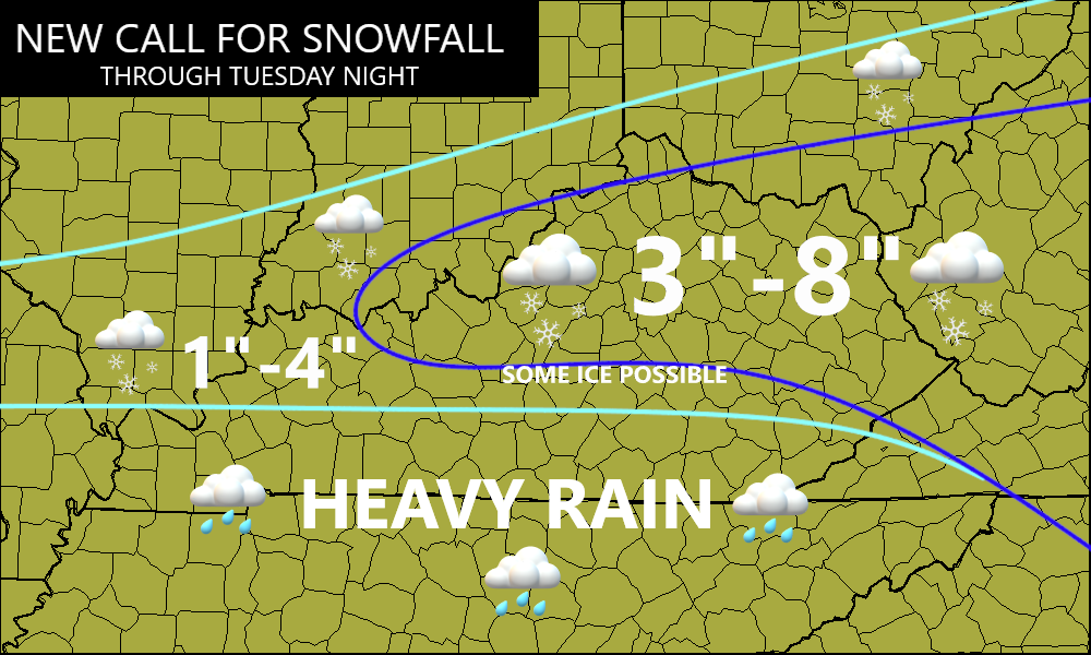
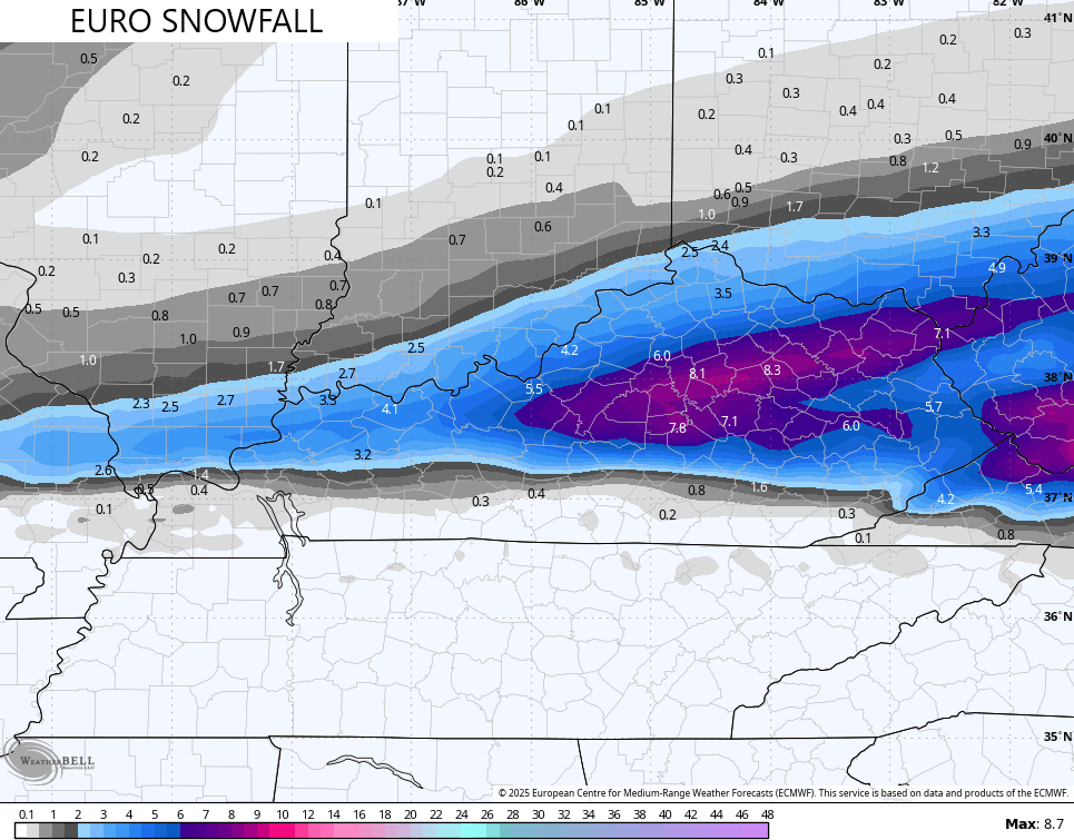
The model trend toward heftier snowfall numbers continues as of this writing. My thoughts are closest to the EURO as of right now…
The snowfall numbers from the EURO are climbing as we get closer…
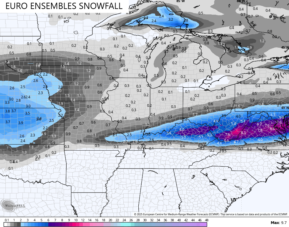
The average of the 50 member EURO Ensembles is similar…
It’s interesting to note how the NAM, Hi Res NAM and the GFS all have a smackdown storm, they just differ with the placement.
These models haven’t exactly had stellar track records this winter, but this is a setup that may wind up being more friendly to them. Still, I’m not buying into the crazy high snow totals until I see some other models jump in, too.
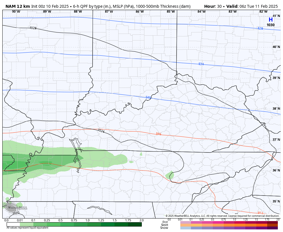
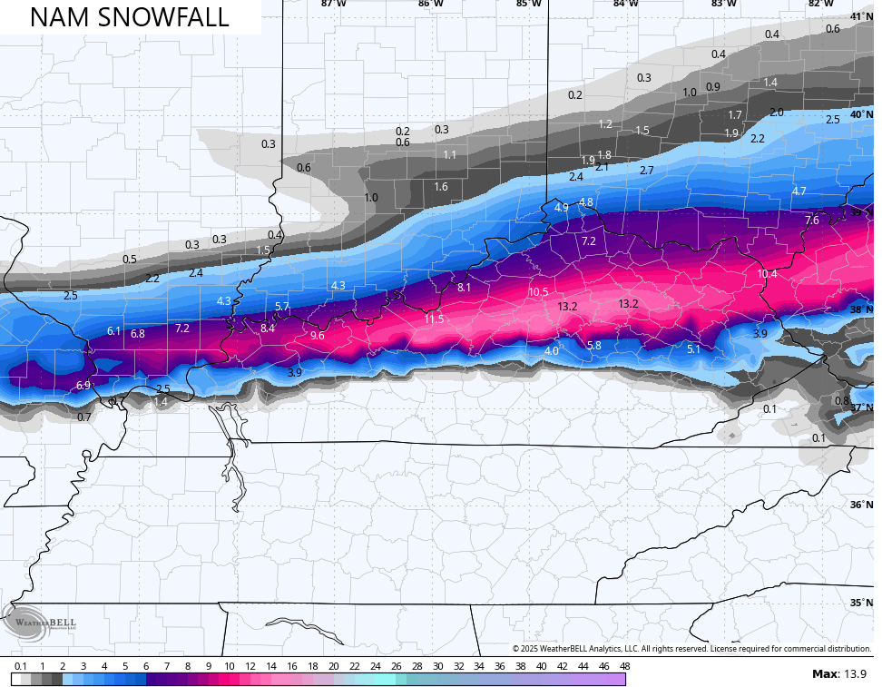
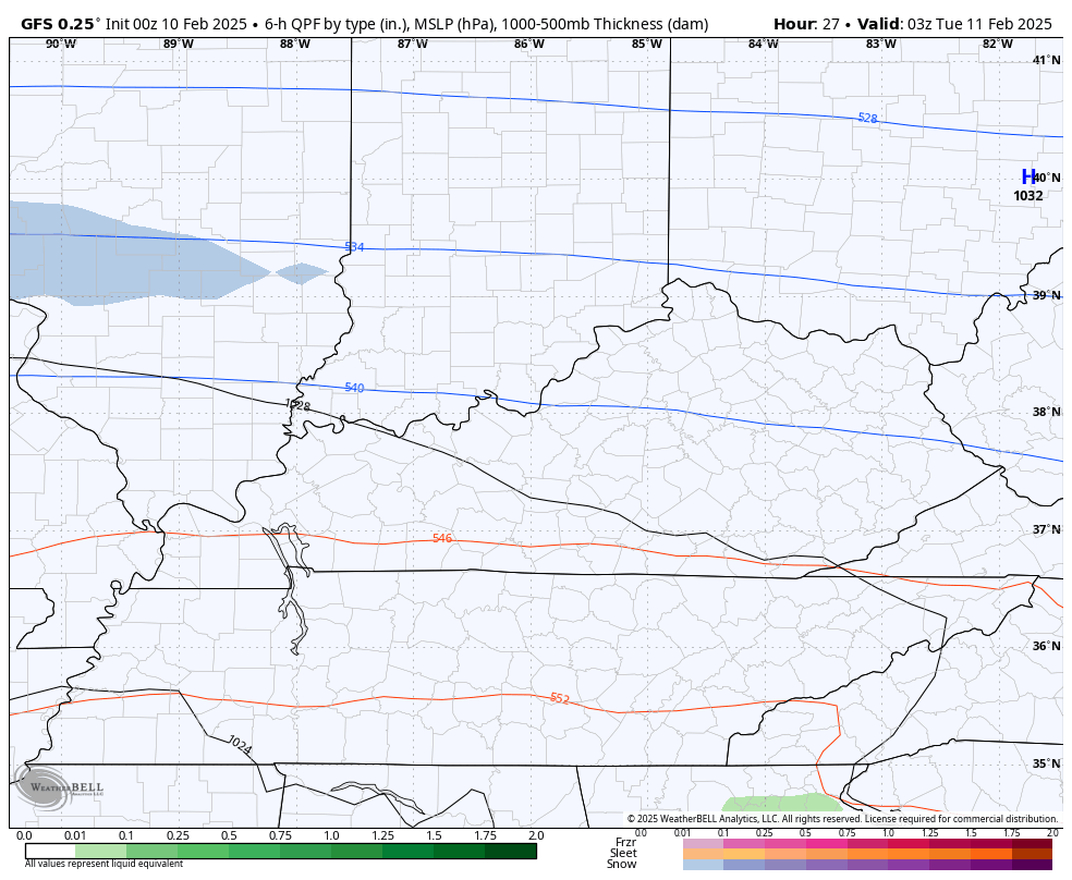
Here’s the whole system showing up on the NAM…
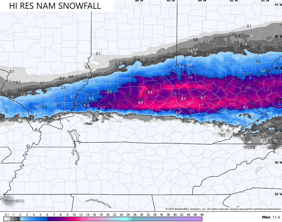
The snow map from the NAM is way up there…
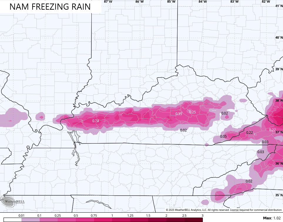
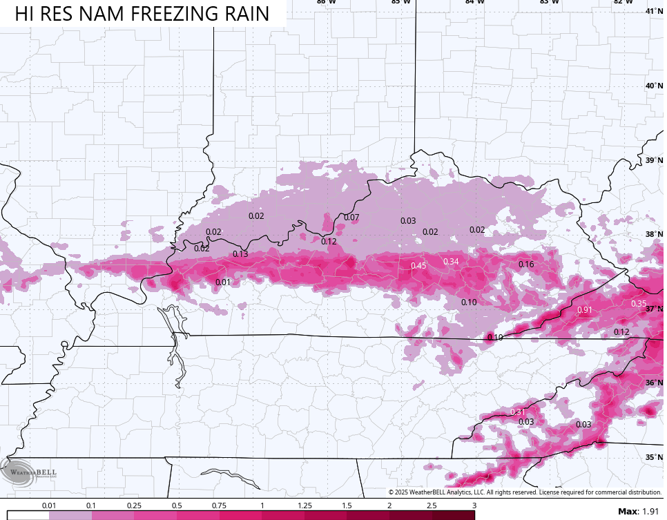
Here’s the freezing rain forecast from that run…
The Hi Res NAM has a similar overall view…
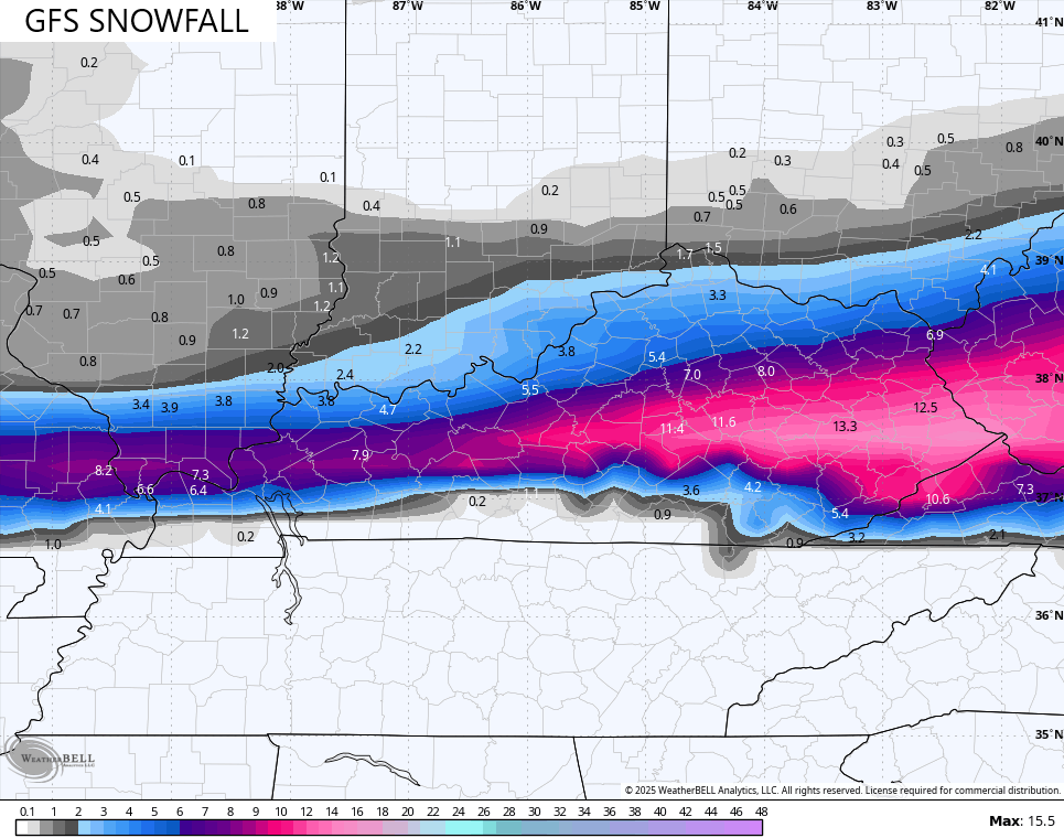
The GFS is all in on the crazy high amounts, but it’s a bit farther south…
The GFS doesn’t have much in the way of freezing rain, so that’s good, at least.
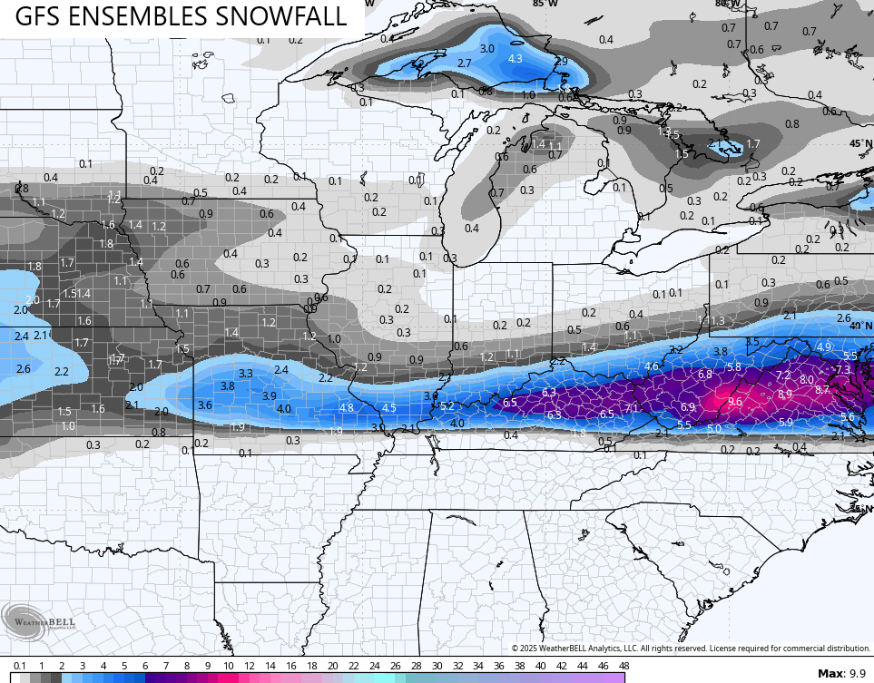
The GFS Ensembles are the average of 21 different members, and they aren’t as far south as the operational run…
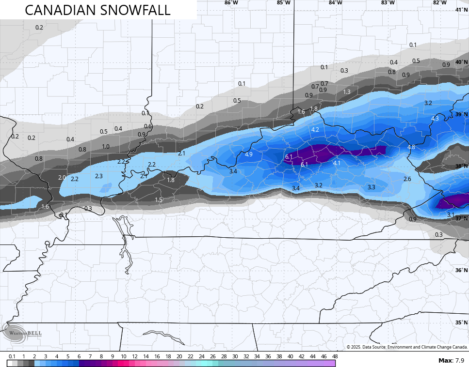
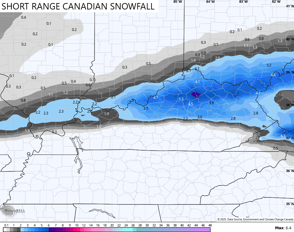
The Canadian family of models is now trending snowier with and is more in line with the NAM in terms of the placement, but nowhere near as heavy with the amounts…
The ICON is also a bit higher compared to earlier runs from the model…
![]()
![]()
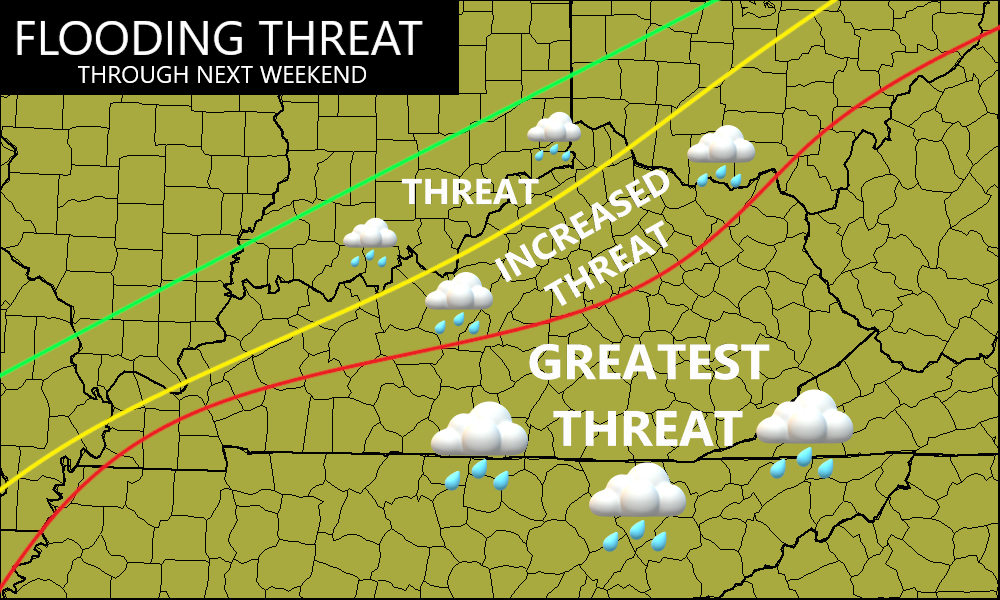
The flooding threat with this system is one that can lead to flash flooding and general flooding with a general 1″-3″ of rain across areas of the south and southeast. This is the first of three systems set to bring heavy rains to many of these same areas.
Here are the areas of greatest concern…
That next system brings mainly rain to the entire state Wednesday into early Thursday and may result in flooding over, even for areas with snow on the ground. That will be followed up by another potent storm system this weekend with heavy rain and gusty winds on the front end, and snow and cold on the backside.
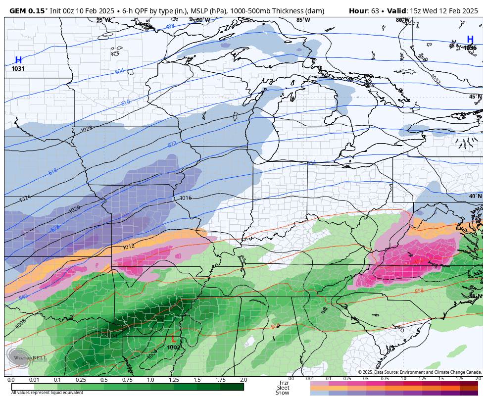
Here’s the Canadian Model with these two systems…
We are likely to see two more big storm systems threaten our region after that into next week.
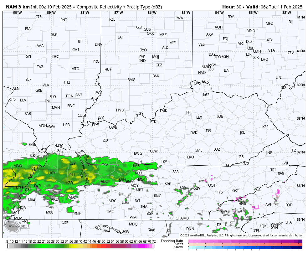
Updates will come your way later today. Until then, here are your radars… Just because…

Make it a great Monday and take care.

*thumbs down*
Must. Get. More. Wood. (into the garage bins)
I mean, I guess if you like snow you can get excited…I like snow too, but not these type of storms when it’s going to dump on you, only to warm up and rain right after…
It’ll be all rain again, as it’s been all winter in south central Kentucky. At least we’re not getting those intervening warm-ups we’ve experienced in recent years, which could lead to premature opening of tree and shrub buds.
Joe, I been through those years many times. It warms up, and plants break their dormancy, only to be damaged by a late freeze in early April. Happens often, with this Mid West climate we live in. I wish now after I’m retired, that I should have started my nursery in the state of Oregon. The prefect climate for plant nurseries.
Thanks Chris, Not looking forward to a potential Ice Storm tonight and tomorrow in my area. And areas that receive the heaviest Snow are the real lucky ones, because it’s going to be the best kind of Snow. Good packing Snow. In my home town in Indiana, we had alot of Snows during the months of February and March, but not here where I live now.