Good afternoon, everyone. Our developing winter storm continues to target the state with significant amounts of snow and rain tonight through Tuesday night. This means several inches of wet snow are set to fall across the region, with the potential for some hefty travel issues. Areas seeing the heavy rain are also in for flooding issues during the same time.
A Winter Storm Watch is out for much of central and eastern Kentucky and this should get upgraded to a warning later today. A Winter Weather Advisory is out for the far north and the Flood Watch continues across the south.
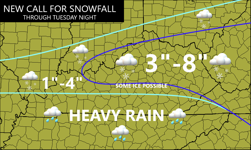
Here’s your updating map to show the latest…

I have no changes to the current Call For Snowfall map…
I’ll be updating that later this afternoon on WKYT starting at 4pm. I suspect my main thing will be to tighten up the gradients on the north and south side of the accumulating snows.
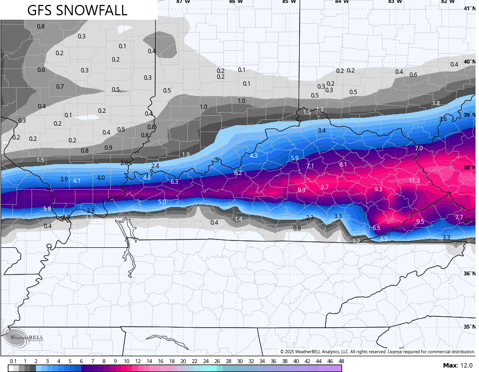
The latest forecast models continue to be in their respective lanes with the GFS still the farthest south…
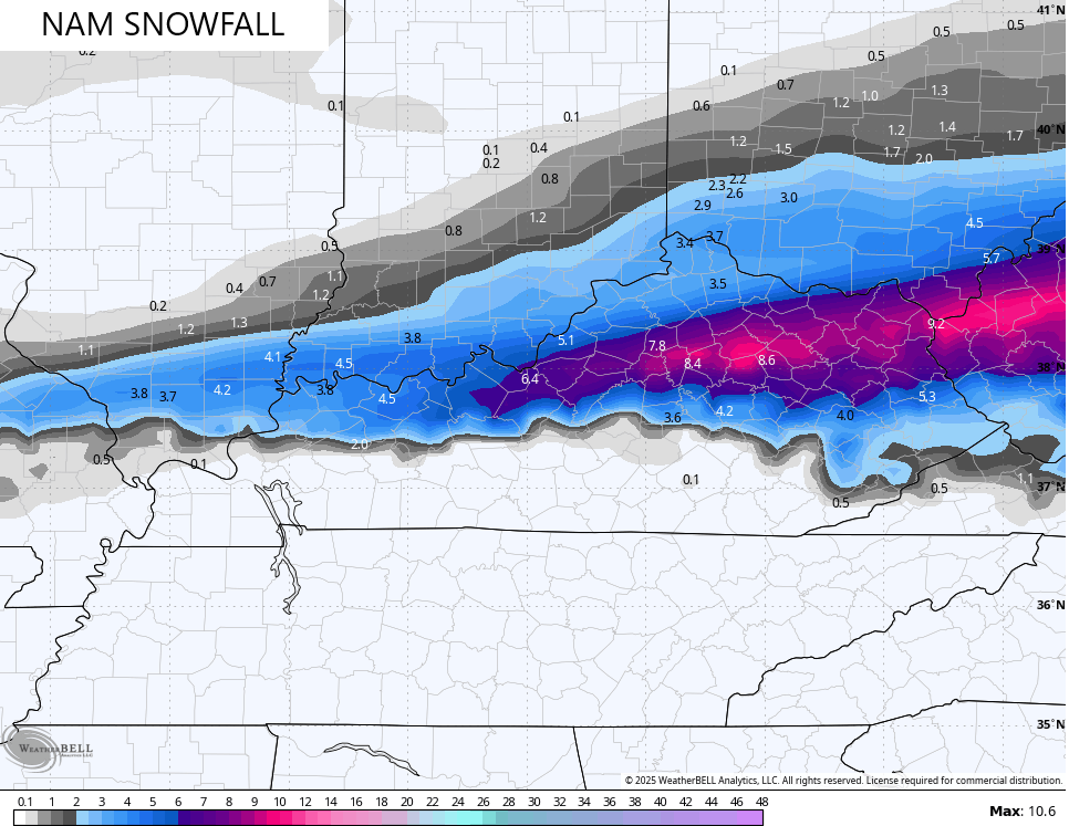
The NAM isn’t too far off from my current map…
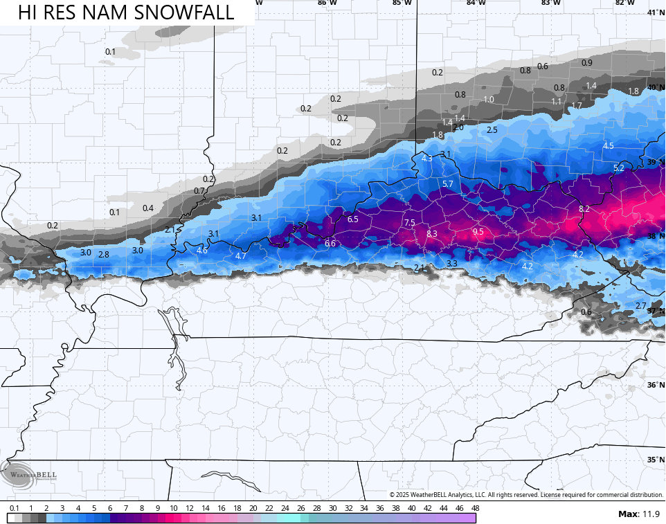
The Hi Res NAM has a sharper southern cutoff on the snow…
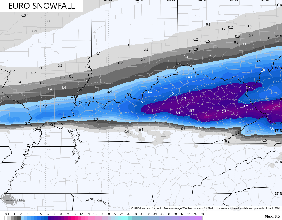
The EURO isn’t as sharp with the gradient and isn’t as hefty with the totals…
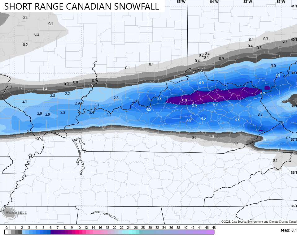
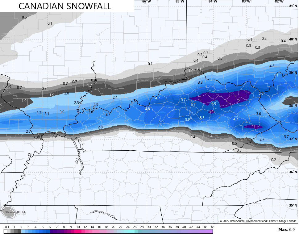
The Canadian and Short Range Canadian aren’t as high with the totals, but line up pretty well with my map…
Here’s the ICON…
![]()
![]()
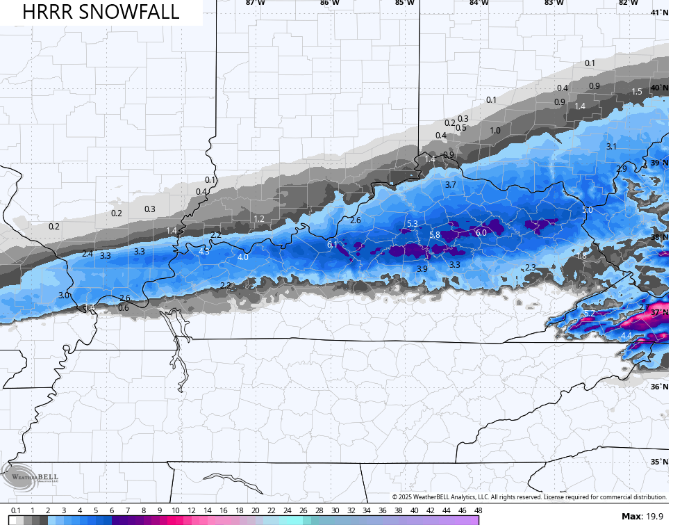
The short range Hi Res models are fairly similar with the placement and the totals…
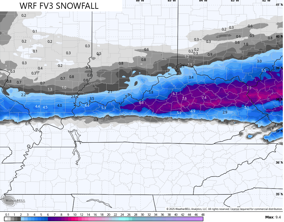
The prime snow time is from around sunrise Tuesday through the late evening hours. During that time, a thumping wet snow will show up in the corridor I’ve outlined.
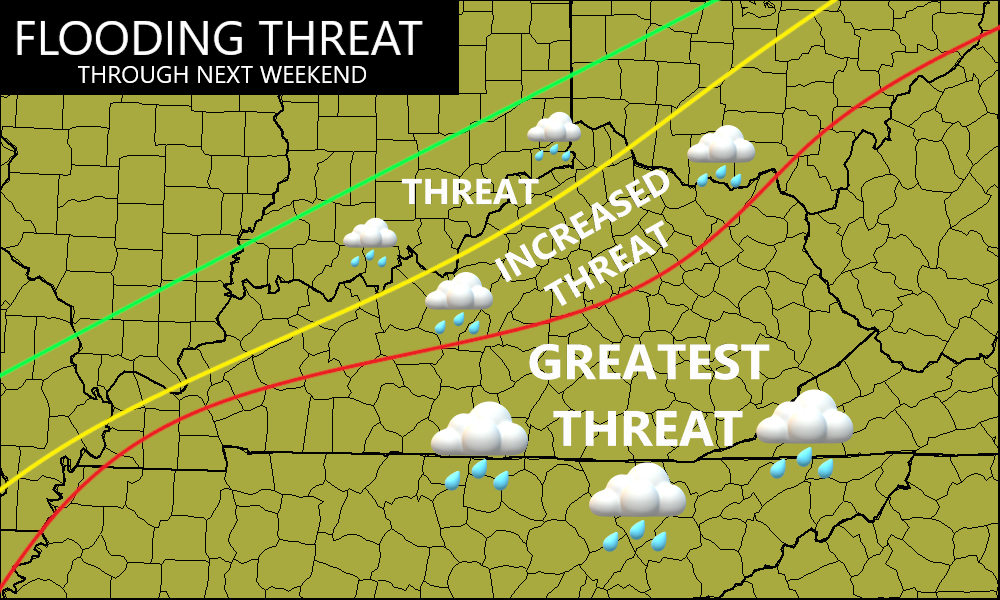
Flooding is a good bet during this same time in the south and southeast. Another system brings an areawide flood threat Wednesday into early Thursday then again this weekend.
Major flooding issues are possible over the next week…
Again, I’ll have the latest on WKYT-TV starting at 4pm and with more updates here on KWC. Until then, let’s track this winter storm in from the west and southwest…

Enjoy your Monday and take care.

Wouldn’t be surprise western ky will be up graded to winter storm watch. Some models are saying 3-5 range. Our local weather stations don’t think this won’t produced that much.
Just looked at the latest forecast map, and it looks like Union County will be in the Snow. Looks like a cold and rainy day for my area of Taylor County. Bummer, but that’s the way this Mid – West climate runs. It has a lot to do with La Nina and the PDO being negative since 2019.
Let it all be snow and no freezing rain. Done with freezing rain for this year! Will take 2 ft of snow over any freezing rain!