Good evening, everyone. A developing winter storm is set to blast the Bluegrass state late tonight into Tuesday with heavy snow and flooding rains a good bet. This will be followed up by more systems bringing flooding issues.
My time is short as I’m working and tending to a very sick pet, so bear with me.
A Winter Storm Warning is out for much of central and eastern Kentucky through Tuesday evening. Winter Weather Advisories bracket this to the north and the south…
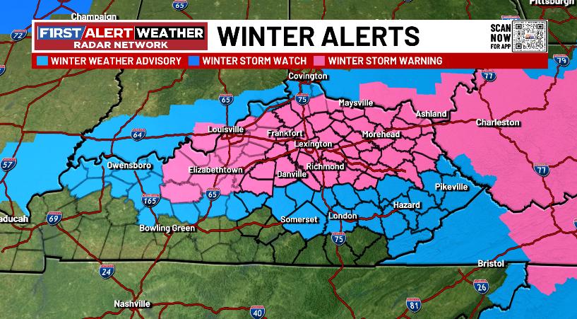
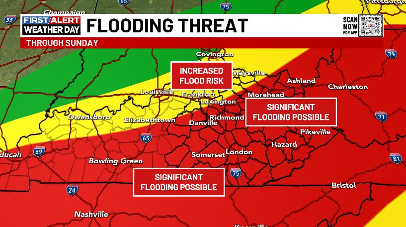
At the same time, a Flood Watch is out for the southern half of the state…
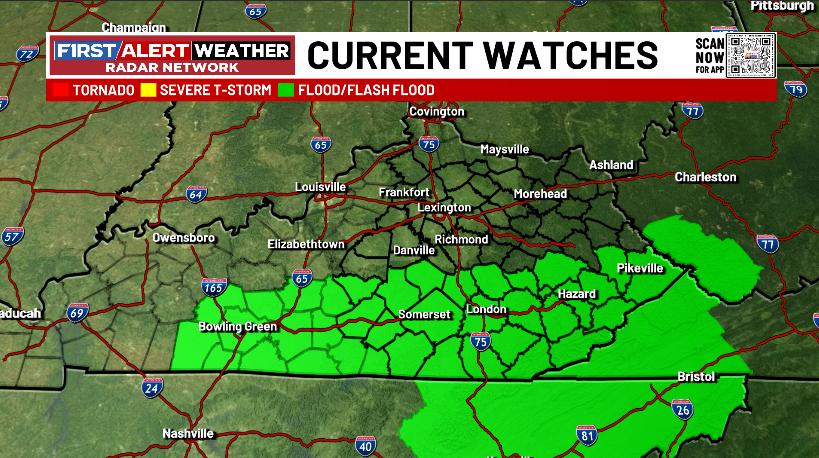
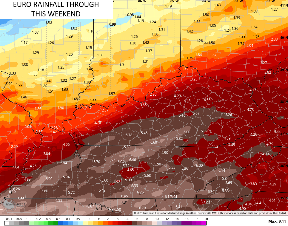
That part of the state averages 1″-2″ of rain with locally higher amounts. That would be enough to cause flooding issues.
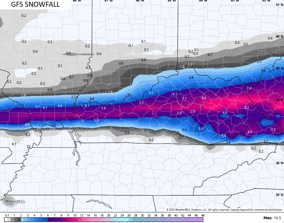
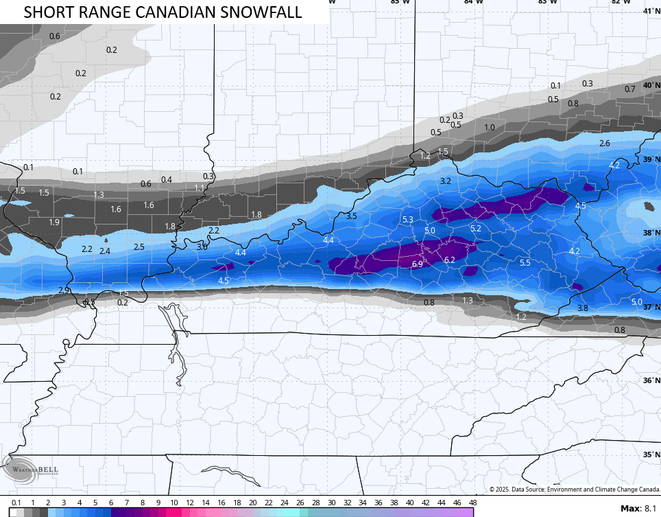
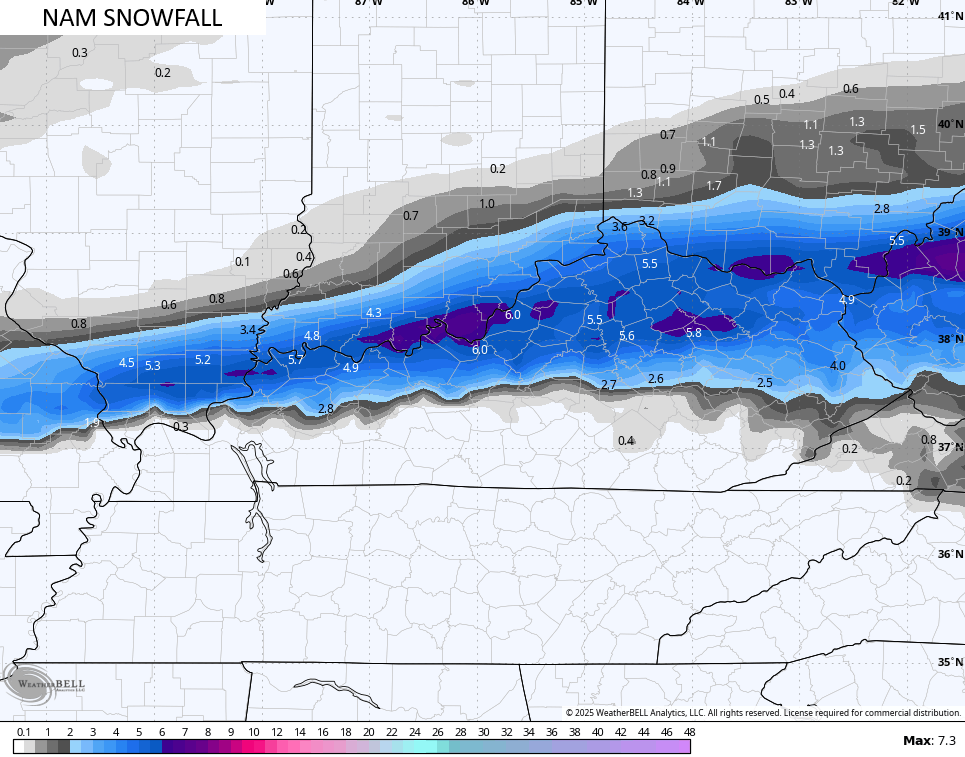
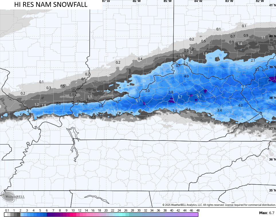
In terms of the heavy, wet snow, here’s the latest call…
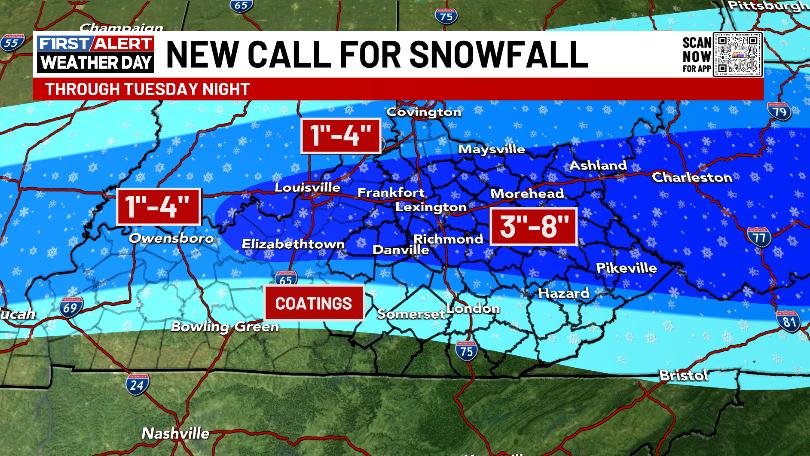
The 8″ potential with that would be the absolute highest possible with most areas falling well short of that.
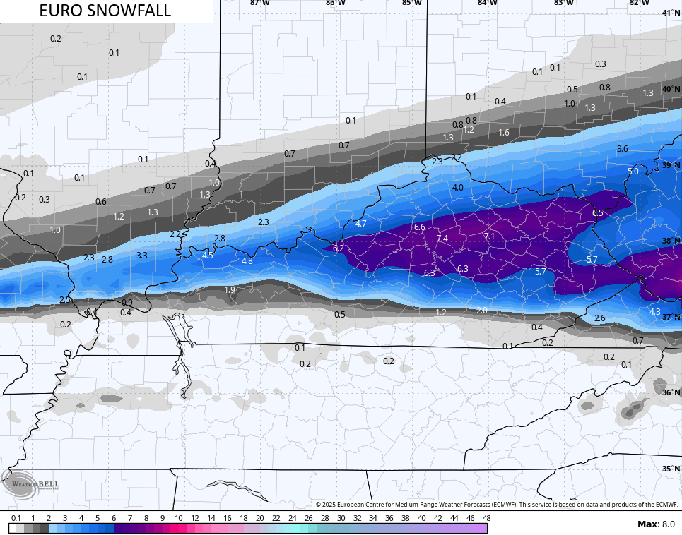
The forecast models continue to show similar results as their respective earlier runs…
Another heavy rainmaker comes in here on Wednesday with a more potent system this weekend. Those bring a lot of rain into the region and here’s the area I’m watching for significant flooding…
The rainfall numbers through the weekend continue to be very concerning…
Here are your radars to follow the progress of our winter storm…

Enjoy the evening and take care.

Thank you for all of your hard work Chris! Take care of that precious fur baby, and I’ll say a prayer.
Thanks CB! Hey! Remember when an event like this would shut down the blog there was so many of us trying to get on? Those we fun days and I met a lot of nice people here. I’m still in touch with one!
That is so true let’s always stay in touch if I don’t float down the big Sandy lol before this mess is over.
Sorry Chris you have a sick fur baby that’s hard we all love our pets!!