Good Tuesday, everyone. A significant winter storm continues to push across the state today and it’s bringing along a heavy, wet snowfall and flooding rains. This system will then be followed by another heavy rainmaker Wednesday, then a big troublemaker for the weekend.
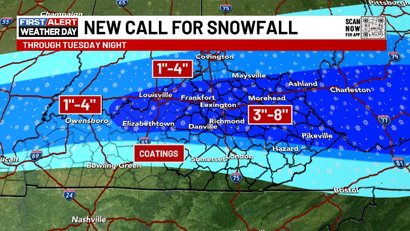
Winter Storm Warnings, Winter Weather Advisories and Flood Watches are all out across Kentucky. Here’s the map showing the latest…

I’m going with the last snowfall map I put out because I just wasn’t able to put in a lot of work in changing it. Having a very sick man’s best friend is taking most of my time and energy.
This won’t be perfect by any means but should be in the ballpark…
The flooding threat across the south and southeast is for a general 1″-2″ of rain which is more than enough to cause issues at this point.
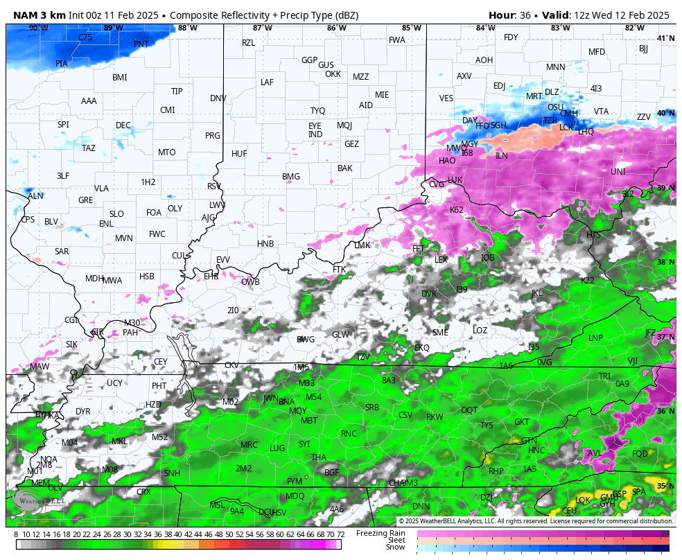
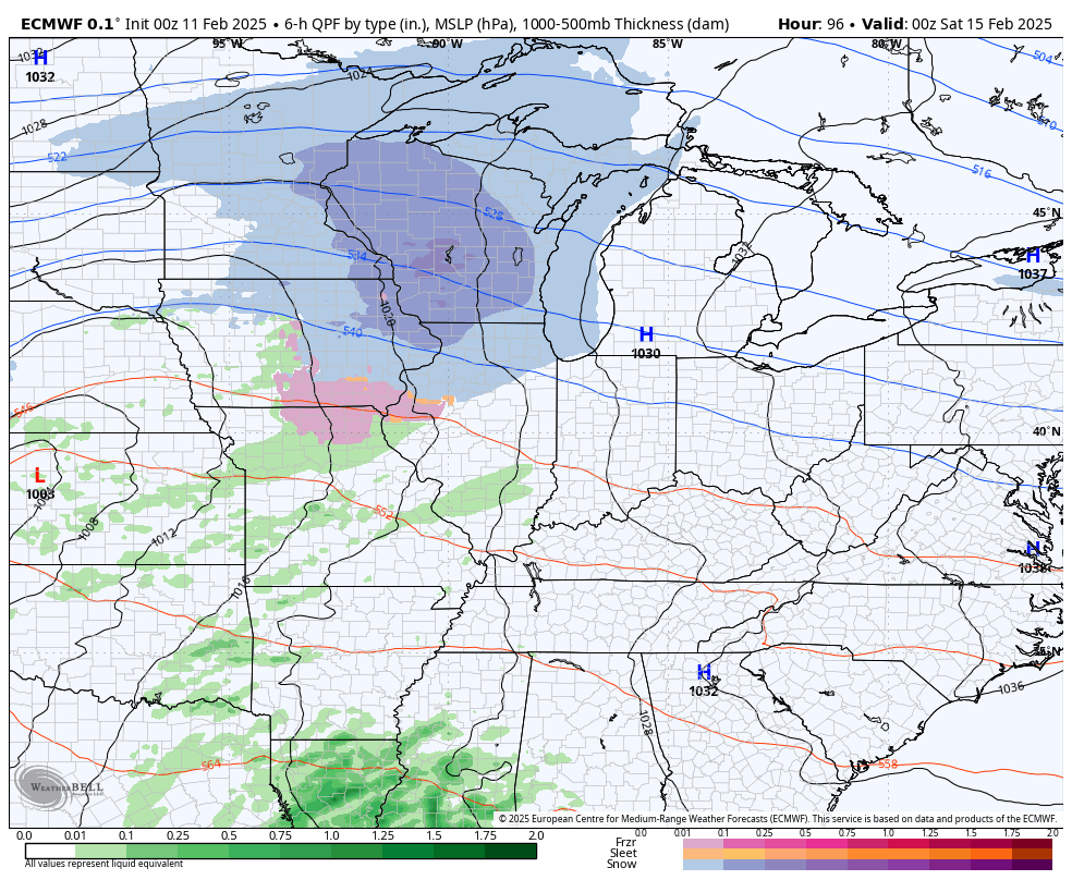
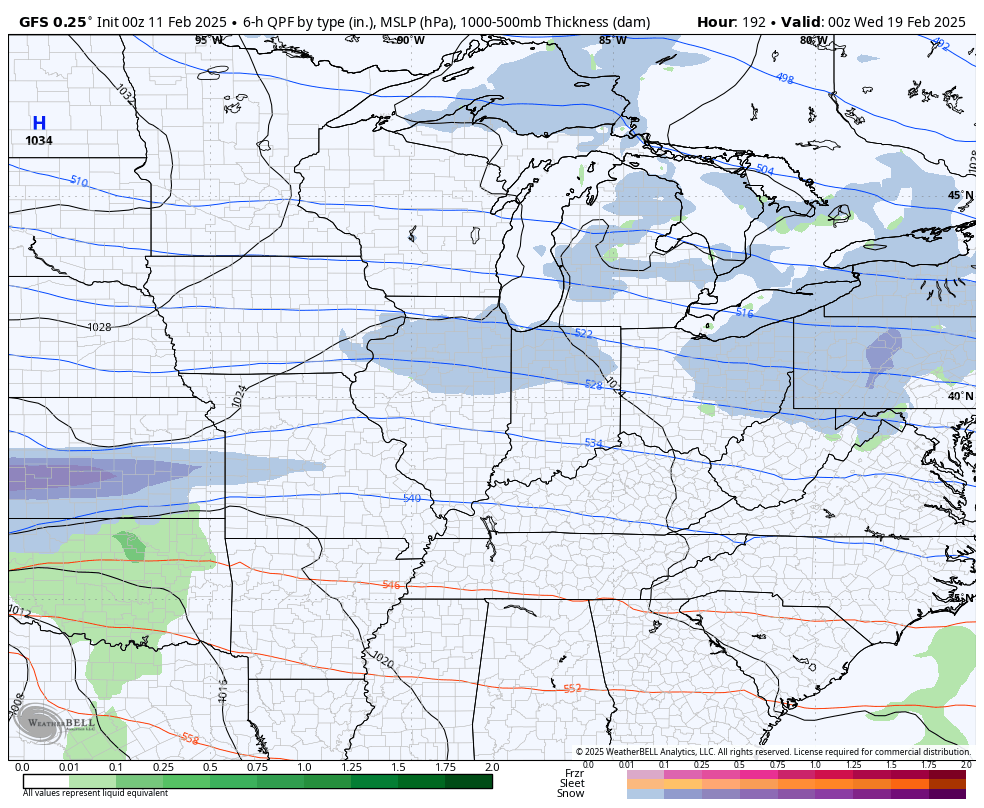
The next system moves in Wednesday into Wednesday night with more heavy rain producing showers and storms, especially in the east and southeast. Here’s the future radar from the Hi Res NAM…
Much colder winds will blow on Thursday with some flurries and snow showers leftover.
Friday looks calm before a potent storm system targets our region. Here’s what this may bring:
- Heavy rain and thunderstorms Saturday through early Saturday night
- A widespread 1″-4′ of rain
- Flash flooding, general flooding and river flooding are all possible
- A few strong storms may even show up across the central and east
- Wind gusts may reach 40mph or greater
- Cold air crashes in Saturday night and Sunday with snow and snow showers
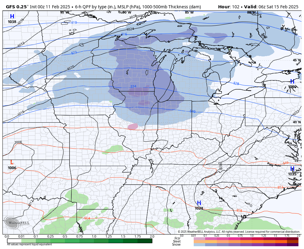
Here’s what that system looks like on the GFS…
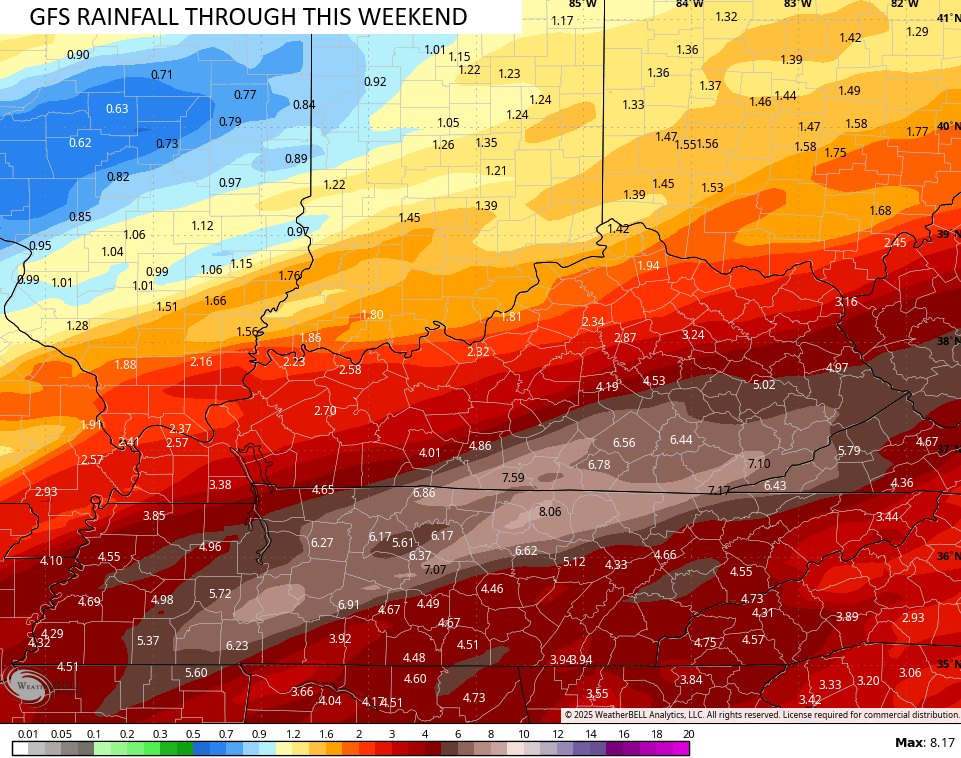
The total precipitation numbers from the GFS from today through Sunday are ugly…
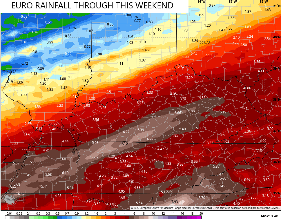
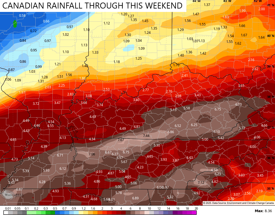
The EURO and Canadian Models have similar numbers…
Those models have much more of a snow signal behind this weekend system…
EURO
CANADIAN

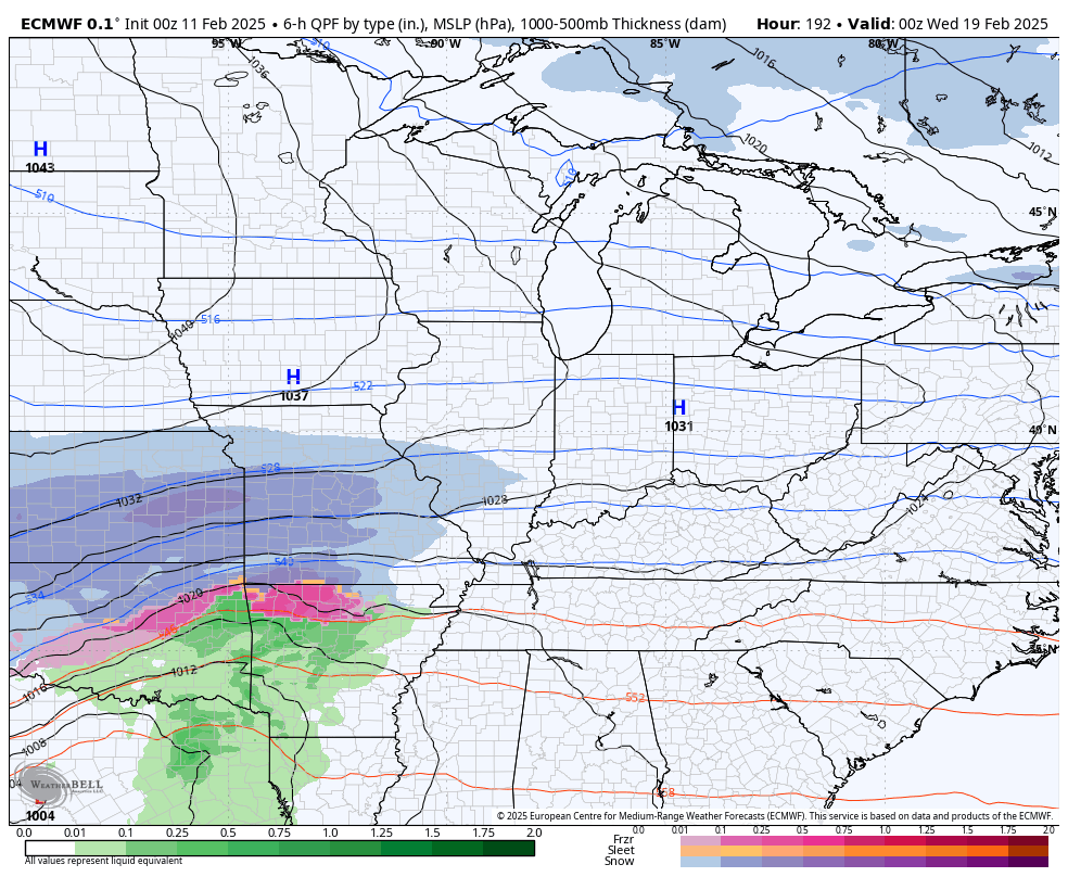
As I’ve mentioned, the loaded pattern doesn’t stop with that system. The signal is there for another potential winter storm next week and we have the EURO and GFS playing nice with one another…
EURO
GFS
I’m going to try my best to update like normal today, but I can’t make any promises. Regardless, I have your tracking tools including our Kentucky Weather Cams to watch the wild weather across entire region…

Have a great Tuesday and take care.

Thanks Chris. I appreciate all your hard work. Hoping and praying that your Dog recovers from his or Her’s illness. We have about 2 inches of Snow on the ground already, and still Snowing heavily.
Stay with your Dog Chris. The weather can wait.
Well, the snow is really pretty – in the early morning light. Traffic noise is noticeably less and muffled. Even UK is closed today! Sitting by the fire and looking out the picture window may be Priority #1.
Nothing but rain here in Bowling Green, and plenty of it. Currently it is 35°F and my PWS has recorded 1.10 inches of rain since midnight. Rain continues to fall at a moderate rate of 0.15 inches per hour. Travel is sketchy on some local roadways that are prone to flooding, and we’re seeing a significant amount of ponding on both roads and yards, since the ground is saturated.
Snow has ended here in Maple with an accumulation of about three inches. Just enough to make the trees and landscape beautiful for a little while. Radar showing heavy rains headed our way. Joe, just be glad there wasn’t any freezing rain with this system.
Hopefully roads are better by the time I drive to Texas tomorrow night.