Good evening, everyone. Heavy snow and heavy rain from our current winter storm will wind down tonight, but the pattern continues to be loaded with potential. Another flooding threat comes into part of the region Wednesday with a much greater threat this weekend.
Northern Kentucky can pick up on 1″-2″ of snow this evening while southern and southeastern Kentucky deals with flooding. Several roads are closed because of flooding in this area. Here’s a look at the current Warnings, Watches and Advisories…

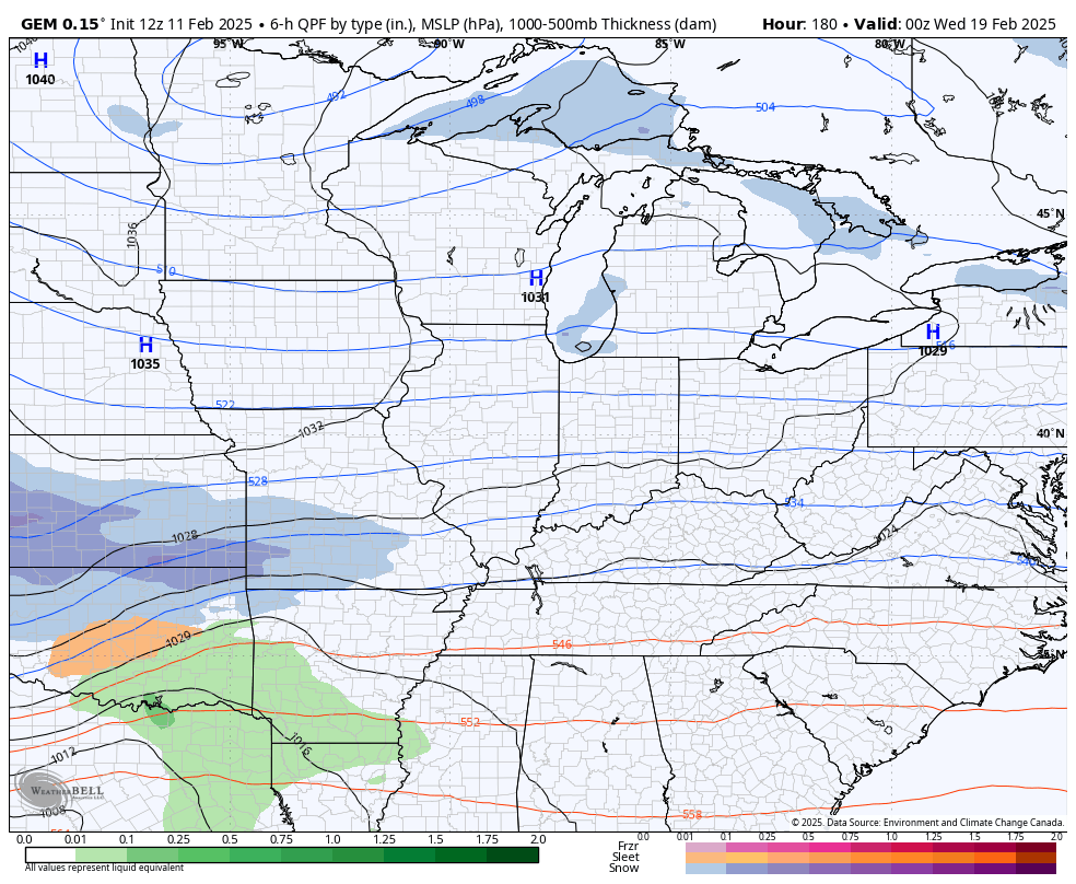
Once this tapers off overnight and early tomorrow, another system brings rain into central and eastern Kentucky with the greatest threat for additional flooding issues across the southeast…
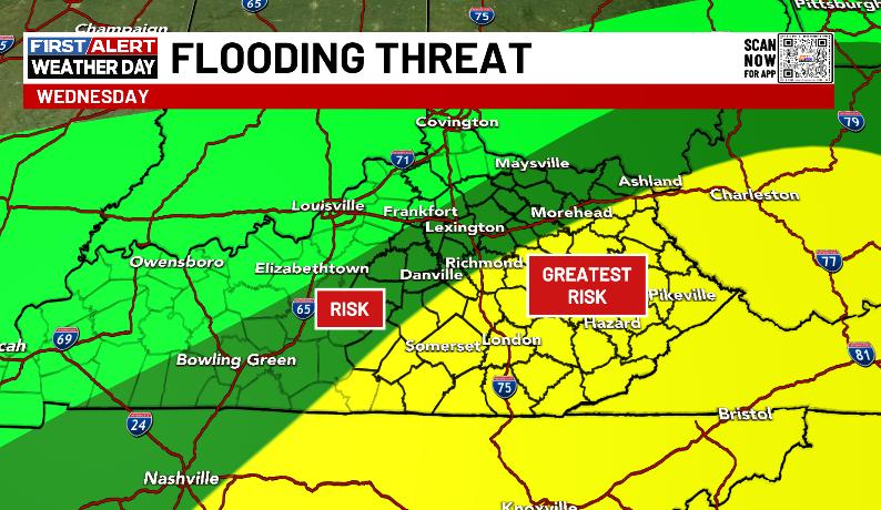
The bar for flooding is incredibly low, meaning it won’t take much at all for high water issues to develop.
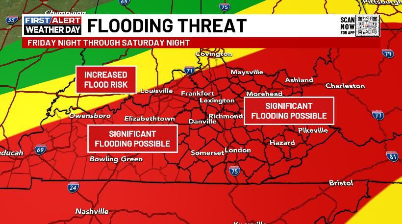
The threat for flash flooding, general flooding and river flooding really increases Saturday into Saturday night. This may bring 1″-4″ of rain to many areas…
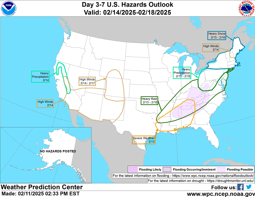
The Weather Prediction Center is highlighting our region in the flood potential…
This system looks to bring heavy rain and wind Saturday with snow and cold for Sunday…

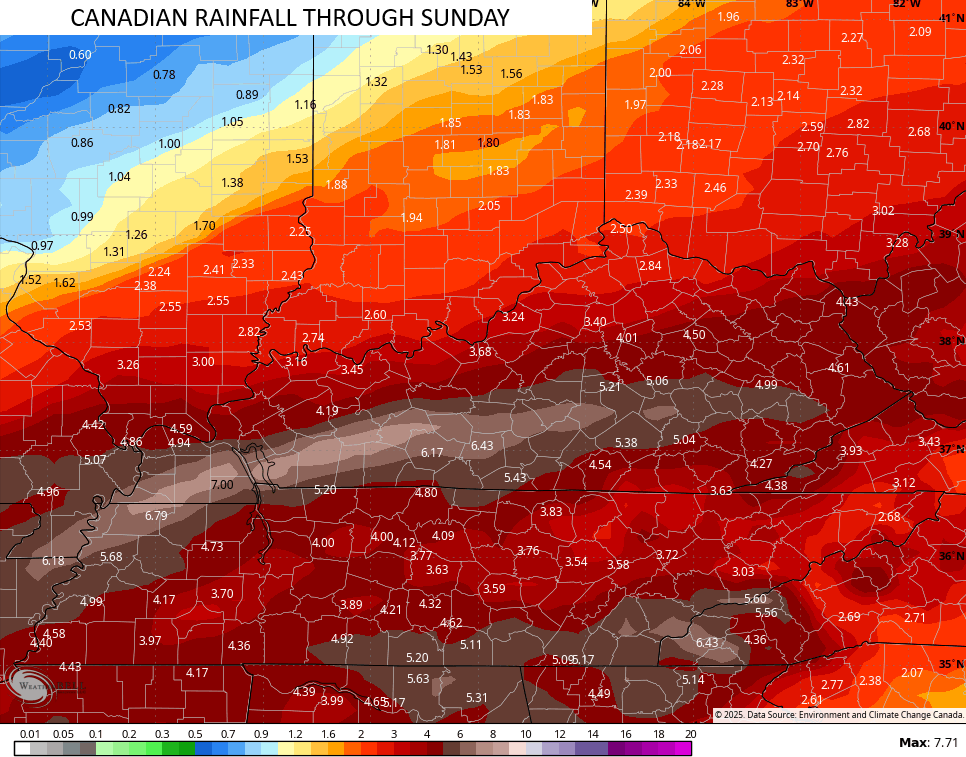
Rainfall totals through this weekend continue to be VERY concerning…
Another winter storm is possible by the middle of next week and the WPC is also highlighting this potential…
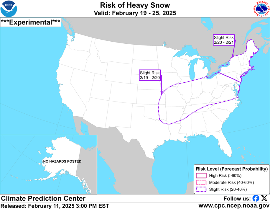
The models all have the signal there, but vary from this range…
I have your tracking tools including our Kentucky Weather Cams to watch the wild weather across entire region…

Enjoy the rest of the evening and take care.

Thank you for keeping us posted Chris. This was a weird storm because the snow accumulated a little despite being “too warm” too snow. Had it been just a few degrees colder, this would havebeen quite a storm. I have the feeling this next one coming up (around the 20th) will be a doozy, but we shall see. Strange to think that our largest snowfalls on record where I live have been in March (March Blizzard/Superstorm 1993), April (the Appalachian “Spring Snowstorm” April 2nd through 5th, 1987) and October (from “Superstorm Sandy” October 29 throigh November 1st, 2012), rarely in the deep of proper winter. Hope your fur-baby is feeling better soon.