Good Wednesday to one and all. This is a super-active setup across our part of the world and it is going to lead to a lot more problems. A low-end flood threat today will be followed by a significant flood threat this weekend with winter weather crashing back in behind that.
Watch for freezing drizzle this morning across the northern half of the state. A light glaze is showing up on elevated objects, so keep that in mind.
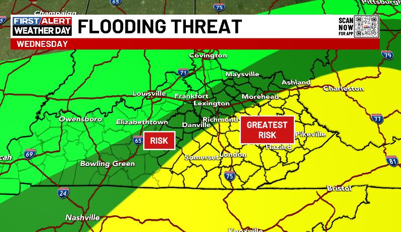
Areas of southeastern Kentucky picked up another 1″-3″ of rain Tuesday with flooding issues continuing in some spots this morning. Another system brings showers and a few storms into the state later today into tonight and can put down local half to 1″ rains across the southeast. That’s where we have the Greatest Risk for high water issues…
Here’s a look at the current watches, warnings and advisories…
Colder winds blow in for Thursday with highs in the 30s as some snow flurries dance about the sky across central and eastern Kentucky.
Friday looks calm with clouds rolling back in ahead of a potent storm system this weekend. Here’s a look at what to expect:
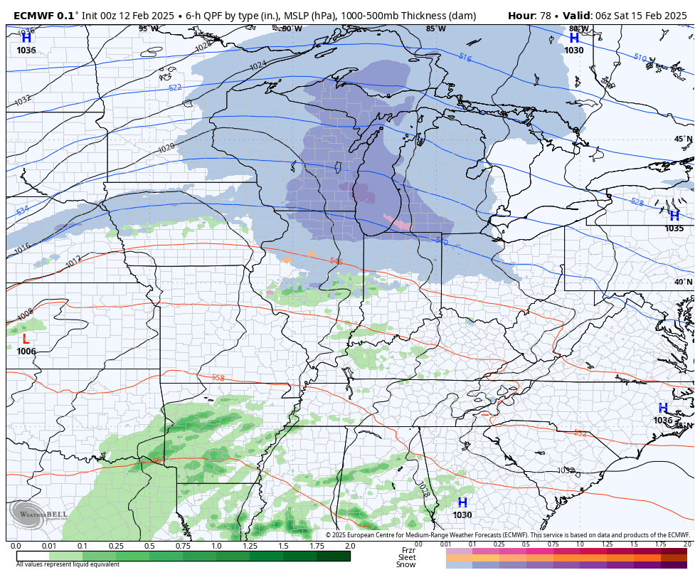
- This is a major rainmaker Saturday and Saturday night for the entire state.
- A general 1″-4″ of rain is likely during this time and that’s more than enough to create flooding.
- Flash flooding, general flooding and river flooding are all possible.
- Depending on the track of the low, a few strong to severe storms will be possible across central and eastern Kentucky.
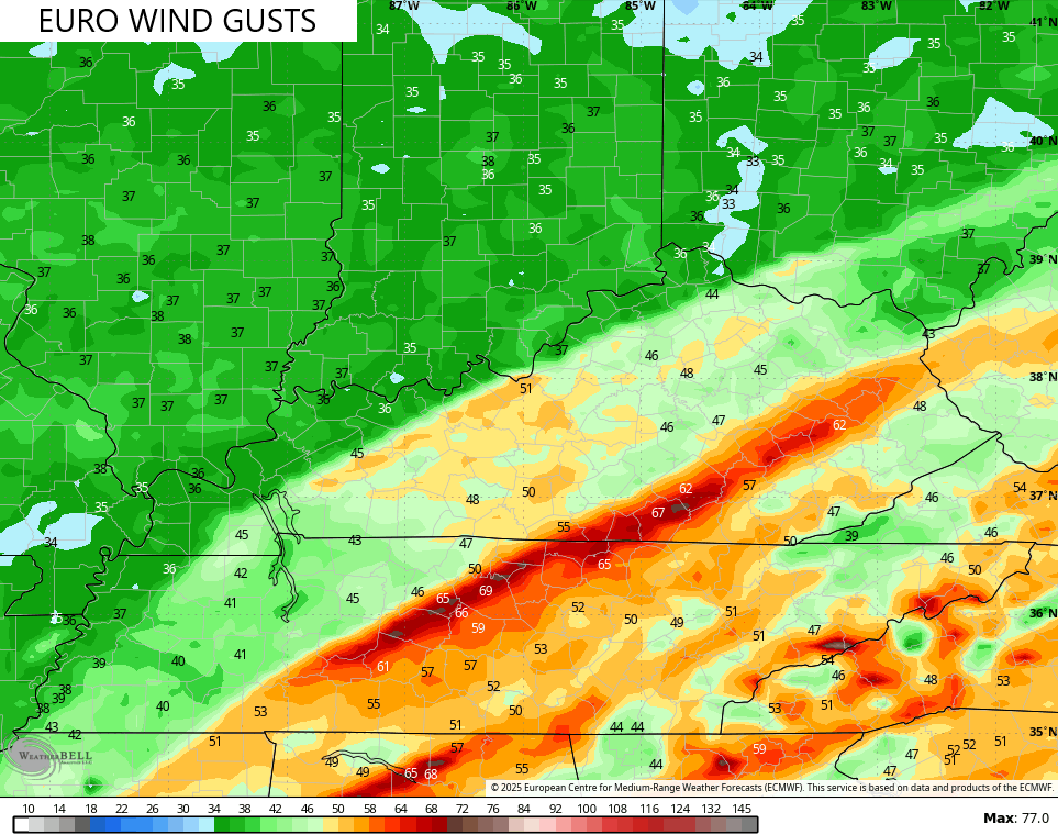
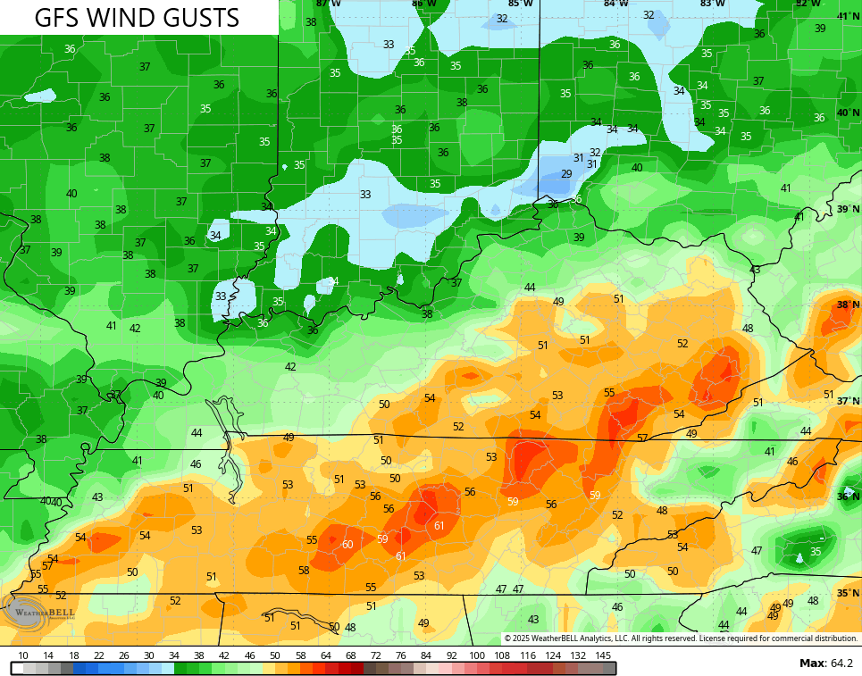
- Winds will crank with this storm system and may reach 40mph or higher through Saturday night.
- Frigid temps crash in from northwest to southeast Saturday night and early Sunday.
- A 30 degree temp drop may lead to a quick ice up.
- A period of wraparound snow is likely Sunday with some accumulations possible.
- Snow showers and frigid temps/wind chills continue Sunday night and early Monday.
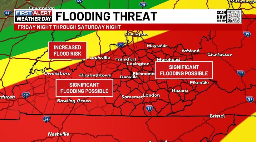
Here’s the area I’m highlighting for the potential of significant flooding issues Saturday into Saturday night…
Obviously, this can change if we can get the track of the storm to change. A best case scenario for us is for this low to track well to our southeast, giving us more snow than anything else. The chance of that happening isn’t good, but it’s not zero.
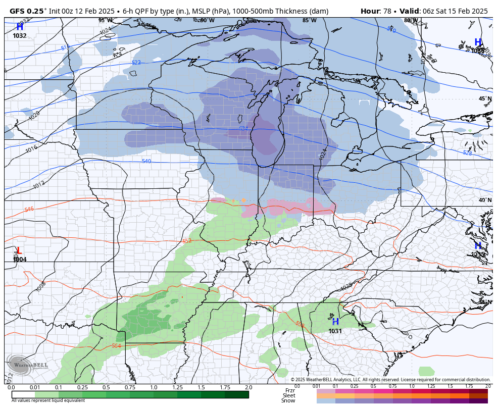
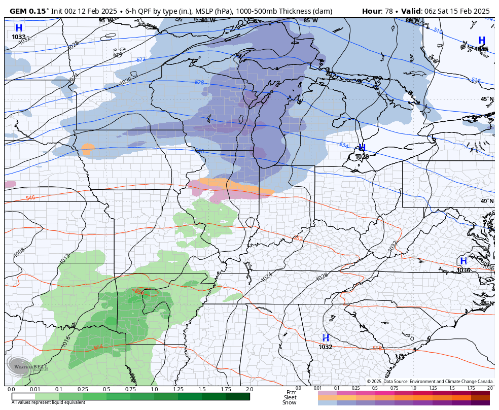
The forecast models are all very similar right now with this low tracking through here, giving us the scenario I outlined in the breakdown…
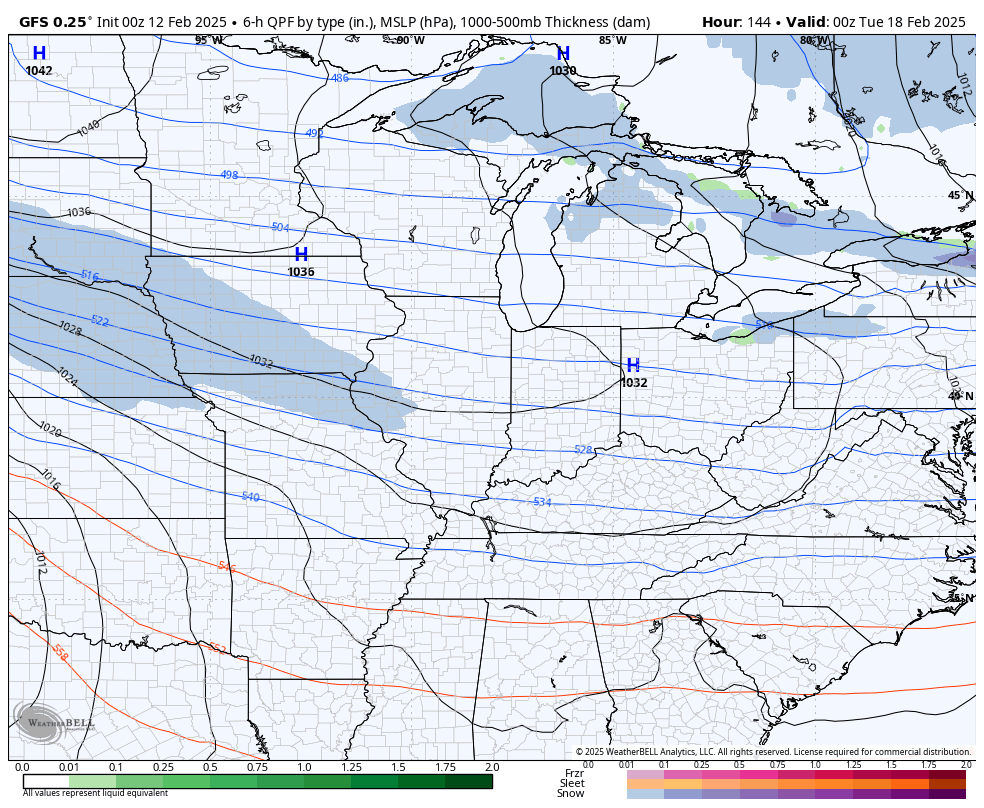
GFS
CANADIAN
The EURO…
It’s interesting to watch the models show the potential for some big time winds across the central and east. The EURO sees the potential for some SERIOUS winds…
The GFS isn’t too far behind…
Temps along and ahead of this low can spike into the 60s late Saturday into Saturday night. From there, arctic air moves in and may send our wind chills below zero by Sunday night. Watch the EURO go from temps in the 60s to below zero wind chills in under 24 hours…

I mean… That’s pretty incredible.
That arctic air then gives us a frigid week with the potential for a winter storm to impact our region and into the eastern part of the county by the middle and end of the week. The models will change a lot, but the signal is there…
I will have updates later today. Until then, here are your radars to follow today’s round of rain…

Have a wonderful Wednesday and take care.

Thanks Chris. I enjoyed seeing the 3″ of Snow that fell yesterday. I’m sure we will have more opportunities in the coming days. An interesting weather pattern setting up.
Have a Great Day Everyone !