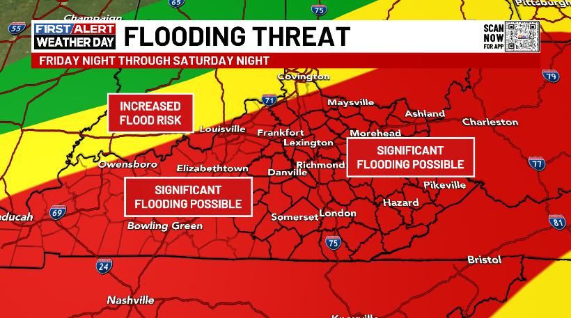
Good afternoon, everyone. We continue with the chance for flooding issues across the southeast today as we keep our eye on the weekend. That’s when a huge storm brings a major flood threat to Kentucky and surrounding areas.
The system today has lighter showers with it for most of Kentucky except the southeast. This is where up to 1″ of rain may fall through tonight. Because of this, a Flood Watch is out for this area…

You can also see Flood Warnings for parts of the Kentucky River and Cumberland River.
A cold break blows in for Thursday as a few flakes fly.
My thoughts on the weekend have not changed with major flooding a real possibility Saturday and Saturday night. Much of the state can pick up 1″-4″ of rain with locally higher amounts…
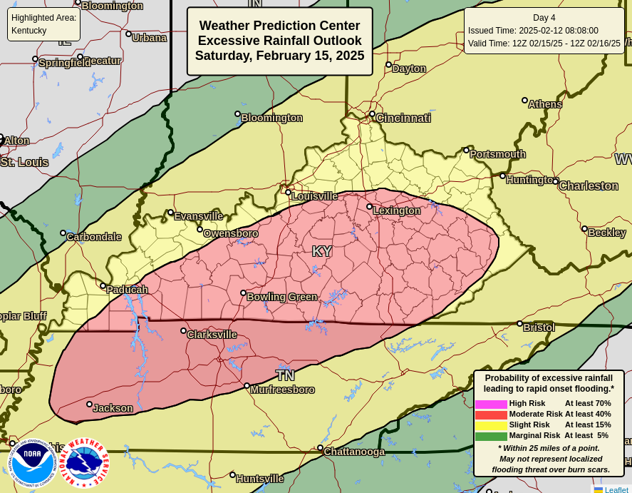
The Weather Prediction Center now has a Moderate Risk for excessive rainfall for most of the state for Saturday…
This same system may spawn strong storms in the central and east and wind gusts that can reach 50mph or greater.
Temps crash on the backside of this with snow and snow showers for Sunday.
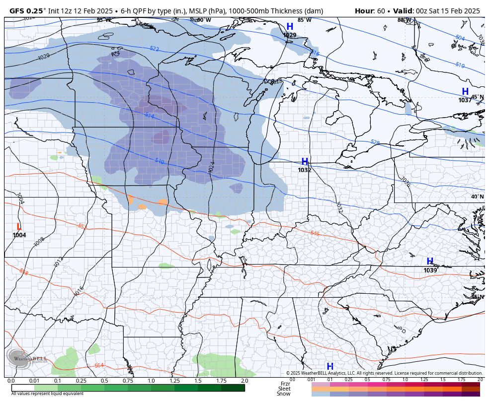
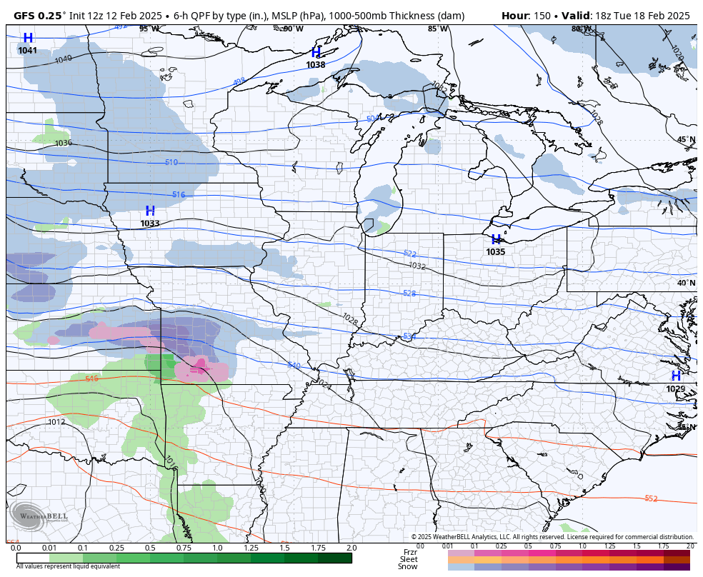
Here’s the GFS with it…
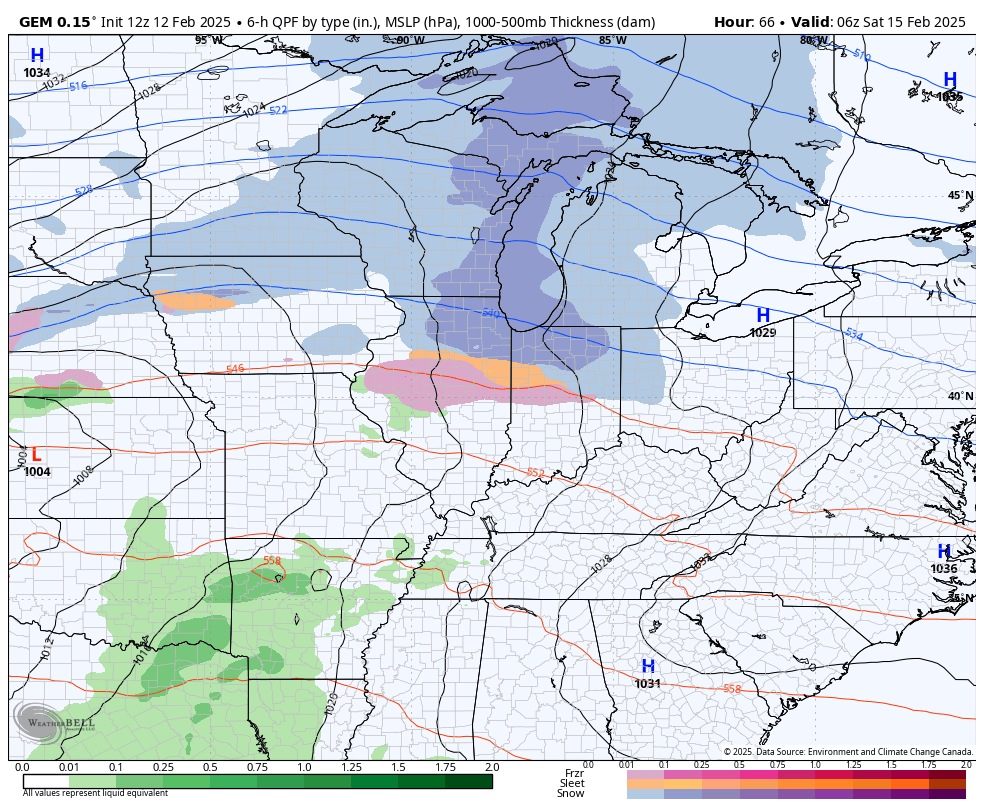
The Canadian is similar…
The threat for a winter storm will follow this up by the middle of next week…
I’ll have the latest on WKYT-TV starting at 4pm then again on KWC this evening…

Have a great rest of the day and take care.

Ready for sunny, dry weather.
Be careful driving to Texas tonight Jeff.
Thanks Chris. I’m really concerned about the Flooding. The river in Pikeville on the weathercams looks like it may be a real problem, if we receive that much rain over the next few days. Lets all hope and pray that this doesn’t happen.