Good evening, everyone. My time is rather limited tonight so this will be quite brief. Our loaded pattern continues with an overnight flood threat in the southeast with a major flood threat and winter lurking for the weekend.
Southeastern Kentucky will see up to 1″ of rain tonight with locally higher amounts. Because of this, a Flood Watch is out for this area…

Flurries and colder winds blow for Thursday.
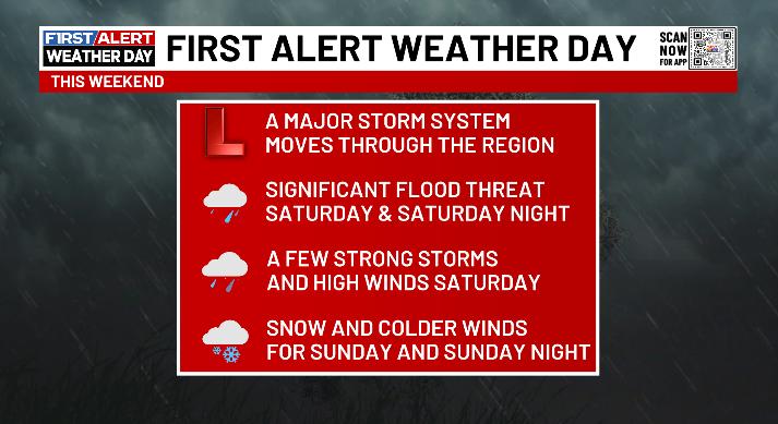
The system this weekend continues to look like a monster, capable of producing significant flooding issues. Here’s a rundown of what to expect:
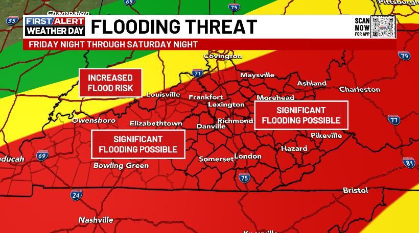
I have no changes to the area primed for significant flooding…
The Weather Prediction Center is really ramping up the language for this event. Check out their thoughts…
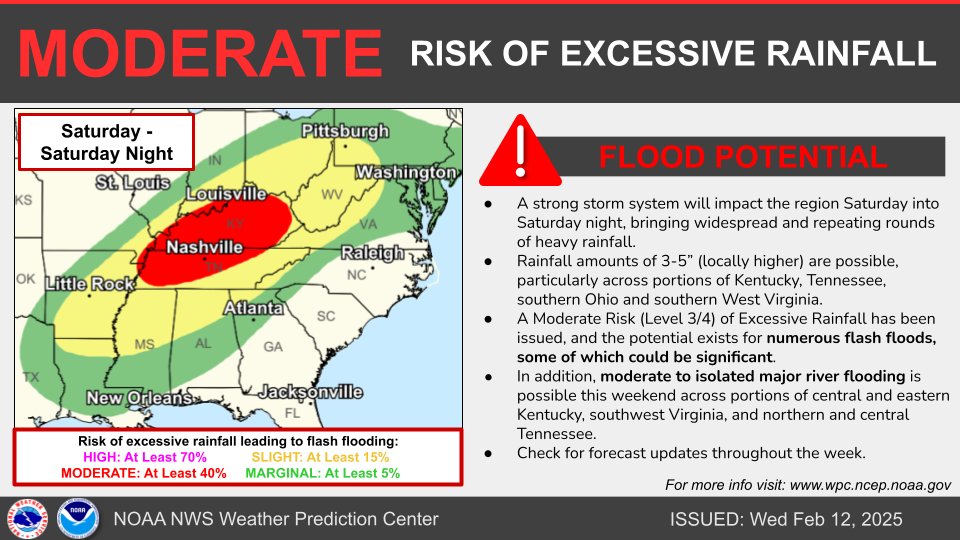
Significant river flooding is a good bet to develop across much of our region…
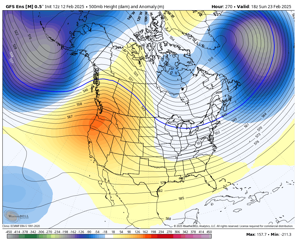
We will likely put some light snow on the ground as frigid temps return Sunday and Sunday night. That will be followed by another system that may bring a winter storm to our region and into the east by late Tuesday and Wednesday of next week.
The overall pattern on the GFS Ensembles is pretty wintry for the closing week of the month. Watch this deep trough develop as a ridge pops across the west…
I’ll get more into all this with the overnight update. Until then, here are your Kentucky Radars to track the rains rolling back in…

Enjoy the evening and take care.
