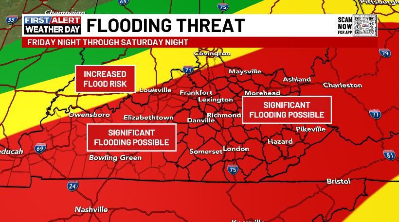
Good Thursday, everyone. Colder winds are blowing a few snowflakes into town today as we quickly turn our attention to a big storm system this weekend. A major flood risk shows up Saturday and Saturday night before we flip the pattern back to winter.
In the short-term, heavy rains are exiting southeastern Kentucky very early this morning. Some local high water issues are possible, but nothing widespread will show up. The Flood Watch for the southeast should expire early today…

Flurries and a light snow shower then show up through the day, especially in the north and northeast. Temps today are generally in the 30s with overnight lows reaching the teens for the first time since January.
The rest of Friday looks seasonably cold, but pretty nice. From there, it’s anything but nice as our major storm system moves in.
Here’s a look at what to expect:
- This is a major rainmaker Saturday and Saturday night for the entire state.
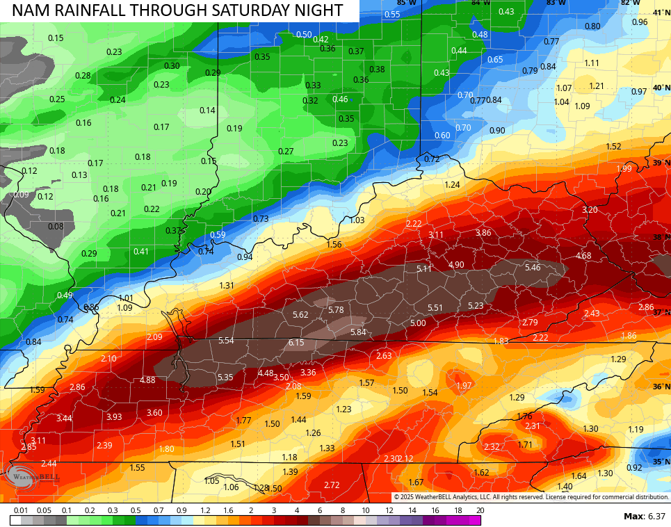
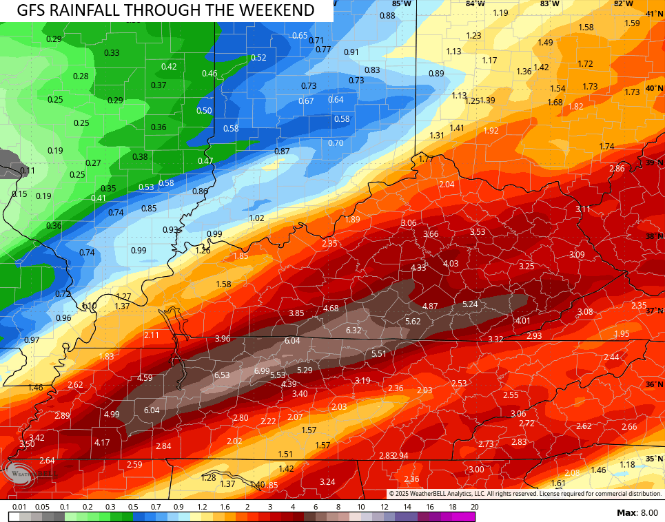
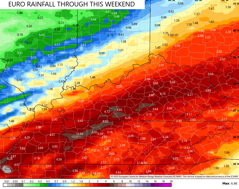
- A general 1″-4″ of rain is likely during this time and that’s more than enough to create flooding. Some 5″+ rains are possible.
- Flash flooding, general flooding and river flooding are all possible.
- Depending on the track of the low, a few strong to severe storms will be possible across central and eastern Kentucky.
- Winds will crank with this storm system and may reach 40mph or higher through Saturday night.
- Frigid temps crash in from northwest to southeast Saturday night and early Sunday.
- A 30 degree temp drop may lead to a quick ice up.
- A period of wraparound snow is likely Sunday with some accumulations possible.
- Snow showers and frigid temps/wind chills continue Sunday night and early Monday.
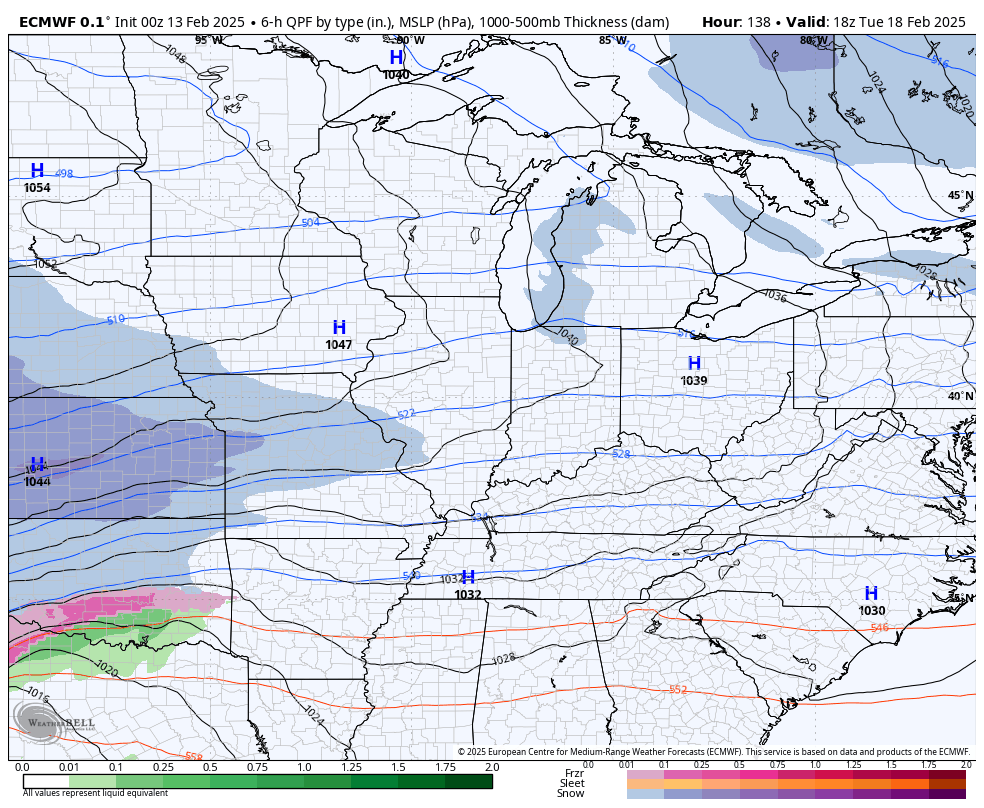
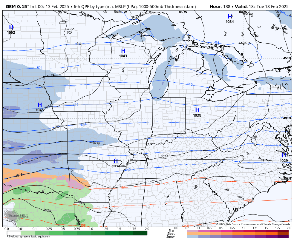
The various forecast models are all lining up pretty good with the area of greatest concern. These numbers are very ugly…
Frigid temps and wind chills blow in behind this for Sunday and Monday with a good chance for a light snowfall.
This cold pattern will continue to dig in next week as much of the country goes back into the deep freeze. This opens us up to a potential winter storm threat during the middle and end of next week.
The EURO continues to see the potential…
So does the Canadian…
As always, I will have updates later today. Until then, here are your Kentucky Weather radars to show the early rains in the east and any flakes that follow…

Have a great day and take care.

Disappointing snowfall totals here in the Chicago Metro Area from Wednesday, which were in the 2 to 3 inch range, with isolated 4 inch totals in the far N and NW Suburbs. A few days ago, computer models were predicting snowfall totals from 4 to 8 inches.
A large dry slot formed over Northern IL during the afternoon, which really cut down on the snowfall.
It is cold though, with several nights of below-zero temps predicted here in the next week.
That would be enough Snow accumulation for me Mike.
Thanks for this morning’s update Chris. Hoping this heavy Rain event won’t cause the Flooding that is predicted, but it doesn’t look good in areas that already have high river levels. At this time, there is a prediction out for a substantial Snowstorm on the 19th and 20th for the entire state of Kentucky. The European model you displayed this morning agrees. We shall see what happens.
Be Safe Everyone !