Good evening, everyone. A major storm system continues to put Kentucky in the bullseye for significant flooding issues this weekend. It’s a system that will also feature the threat for severe storms and some snow.
A Flood Watch continues for just about all of Kentucky and many surrounding areas from Friday night through the weekend…

The Weather Prediction Center has this large area of a Moderate Risk for excessive rainfall…
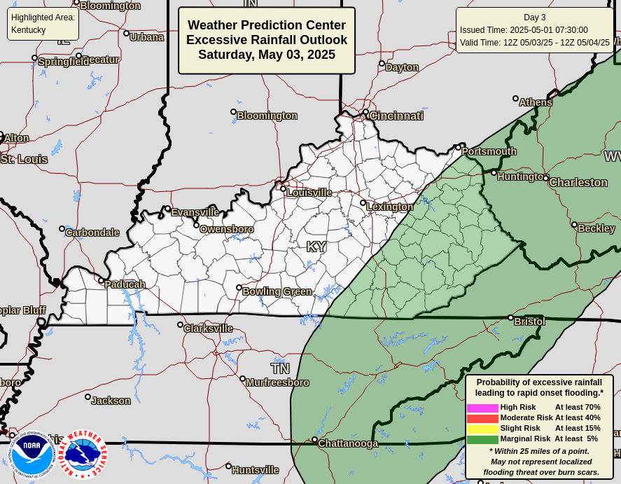
The hazards outlook from the WPC also shows much of Kentucky now shaded in the “Flooding Likely” area…

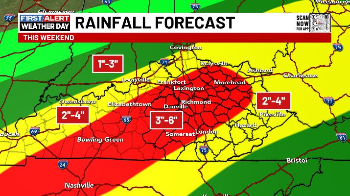
A general 1″-4″ of rain is likely across Kentucky with a corridor of heavier rains setting up from northwest to southeast. Exactly where that sets up is still a bit of a work in progress as we are dealing with thunderstorms and the exact track of a low pressure. Wherever this sets up, 3″-6″ of rain would be possible…
In addition to the significant flood threat, the Storm Prediction Center is also highlighting the low-end risk for severe storms. The greatest chance for this comes during the afternoon and evening hours…

A light snowfall follows this up on a cold northwest wind Sunday into Sunday night. That kicks off a very cold pattern that will likely throw another snow threat at us by the middle of next week…
I leave you with your Kentucky Weather Radars…

Enjoy the evening.
