Good afternoon and Happy Valentine’s Day, everyone. It’s a sweet looking Friday and you had better get out and enjoy it because the weekend has ugly written all over it. A major storm system brings significant flooding, severe storms, high winds and snow to Kentucky.
The Flood Watch now includes the entire state of Kentucky from tonight through early Sunday…
A general 1″-4″ of rain falls across the entire state with a swath of 3″-6″ rains setting up shop within this. Exactly where that is depends on the track of the low and what looks to be showers and storms that “train” from southwest to northeast.
I just don’t see much reason to change this at the moment…
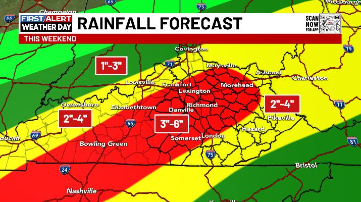
I may have to shade that a bit west, but not by much.
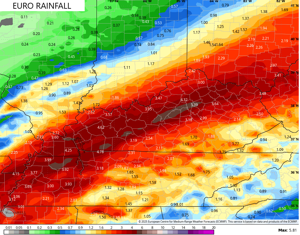
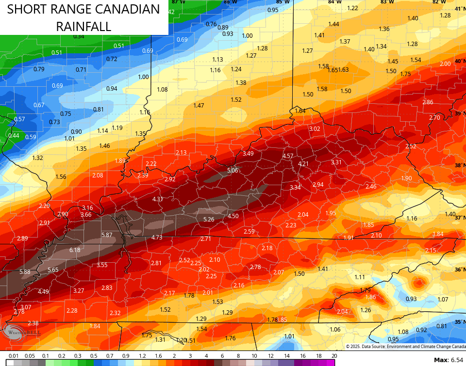
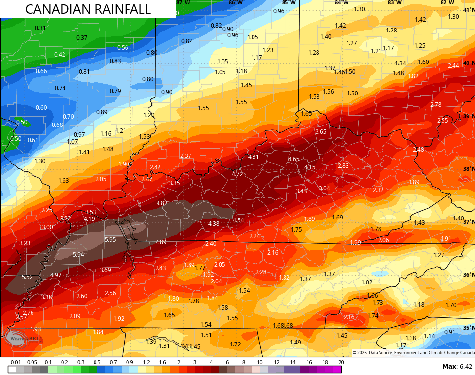
The EURO and Canadian Models see this same swath aimed a tad west…
EURO
SHORT RANGE CANADIAN
CANADIAN
The ICON has a similar look but has a wider area of 4″+ rains…
![]()
![]()
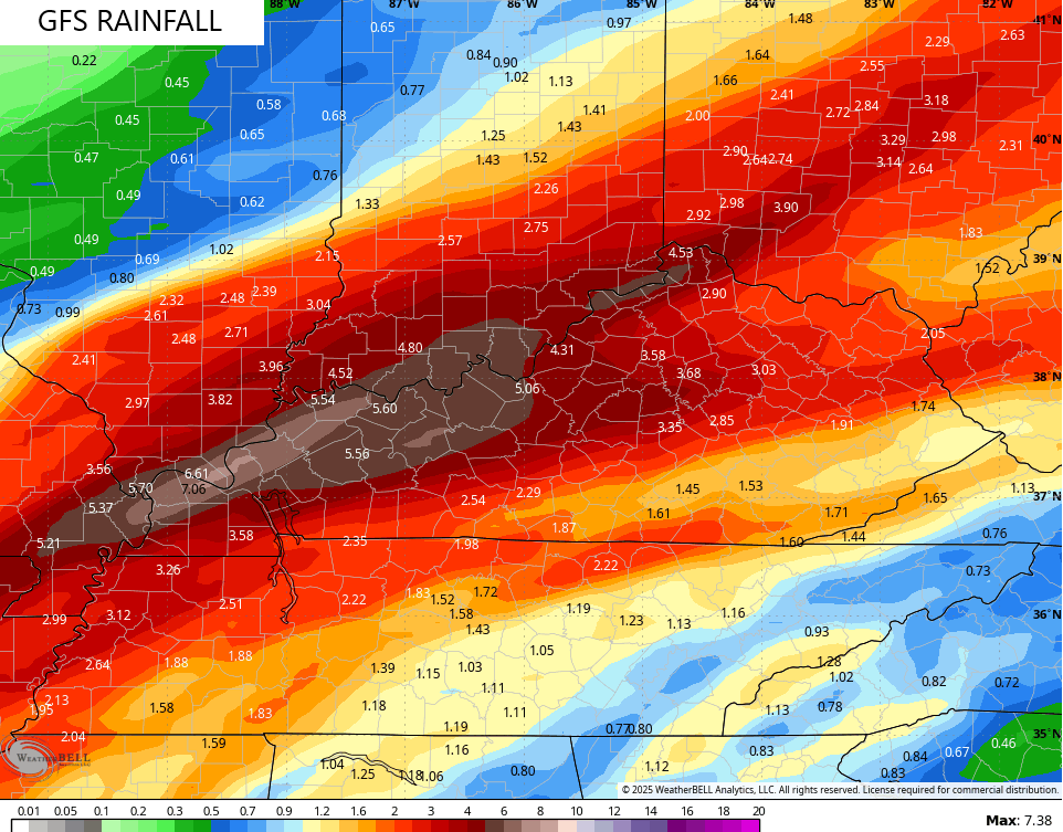
The American models like the GFS and NAM continue to look different than the others with two prongs of heavy rains, one of which is way north and west…
GFS
NAM
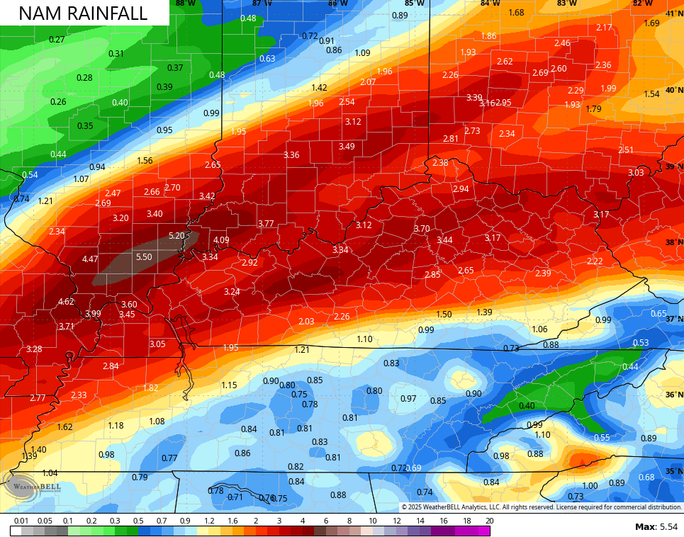
Convective feedback issues may very well be at play with these models, leading to the rains being too far northwest.
High winds of 40mph to 50mph will be possible as our low moves through here.
The Severe Weather Outlook continues to highlight the severe threat across southern Kentucky…

That risk includes a small tornado threat…

Frigid winds kick in behind this Sunday and Sunday night with a light snowfall looking likely. 1″-2″?
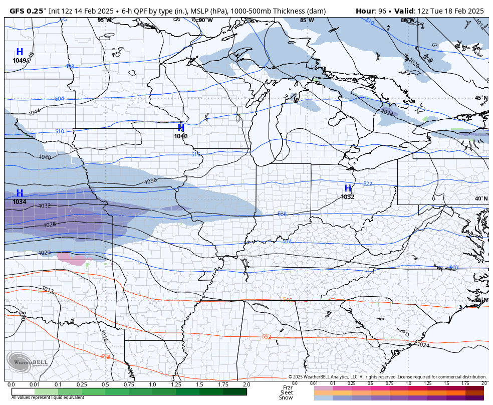
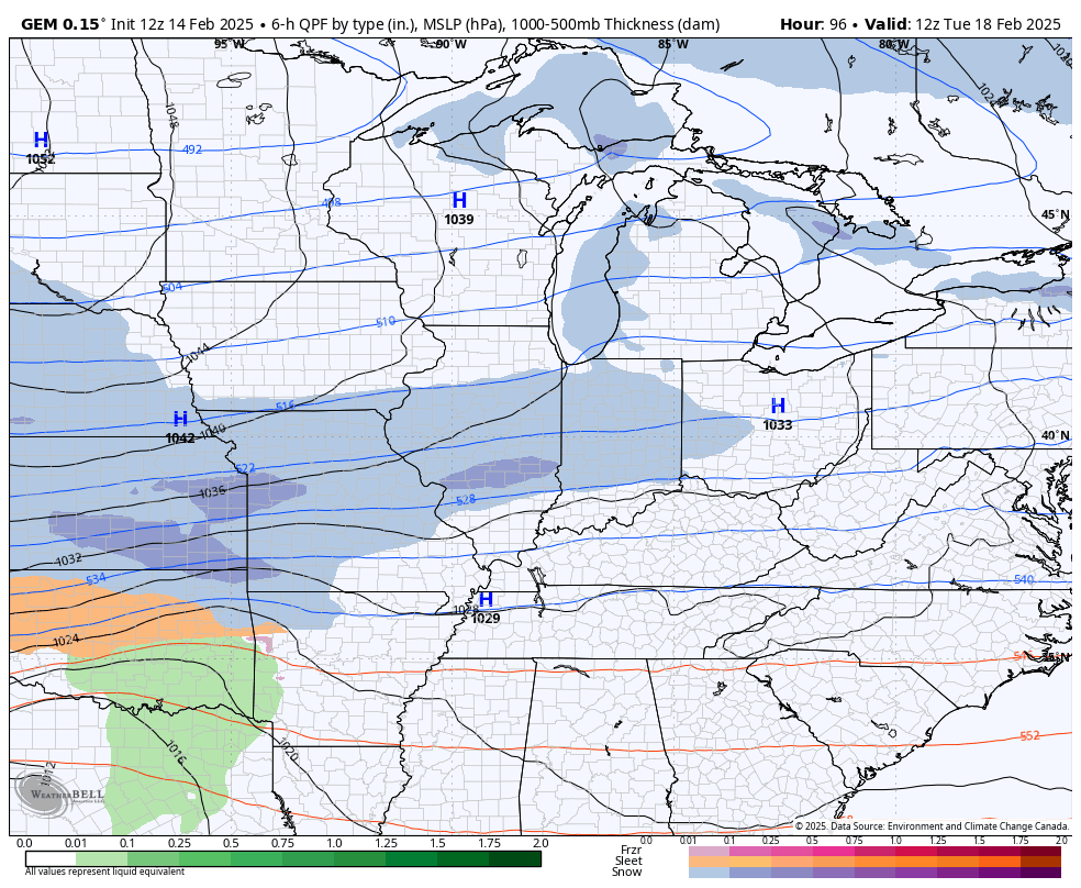
Next week turns harsh as Old Man Winter flexes once again. Bitterly cold temps and the potential for a significant winter storm are on the table.
The GFS shows our winter storm possibilities…
The Canadian has an even stronger signal…
Temps and wind chills may go below 0 later next week.
Winter ain’t done, yet.
I’ll have the latest on this wild weekend of weather on WKYT starting at 4pm then again on KWC later in the evening. Make it a great day and take care.

The Climate Prediction Center has issued their February ENSO update, and it indicates that a weak La Nina remains in effect, and there is a 66% chance the we will phase into an ENSO-Neutral phase in the Mar-May time-frame. Historically, incidence of severe weather increases in years when a La Nina/ENSO Neutral shift tales place during Spring.
https://www.cpc.ncep.noaa.gov/products/analysis_monitoring/enso_advisory/ensodisc.shtml
https://www.ospo.noaa.gov/data/cb/ssta/ssta.daily.current.png
Just seen that the WPC has issued a rare high risk for flooding tomorrow and the flood watch is now a PDS flood watch. I don’t recall seeing this happen before for a rain event. Stay safe tomorrow folks!