Good evening, everyone. A MAJOR flood threat is with us over the weekend with several inches of rain falling in less than 24 hours. This will be accompanied by a low-end severe storms risk for some and will be followed by a harsh winter pattern.
Our Flood Watch continues for all of Kentucky and much of the surrounding areas…
The Weather Prediction Center has a Moderate Risk to HIGH RISK for flooding across Kentucky…
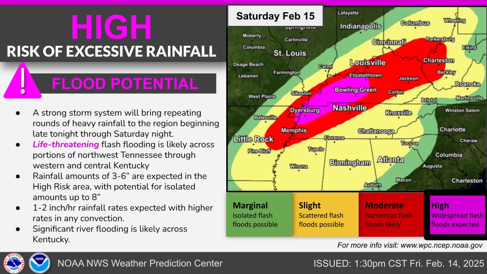
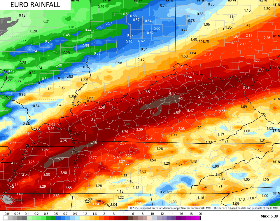
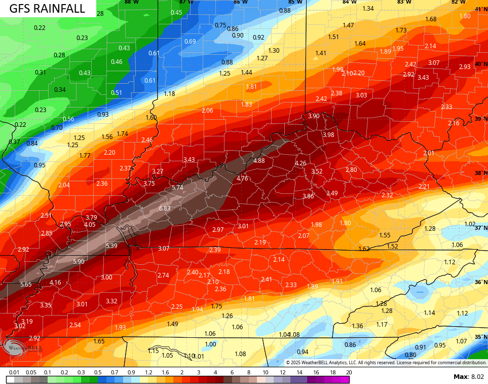
That High Risk is likely a bit too restrictive into the west and should be expanded into central Kentucky. I’ve tightened up the rainfall forecast, but I didn’t make any substantial changes…
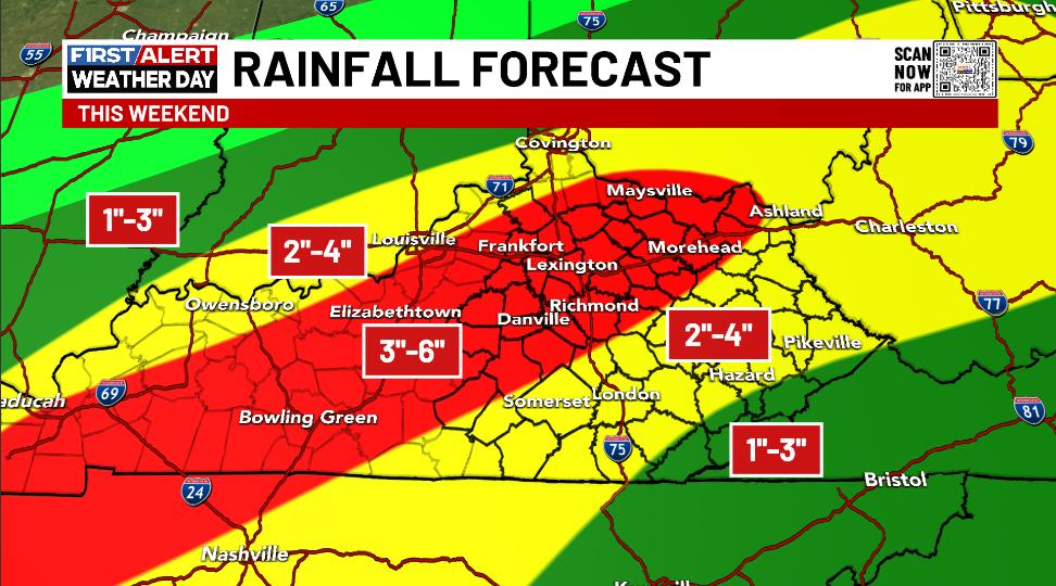
The forecast models are settling into my zone with the axis of heaviest rains.
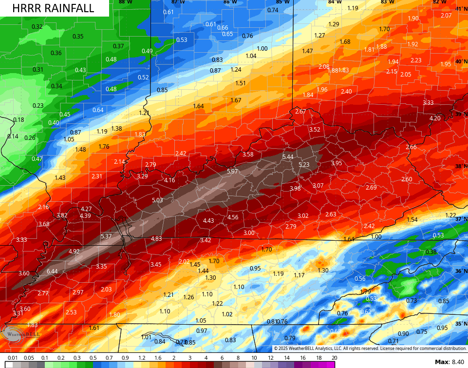
Here’s the short range model known as the HRRR…
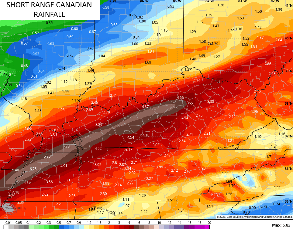
The Short Range Canadian is similar…
As is the EURO…
As expected, the GFS is now shifting back to the southeast with the heaviest rains and this trend should continue tonight…
Significant flash flooding, general flooding and river flooding are all likely this weekend. If you live in a flood prone area, please take action now!
There’s still the low-end risk for a few severe storms across southern Kentucky during the late afternoon and evening hours…


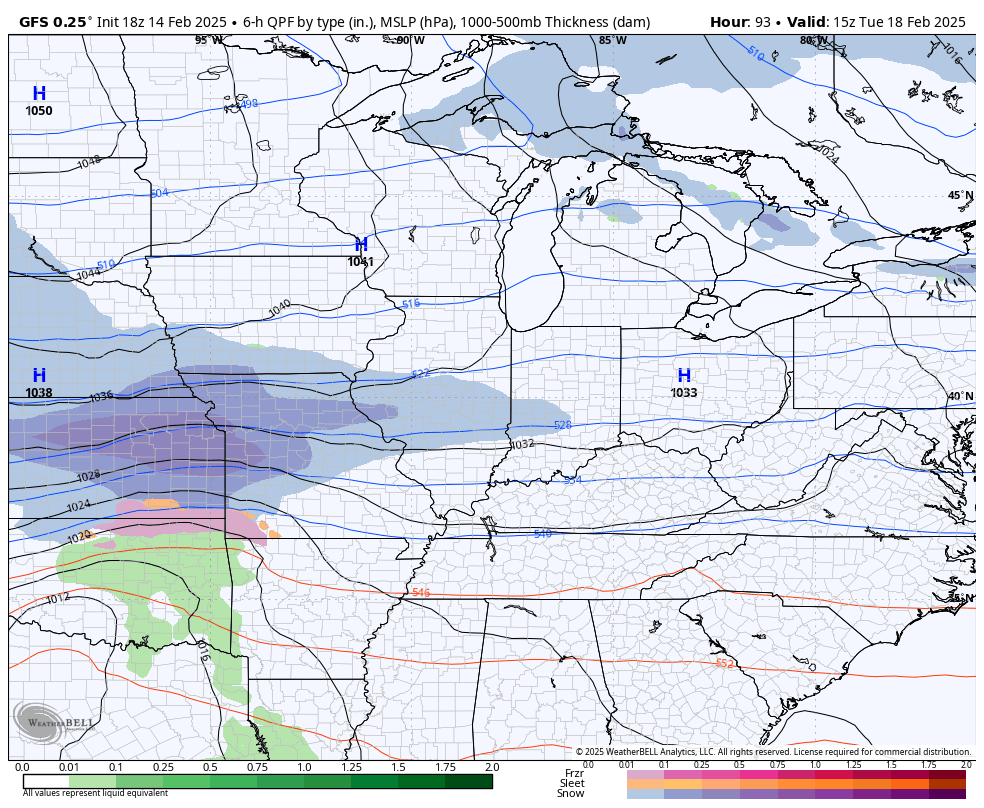
Temps crash on Sunday with a light snowfall through Sunday night. This kicks off another harsh winter pattern that has the chance to put several inches of snow on the ground late Tuesday through Thursday.
The models have a good look at this…
GFS
EURO…
Bitterly cold temps and wind chills would accompany the snows.
I’ll be back with a full update later tonight. Until then, let’s track some rain increasing from the southwest…

Enjoy the rest of the evening and take care.
