Good afternoon, everyone. Major flooding is ongoing across many areas of Kentucky and this only get worse into the evening and overnight. That’s when the potential for a few severe storms jumps into the mix.
All of this will be followed by a harsh week of winter that begins with cold and snow on Sunday.
Life-threatening flooding continues across Kentucky into early Sunday. Please stay safe everyone and you can follow all the warnings on this map…
The Storm Prediction Center has upped the chances for severe storms in south central Kentucky…

Damaging wind is the main threat, but a brief tornado spin up is possible…

A swath of accumulating snow may follow this up on Sunday with light snow and snow showers coming in behind that later Sunday afternoon and evening.
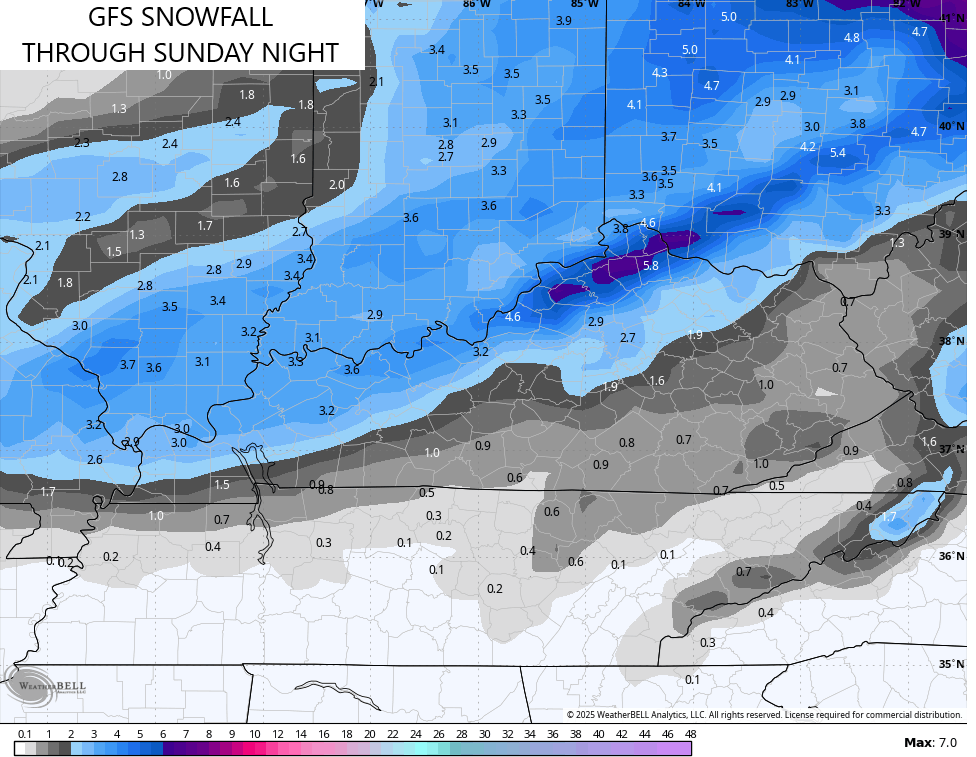
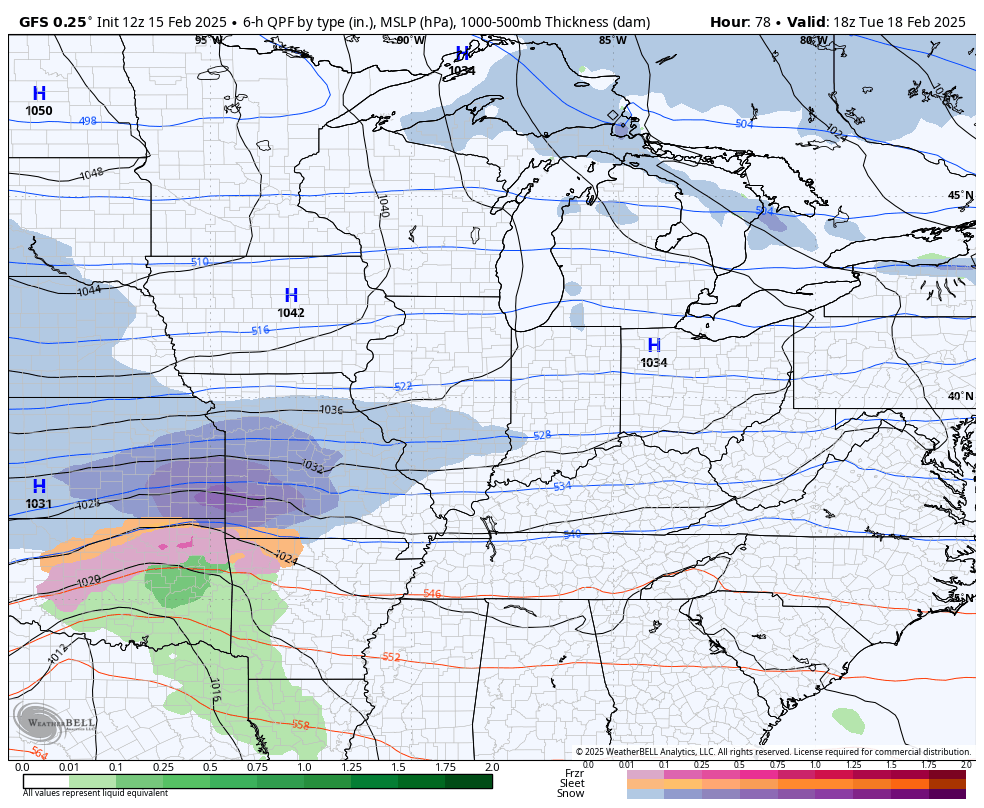
The models are growing more emphatic on the possibility of a few slushy inches on the backside of the departing low early Sunday. The GFS is actually ramping that up to several inches in the north…
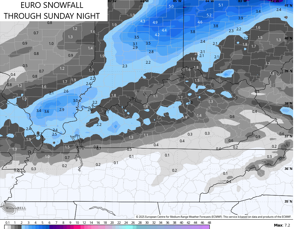
The EURO is trying to do the same, but isn’t quite as stout…
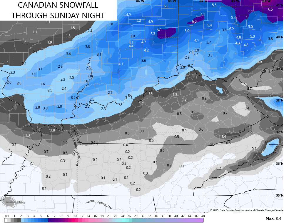
The Canadian is seeing this too…
This would, at least, be advisory type snows.
A developing winter storm targets Kentucky with significant snows late Tuesday through Thursday…
EURO
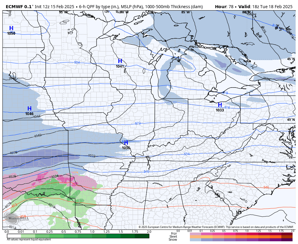
GFS
That’s likely to become a shutdown winter storm for many states and I can’t rule Kentucky out of that category.
I’ll have breaking weather coverage on WKYT as needed. Until then, I leave you guys with your shower and storm tracking tools for the day…

Current watches

Possible Watch Areas

Stay safe and have a great Saturday. Take care.
