Good Sunday, everyone. Major flooding continues across much of Kentucky as Old Man Winter starts to flex. This brings snow and cold to the region today, kicking off a harsh week of weather that may throw several inches of snow down.
A Winter Storm THREAT is now out from Tuesday night through Thursday. I’ll get to that in a moment.
Deadly and destructive flooding hit the region Saturday and continues into today. Major flooding is occurring on many creeks, streams and rivers. At one point overnight, all 120 Kentucky counties were under Flood or Flash Flood Warnings.
Here’s a look at the current warnings…
A Winter Weather Advisory is also out for parts of the state today as a thumping band of snow follows in behind the heavy rains. Snow showers and squalls will then follow that up this afternoon and evening.
Can we get some thundersnow? Maybe.
Slushy accumulations will show up today…
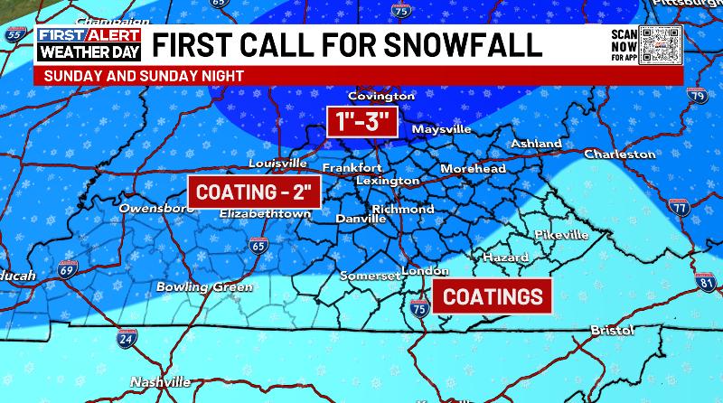
Much of this falls on grass and elevated surfaces.
Slick roads are likely to develop later today and tonight as temps plummet.
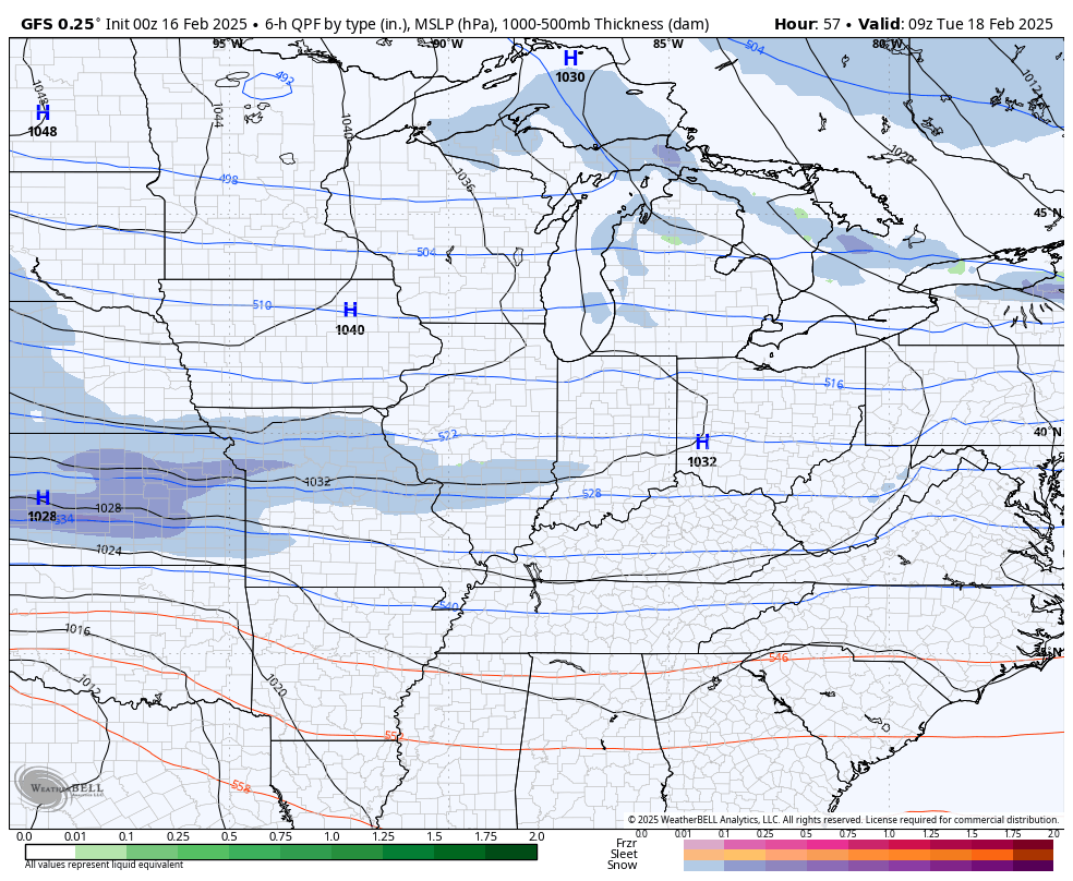
Frigid temps continue into Monday ahead of our Winter Storm THREAT from late Tuesday through Thursday. Several inches of snow may fall during this time as a storm system moves from west to west to east across the south. That should turn the corner up the east coast as a significant winter storm.
Here’s the GFS…
Here’s the EURO…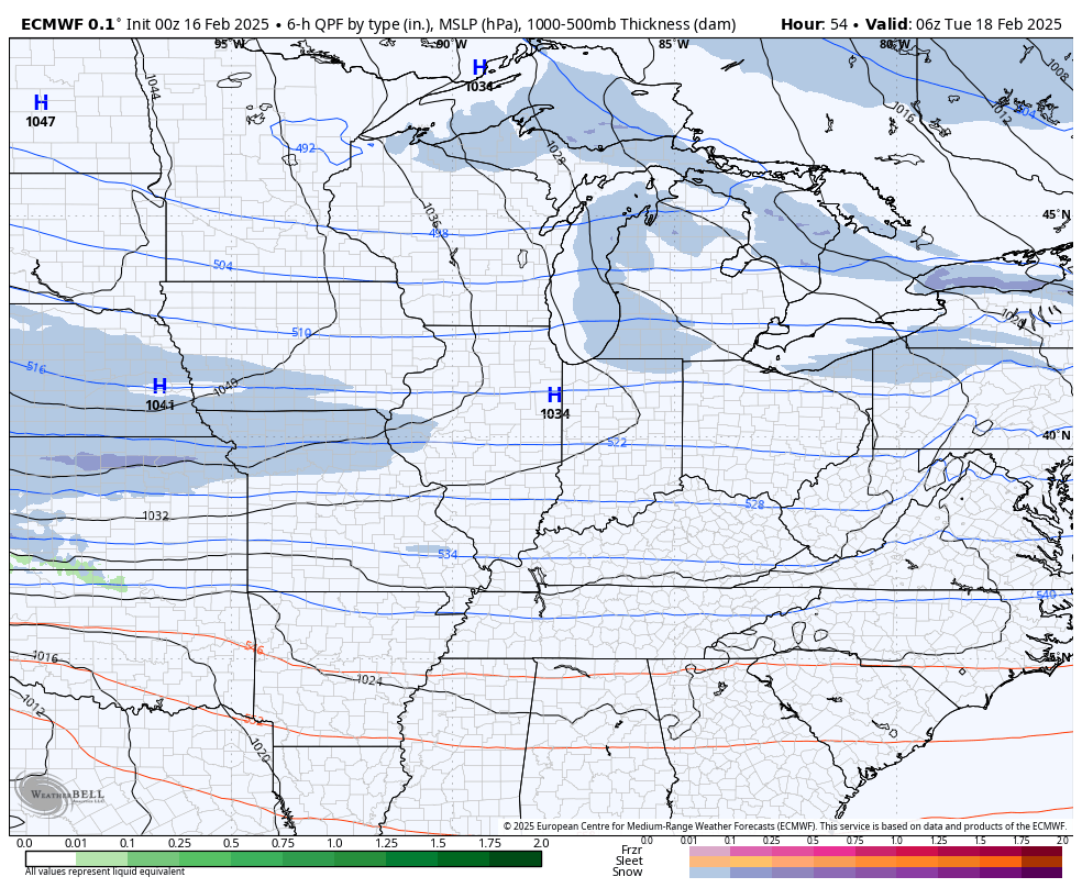
I’ll have updates later today. I have your tracking tools including our Kentucky Weather Cams to watch the wild weather across entire region…

Have a great Sunday and take care.

Truly tragic, this event. We desperately need a dry spell of a week or two.
I agree Jeff.
I hope JoeD and Crystal can check in soon. Lexington didn’t get nearly what they did.