Good evening, everyone. Old Man Winter is flexing on the region at a really terrible time as thousands of people across Kentucky deal with severe flooding. Snow is causing travel issues tonight and this is ahead of a developing winter storm moving in for the weekend.
Before we get to the snow, the flooding continues to devastate many communities and towns across Kentucky. For some areas, it’s the worst flooding in more nearly 50 years as Flood Warnings continue for many rivers and many counties throughout Kentucky and surrounding areas. Those are in green on this map…
Another inch or two of snow will be likely through tonight across much of central and eastern Kentucky. For that reason, a Winter Weather Advisory is out for many areas…
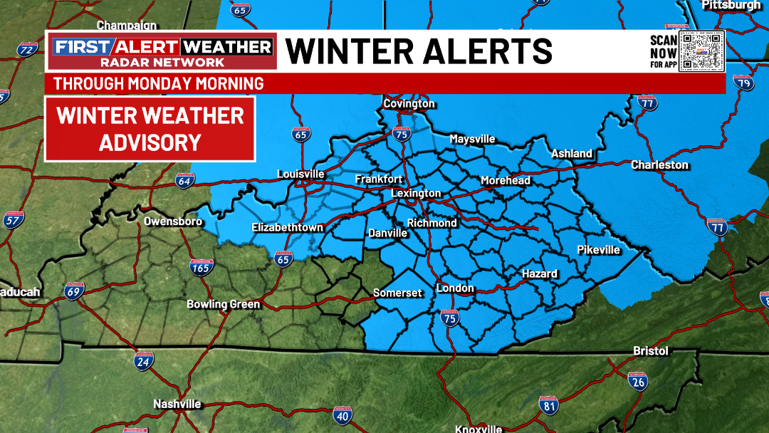
Snow showers continue into Monday on a frigid northwest wind. Travel conditions will continue to be poor during this time.
There’s also a sneaky streak of light accumulating snows coming at us Monday night and early Tuesday. That one may be an overachiever, so keep that in mind.
That’s ahead of a winter storm set to bring several inches of snow to all of Kentucky. Winter Storm Watches are already up for western and central Kentucky…
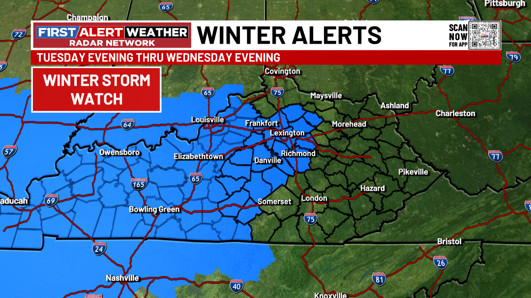
Those should be issued all the way through Kentucky and into West Virginia and Virginia and all of this will likely be upgraded to a warning.
My overall thoughts have not changed with much of Kentucky likely receiving 4″ or more of snow…
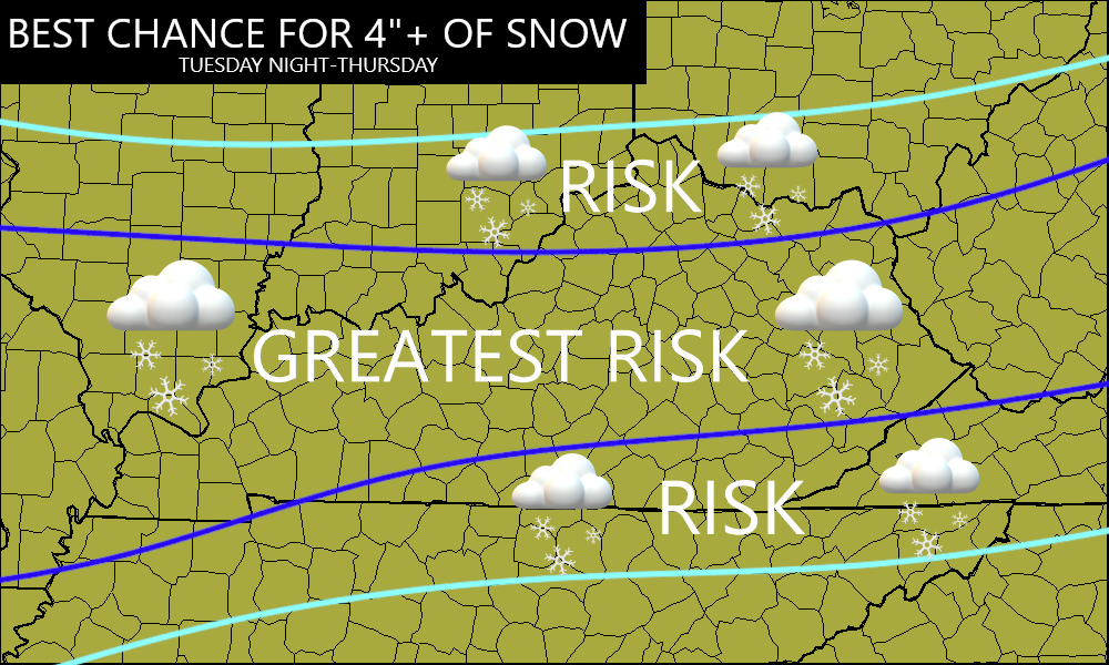
The ceiling on this is 10″ with the bottom floor being around 2″.
This is a storm that will be a HIGH IMPACT travel event from Tuesday night through Thursday, so adjust travel plans accordingly. Bitterly cold temps accompany the snow with near zero lows and wind chills well below zero.
I’ll have the First Call for Snowfall coming later tonight. Until then, I have your tracking tools including our Kentucky Weather Cams to watch the wild weather across entire region…

Enjoy the snowy evening and take care.
