Good afternoon, everyone. A developing winter storm continues to chug toward Kentucky, ready to bring several inches of snow to the Commonwealth. This will also bring along bitterly cold temps for the second half of the week into the start of the weekend.
Major flooding continues across our rivers and will continue for a few more days. Winter Storm Watches are out for much of Kentucky and will likely be upgraded to a warning later today or tonight.
All the Watches/Warnings and Advisories show up on his map…

I’m still watching for that “sneaky” band of light snow to move from west to east later tonight into Tuesday morning. That can drop an inch of snow on its own, but that looks to be in a narrow band.
That shows up ahead of the winter storm that crosses the region Wednesday with a follow up round of snow Wednesday night into early Thursday. This shows up well on the GFS…

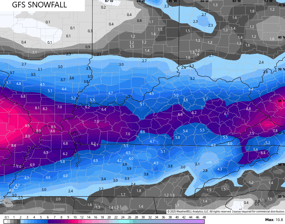
The whole setup still looks to bring the highest snow totals along and south of the Interstate 64 corridor with much lighter amounts in the far north.
Here’s the GFS snow forecast…
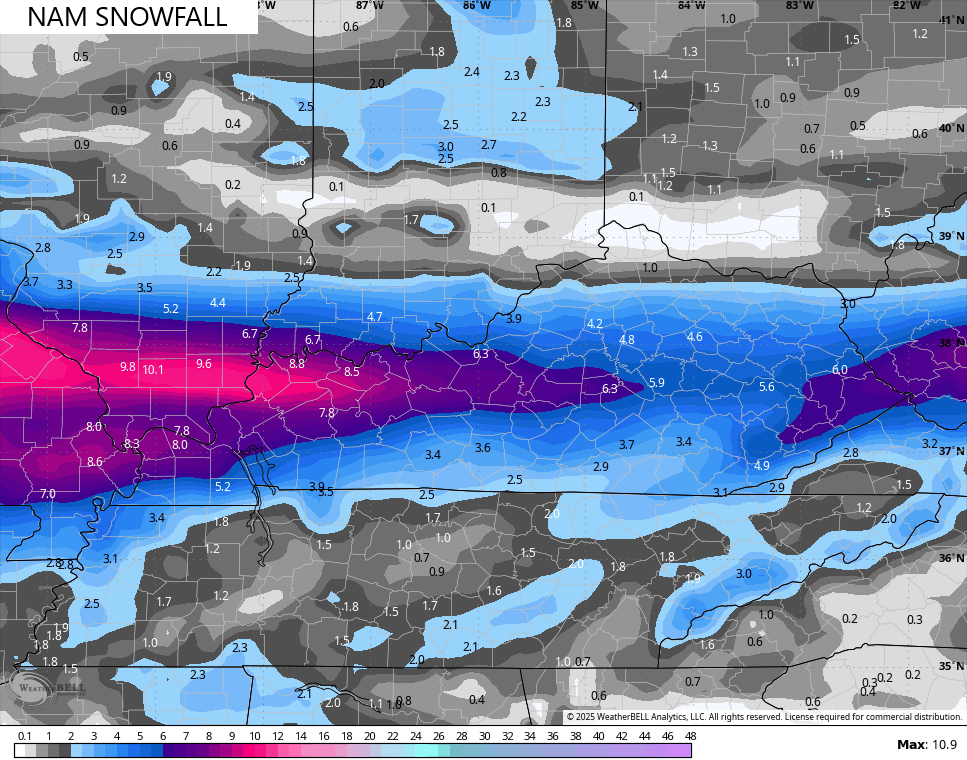
The NAM has way too sharp of a cutoff of the snows in the north and the south…
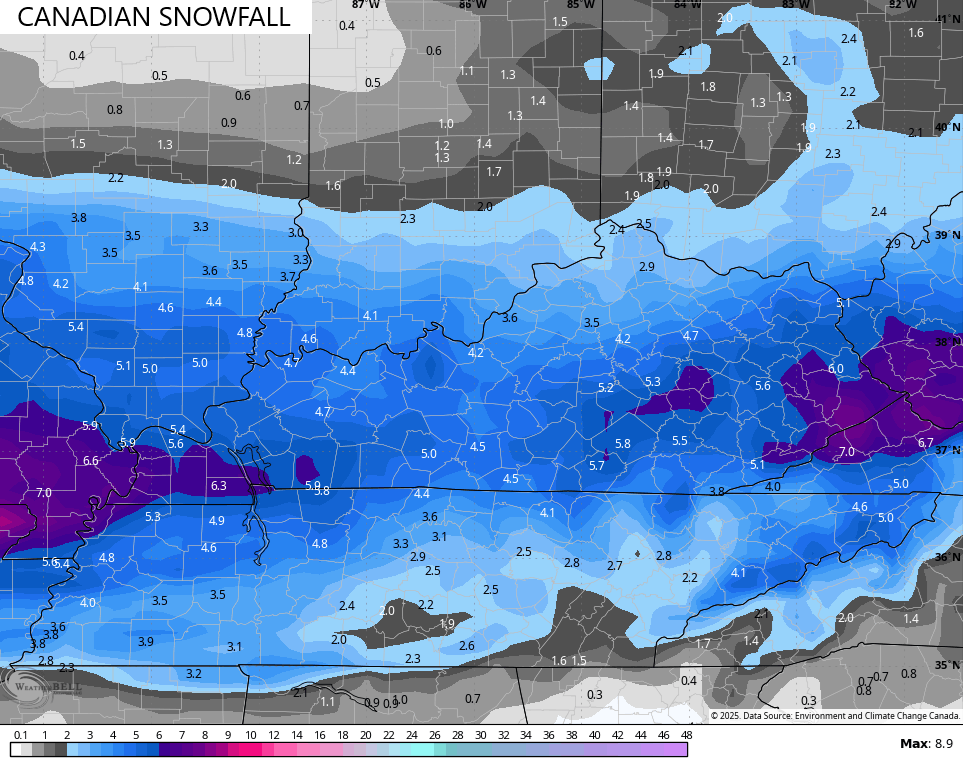
The Canadian is more in line with the GFS…
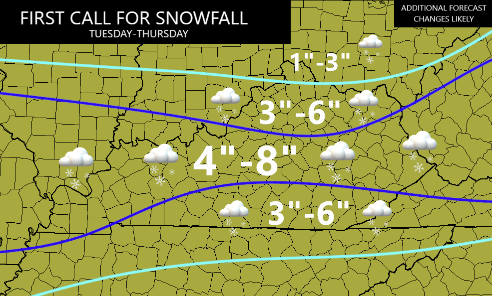
I’ll keep my First Call map going for now , but I will freshen this up later today on WKYT-TV starting at 4pm…
I’ll have a couple more updates for you guys later today. I leave you with your tracking tools including our Kentucky Weather Cams to watch the wild weather across entire region…

Enjoy the afternoon and take care.

Looks like western ky could be the bulls eye for a change. Wiĺ see how this unfolds
JKL must be really confident in their forecast for Whitley, McCreary, Knox & Bell.