Good evening, everyone. A developing winter storm continues to target Kentucky and surrounding states over the next few days. This will bring several inches of snow to the region and also unleash bitterly cold temperatures for the second half of the week.
A Winter Storm Warning is out for much of Kentucky with a Winter Weather Advisory in other parts. Here’s a look at what that looks like…
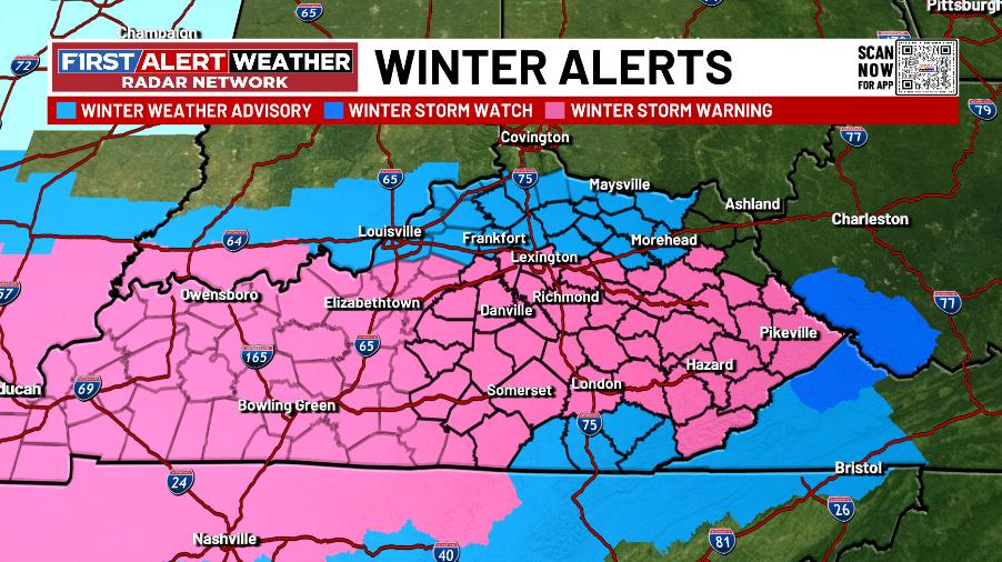
I think the warning should include those 4 counties in the southeast. I also think we could add a county on the northern edge of it and that the Advisory should go all the way through Cincy. Also… I have no idea on what the NWS in Charleston is doing with the lack of watches, warnings and advisories.
Before the main part of the storm arrives Tuesday night, a band of light snow can put down light accumulations later tonight and early Tuesday. Here’s how that may play out…
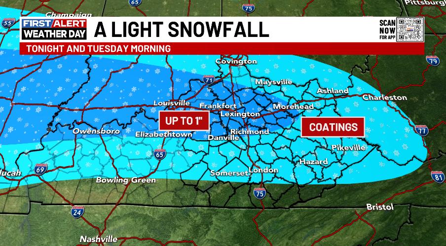
Slick roads may lead to cancellations and delays in some areas.
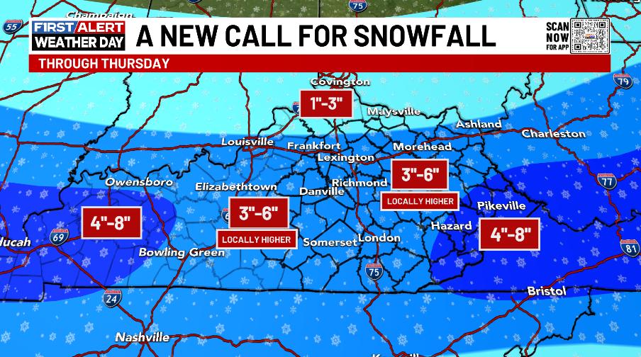
The main part of the winter storm moves in Tuesday evening in the west then spreads across the rest of the state Tuesday night into Wednesday. As that tapers Wednesday afternoon, another round of light snow engulfs central and eastern Kentucky Wednesday night into early Thursday.
Here’s what I’m currently thinking for snowfall…
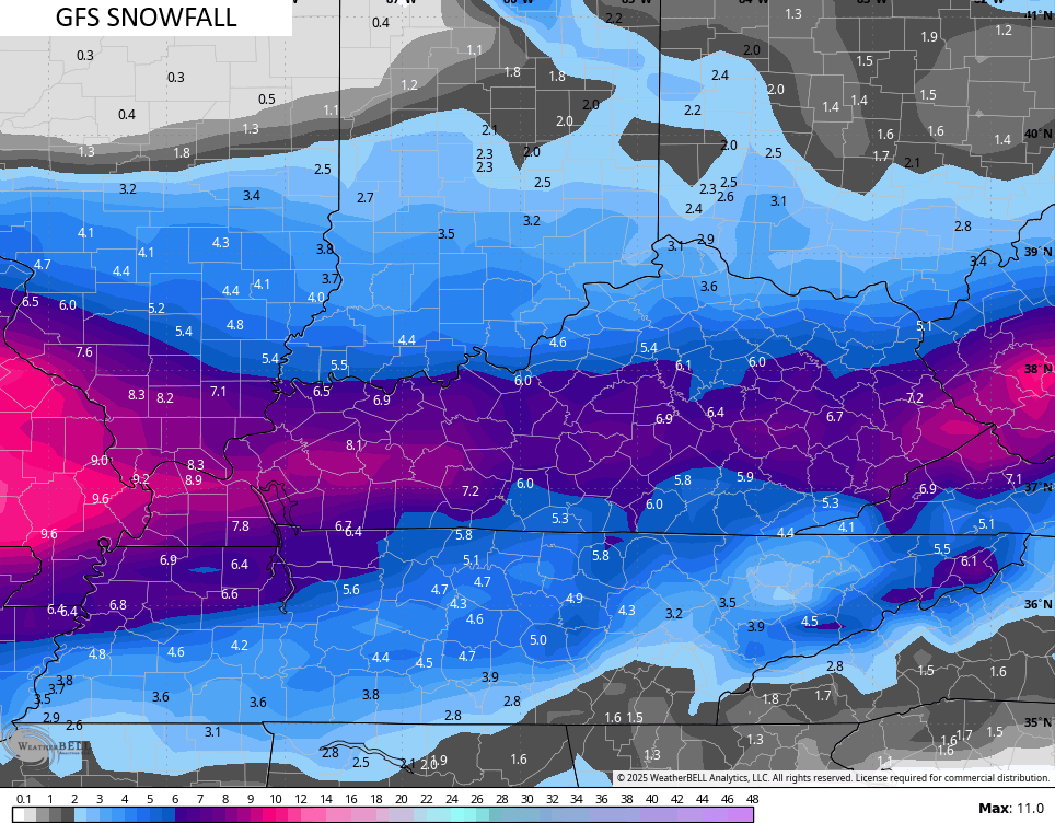
The GFS continues to have the healthiest band of snow…
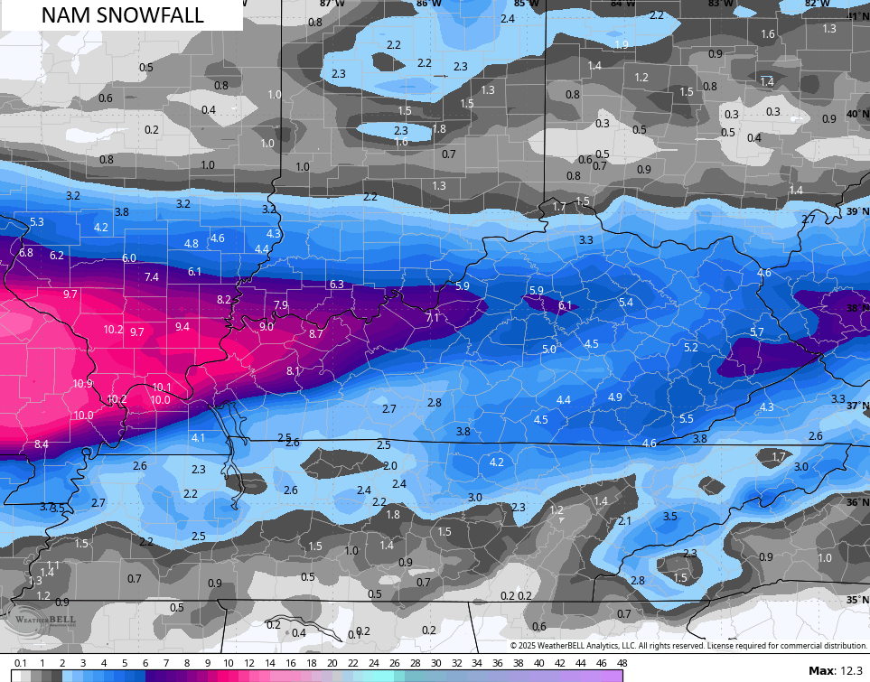
The NAM looks better than earlier as it’s shed the sharp cutoffs…
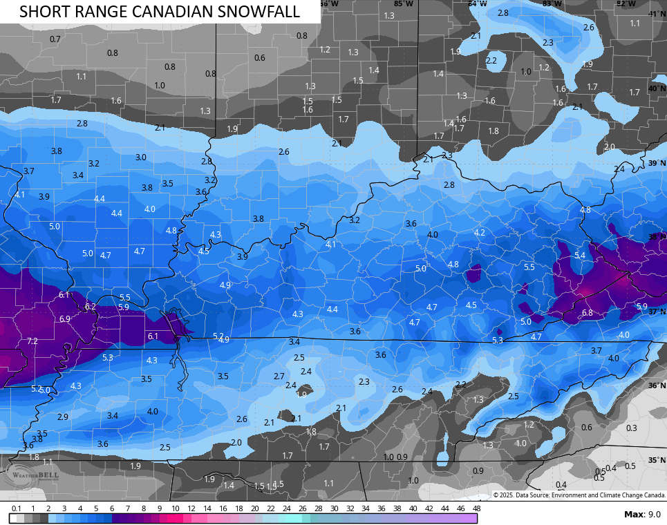
The Short Range Canadian…
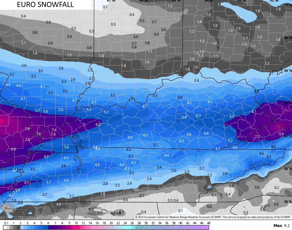
And the EURO…
I may drop in for another update this evening. Until then, here are your tracking tools…

I leave you with your tracking tools including our Kentucky Weather Cams to watch the wild weather across entire region…

Enjoy the evening and take care.
