Good Tuesday to one and all. A winter storm is taking aim at Kentucky and surrounding areas today and Wednesday. This drops several inches of snow across the region and will be accompanied by bitterly cold temps settling in for the rest of the week.
A Winter Storm Warning is out for much of Kentucky through Wednesday night. Other areas have a Winter Weather Advisory. All of this shows up here…
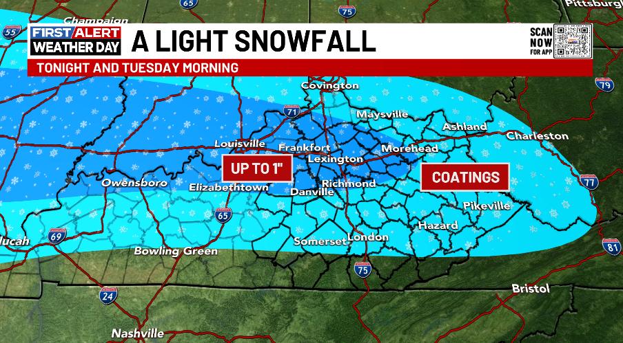
Preceding the actual winter storm is a band of light snow that can put down light accumulations for some through the middle of today. Local 1″ amounts will be possible and here are the areas with the best chance of seeing this today…
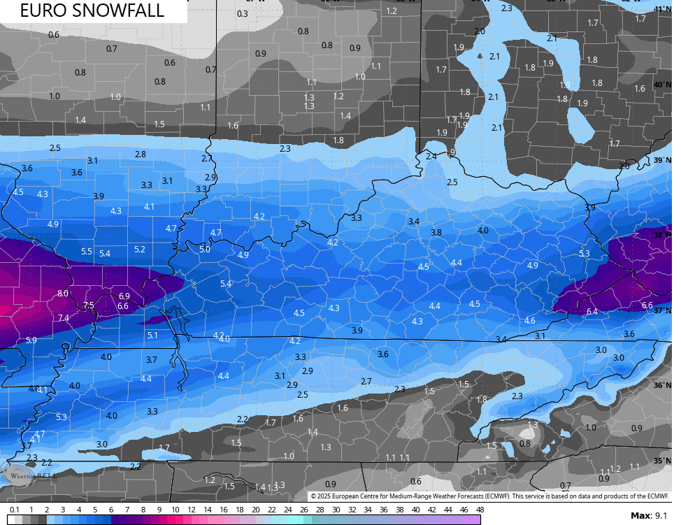
I’ve made no changes to my Call For Snowfall…
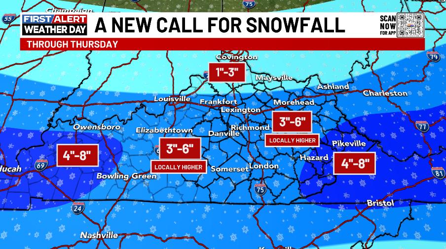
Keep in mind that’s everything that falls through Thursday!! I will update that another time or two today before the snows arrive. There’s the chance for areas of far western Kentucky to surpass the 8″line.
Here’s a quick breakdown of this storm:
- Light snow zips eastward into some areas of central and northern Kentucky with light accumulations.
- Moderate to heavy snow moves into the west this evening then spreads eastward overnight.
- The heaviest snows fall along and south of Interstate 64 with lighter totals in the north.
- Most roads will become snow covered very quickly.
- The snows taper from west to east on Wednesday with gusty winds creating a little blowing snow.
- Another round of light snow then overspreads central and eastern Kentucky Wednesday evening through early Thursday.
- Snow showers and a few squalls continue in the east Thursday afternoon.
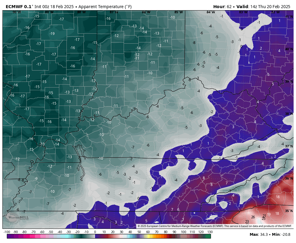
- Bitterly cold temps show up with this system. Lows in the singles show up by Thursday morning and we may be near 0 by Friday morning.
- Wind chill temps may approach -10 at times from Wednesday night through Friday morning.
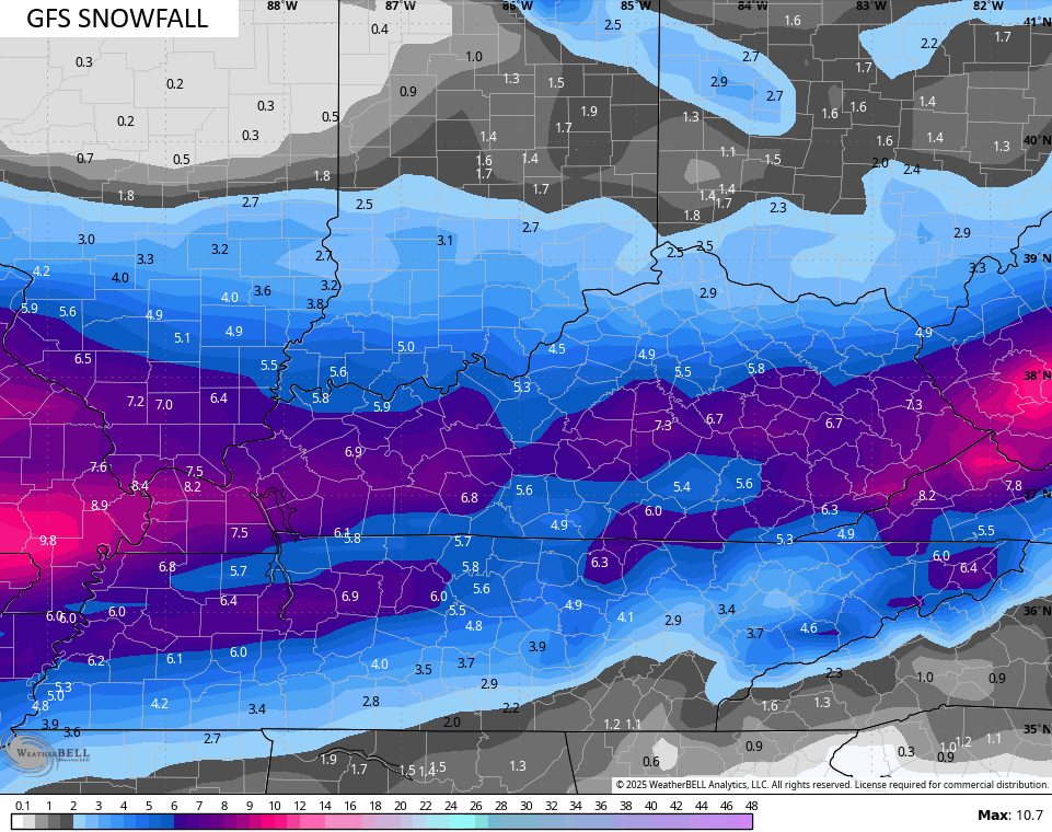
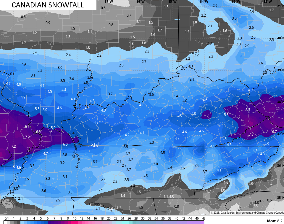
The forecast models are pretty much holding steady with their respective forecasts…
Wind chills during this time are brutal. This amination goes from Thursday morning through Friday morning…
Updates later today. I leave you with your tracking tools including our Kentucky Weather Cams to watch the wild weather across entire region…

Enjoy the evening and take care.

Disgusting
The forecast looks less like winter and more like early spring, starting next Monday. Does anyone still want more snow after this?
No, even though we all know there are plenty of chances the next two months.