Good evening, everyone. Snow is quickly developing and overspreading the state once again as round two of this winter storm kicks in. This round is bringing along bitterly cold temps that will be with us through the rest of the week.
A fresh 1″-3″ of snow will fall across central and eastern Kentucky with coatings to maybe an inch in the west. Here’s the latest call on additional snowfall through Thursday…
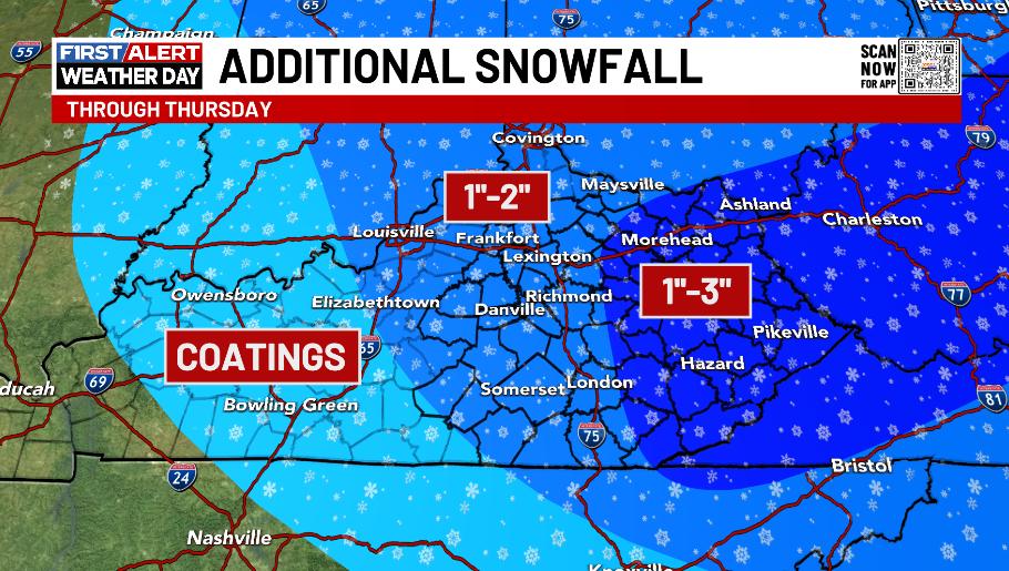
Kudos to the NWS offices in Jackson and Charleston, WV for keeping the Winter Storm Warning going as this snow is still part of the overall setup. Winter Weather Advisories are out for many other areas for the same system…

Bitterly cold wind chills will be noted over the next few days and may reach as low as -10 at times for some areas.
The pattern gets better this weekend into early next week with near normal numbers in the closing days of February. Unfortunately, this pattern isn’t going to continue as the setup for the first few weeks of March has a definite winter look…
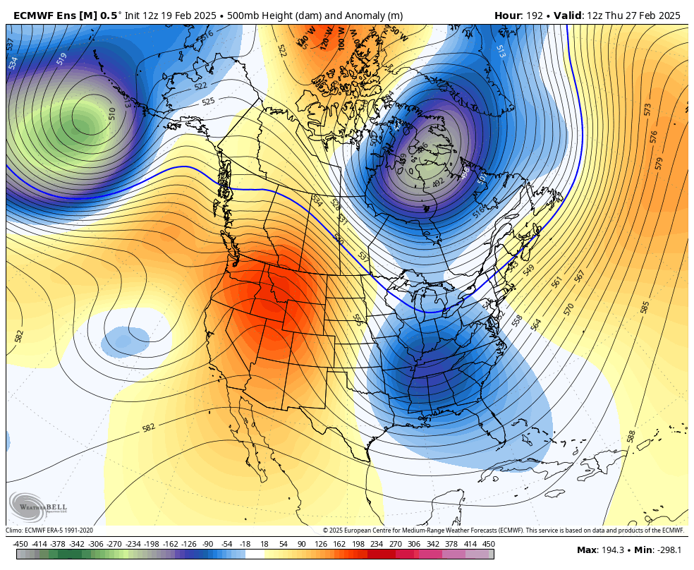
March has been known to give us some pretty healthy winter storms and the pattern taking shape is one that can do just that. Ugh
As usual, I leave you with your tracking tools including our Kentucky Weather Cams to watch the wild weather across entire region…

Enjoy the afternoon and take care.

I don’t buy the March signal one bit.
Jeff, didn’t you say the same about this current cold shot? #Teamwinter
Who cares
Oh boy Jeff I’ll bet you’ve been HATING this weather! LOL