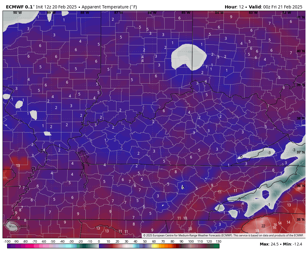
Good evening, everyone. Our recent winter storm has come and gone and now it’s one more night of bitterly cold temps. This cold slowly fades into the weekend as better weather takes control for a bit. That better weather may not hang out very long, so let’s enjoy it.
Wind chills tonight and early Friday will go below zero once again. Here’s a look at the hour by hour wind chill numbers through 7am Friday…
Temps this weekend will hit the 40s by Sunday and likely reach 50 Monday. That’s ahead of a weak cold front dropping in from the northwest with a few showers Tuesday. This takes us into a pattern that slowly becomes more active and, eventually, wintry once again.
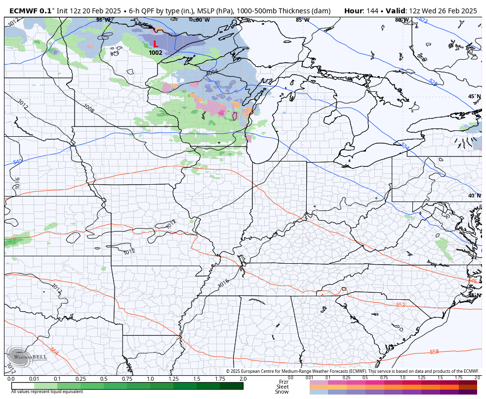
The system coming in by next Thursday and Friday may go from rain to some snow…
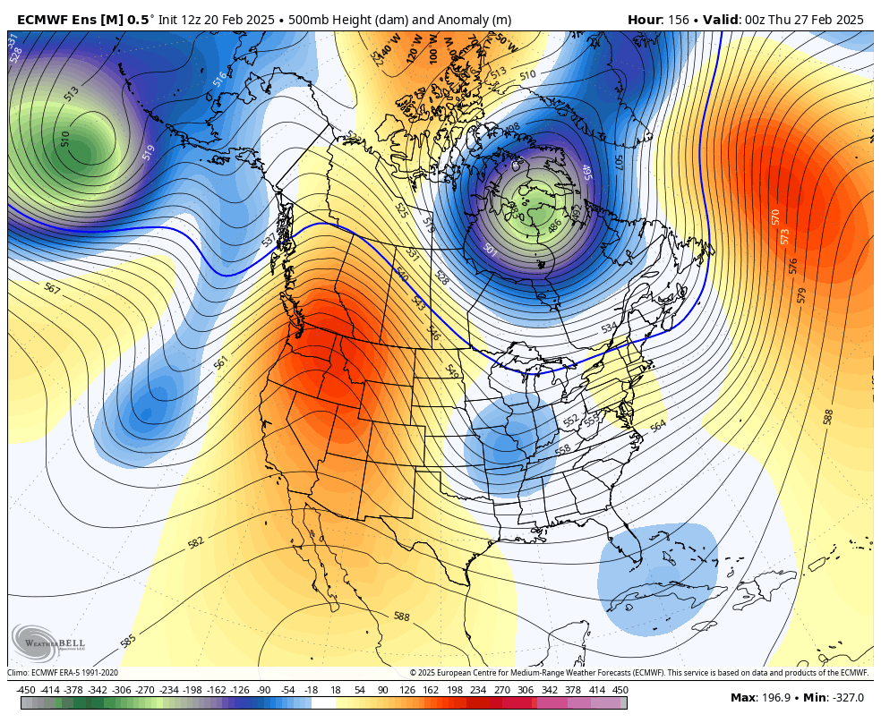
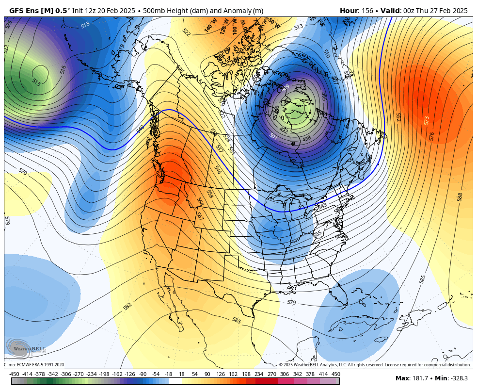
That begins another run of winter weather days with deep troughs swinging into the eastern half of the country. The Ensembles are all over this as we go into the first few week of March.
The EURO Ensembles…
The GFS Ensembles…
Ugh! #TeamSpring ain’t happy.
Some more flakes are flying in the east and those may continue into Friday morning if you can believe it. As usual, I leave you with your tracking tools including our Kentucky Weather Cams to watch the wild weather across entire region…

Enjoy the evening and take care.
