Good Friday, everyone. We are wrapping up another brutal week of winter weather across Kentucky, but some calmer days are on the way. This is exactly what the weather doctor ordered for the weather weary residents of the Bluegrass state.
Temps this morning are frigid with single digits and wind chills dropping below zero in some areas. There’s still enough of a northwest flow to spit out some flurries and a light snow shower early today in the far east.
Skies become partly sunny this afternoon with highs in the mid and upper 20s for many with a low 30 in the west and south.
The weekend will see temps reaching the upper 30s and low 40s Saturday with 45-50 in many areas for Sunday.
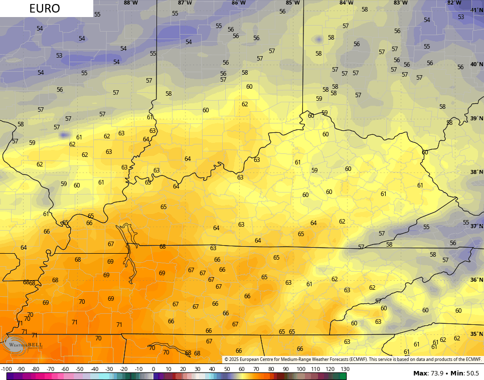
Temps can really spike into early next week with temps deep into the 50s with a chance for a 60 at some point Monday through Wednesday. The GFS and EURO are showing this potential…
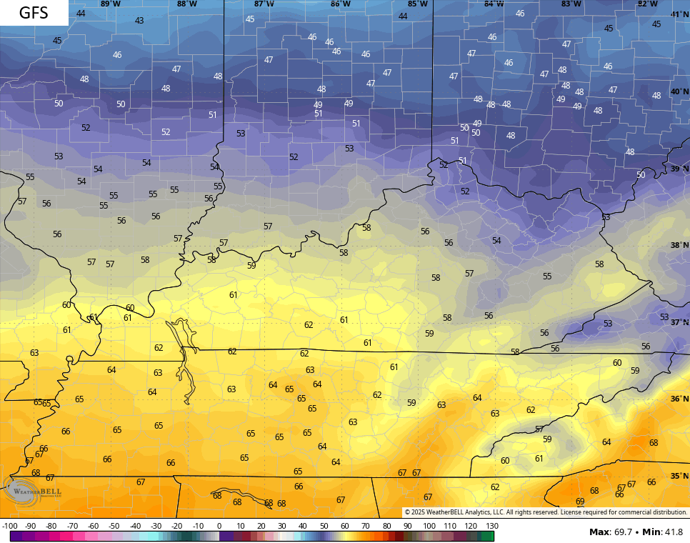
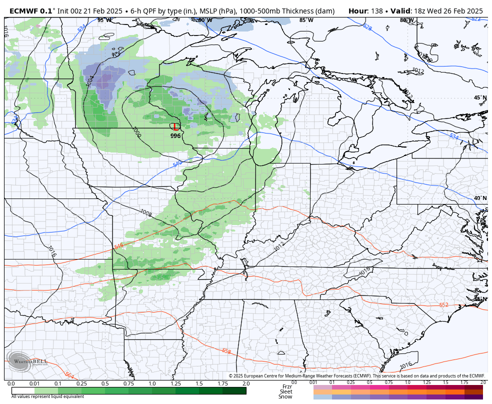
That’s ahead of a series of systems dropping in from the northwest starting late Wednesday and taking us through the first few days of March. These can bring rain and snow to the region…
This much colder than normal setup for early March continues to show up very well on all the ensembles. A look at the GFS Ensembles have a rather ugly look…
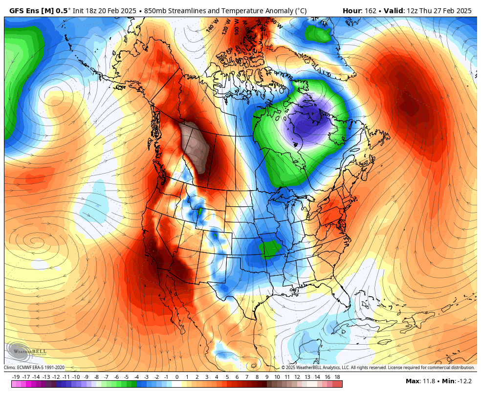
#TeamSpring ain’t happy!
I’ll have another update for you guys later today. Have a fantastic Friday and take care.

Thanks Chris. Boring weather is just what we need, but I feel real Spring weather will be late this year. Easter is very late (20th of April, ) and when that happens, so will Spring weather.
Enjoy the Day Everyone !
The GFS is lying.
I suppose that one good thing in our favor is that we haven’t had a protracted warmup this February, specifically one that causes the buds on trees and shrubs to start swelling prematurely. This is especially important when the prospects for another cold snap loom in March. I’ve spent more than enough money replacing greenery around my yard over the past few years!
Joe, I can’t Grow anything here, so I just enjoy the natural scenery.