Good Saturday to one and all. Our colder than normal pattern continues out there today, but the overall trend line is up. That’s a trend that continues into the start of the upcoming week before the pattern turns back colder into early March.
Temps this morning are in the teens to start with a few singles in the cold valleys. A mix of sun and clouds will be noted with highs in the 35-40 degree range for many. This is ahead of milder Sunday with temps making a run into the upper 40s to low 50s across the state.
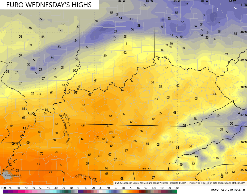
Temps are into the 50s Monday with the chance at 60 by Tuesday and Wednesday…
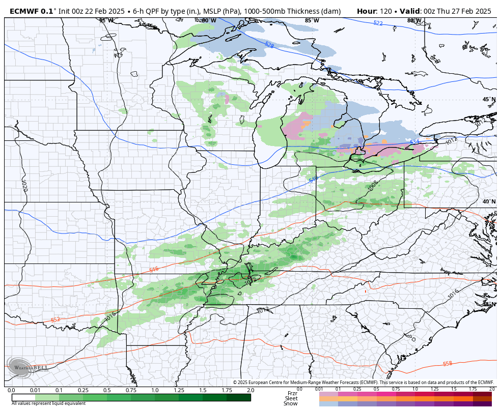
The setup features deep troughs digging into the eastern half of the country with systems bringing the potential for rain and some snow. These systems will drive the models crazy trying to get a handle on them…
That pattern continues to show up very well on the various ensembles. The GFS Ensembles keeps that deepening trough across the east into the beginning of the second week of March…
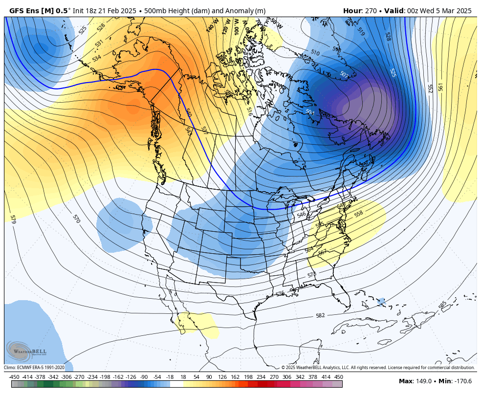
That’s likely to create some winter opportunities around here and for much of the eastern half of the country.
I’ve been talking a lot about how this pattern should flip toward a more spring look and feel around the middle of the month. The EURO Weeklies are seeing this flip that would take us into early April. Check out the 30 day mean of the 500mb height anomalies during this time…
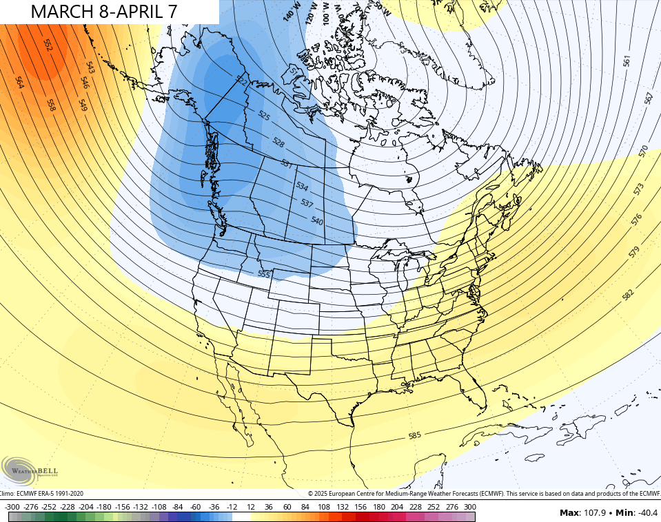
This pattern will likely feature an increase in severe weather threats and that’s something likely to increase as we head deeper into April and May. The severe weather bullseye may very well be on top of us this spring. It looks active, folks.
Make it a great Saturday and take care.

Compared to what we’ve had, March is nothing.
Maybe we will have some Summer weather next month. In recent years, I’ve seens some very warm days in March. Temperatures in the mid and upper 80’s. Your kind of weather Jeff.
Thanks Chris. I would say that my area had a mostly Cold and Drier Winter. Total Snowfall for the season was around 10 inches for Maple. I don’t actually know what our average Snowfall is for any given Winter ? Can’t find any weather records for Taylor County. In the past, the month of March featured the largest Snowstorms ( up in Indiana, ) but not sure here in Kentucky ? I know one thing I don’t care for Stormy Springs here in Tornado alley.
Enjoy the Weekend Everyone !