Good Sunday, everyone. The final weekend of February is wrapping up with temps slowly on the increase. This increase will really become noticeable over the next few days as we surge toward the 60s, giving your friendly weatherdude some good news to talk about for a change.
Today hits the 40s and may flirt with 50 in a few spots, especially in the south and west.
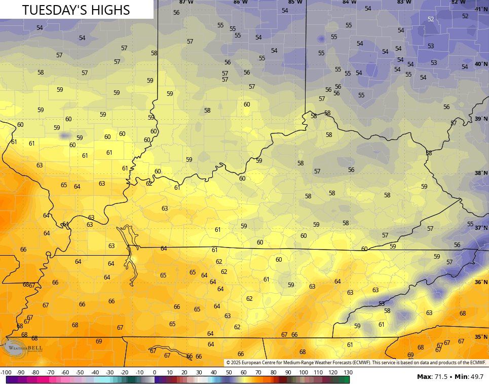
Highs then surge into the 50s for Monday as most of the remaining snow bites the dust. From there, the numbers climb toward the upper 50s and low 60s for Tuesday…
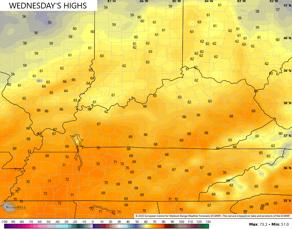
Highs are deep into the 60s for Wednesday with the chance for a 70 in the south and west…
That is EXACTLY what we need as many continue to piece their lives back together after the devastating floods last weekend.
This pattern starts to change as we head into late next week into early March. It’s a pattern featuring systems dropping in from the northwest. These will have temp spikes ahead of them, and big drops right behind them…
The pattern after that looks more conducive for bigger systems of rain and snow late in week one of March.
I’m continuing to point toward a huge flip to spring around mid March. That’s a signal I’ve been featuring for a bit now and it continues to grow stronger as we get closer.
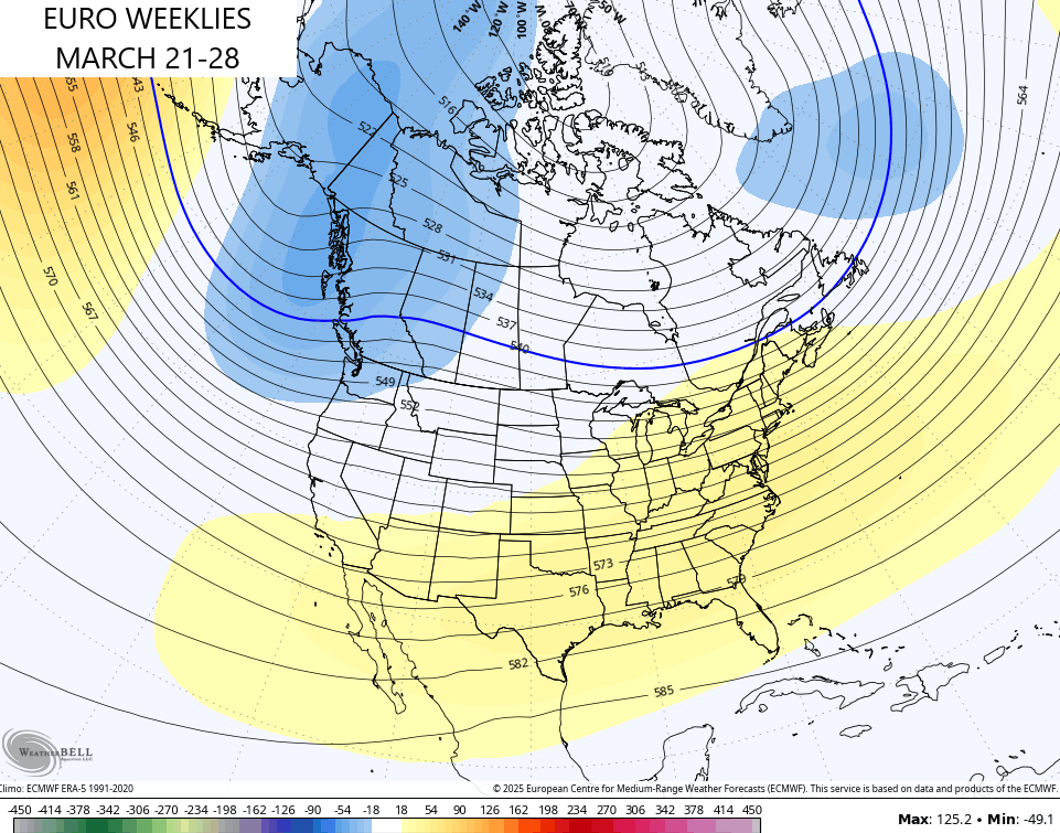
The EURO Weeklies see this winter looking pattern fading during this time. The 7 day height anomalies show that deep trough in the east hanging through March 12th…
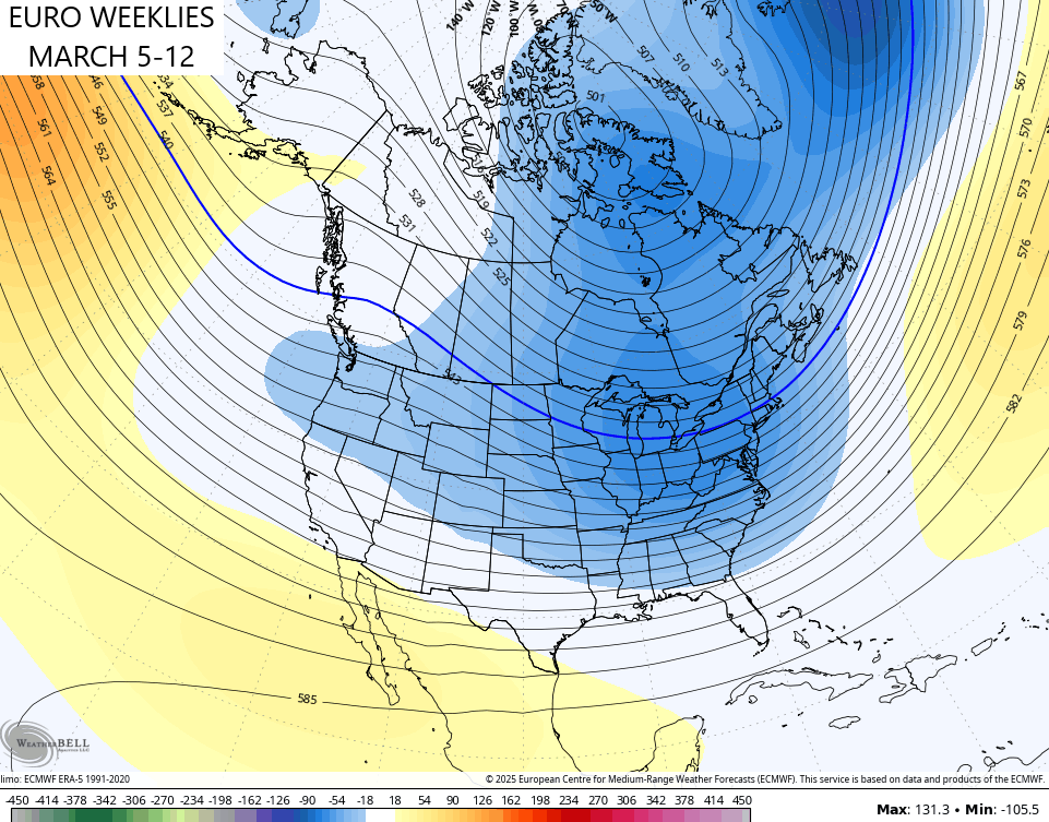
The following week sees the snap with a ridge going up in the eastern half of the country with the trough going back to the west…
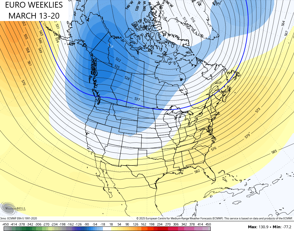
That gets more established into the following week…
That pattern has highs in the 70s written all of it, folks.
It’s also one that should feature above normal rainfall with the potential for early season severe storms. That likely kicks off a very active severe storms season in our part of the world.
Have a sensational Sunday and take care.

Hopefully that verifies.
Hopefully not the severe storms part,
Tradeoffs to everything.