Good Monday, everyone. Thermometers are set to really take off in the coming days as a much milder than normal pattern settles in. This gives us a round of 60s before we change it up toward a more active pattern that can feature some winter weather into the first few weeks of March.
After that… Spring fully takes control and does so in a big way!!
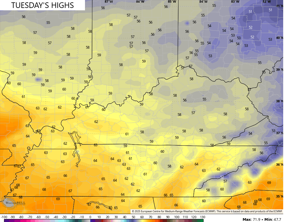
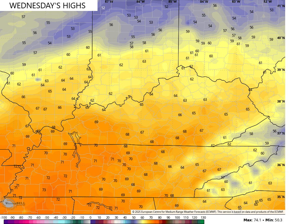
Temps today hit the 50s for all of the state with the chance for a 60 in the west and south. 60 degree temps become much more common Tuesday and Wednesday…
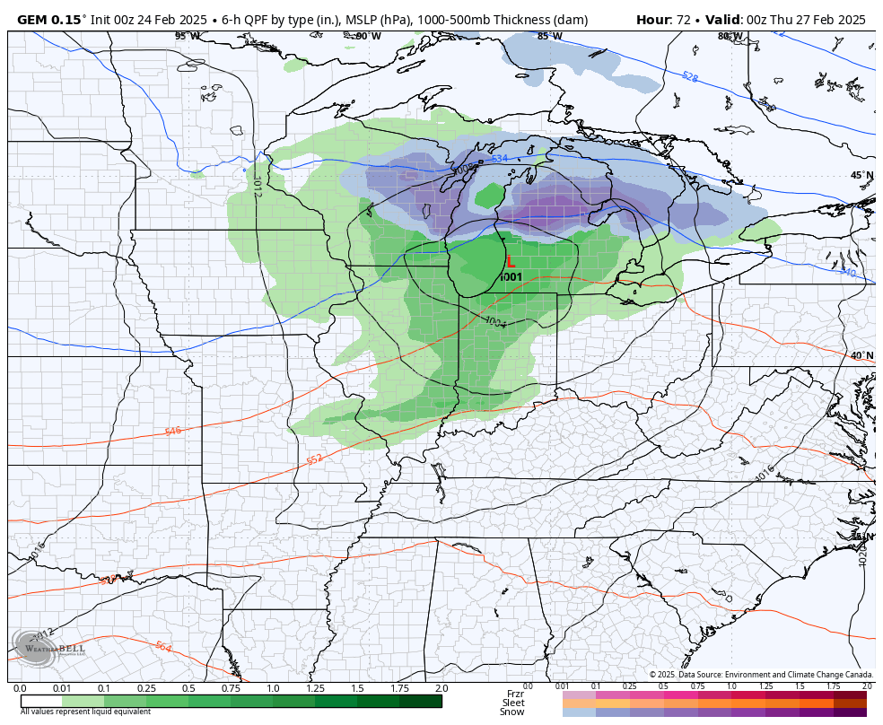
Those mild temps are along and ahead of a cold front dropping in from the northwest. This will bring gusty showers followed by colder air and the chance for a few flakes. Another front drops in behind that this weekend with the chance for some flakes behind it…
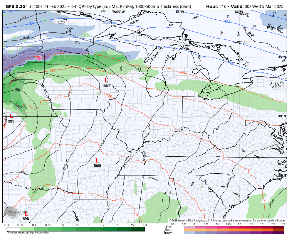
Temps should bounce back right behind that and ahead of a potent storm system that may very well have strong storms ahead of it by the middle of next week. That has a serious push of cold air coming behind it…
I’m going to continue to beat the drum on a very mild second half to March. This comes as a ridge goes up in the east with the trough going into the west. The 30 day average of the 500mb height anomalies from the EURO Weeklies keep giving us a healthy signal for some serious spring…
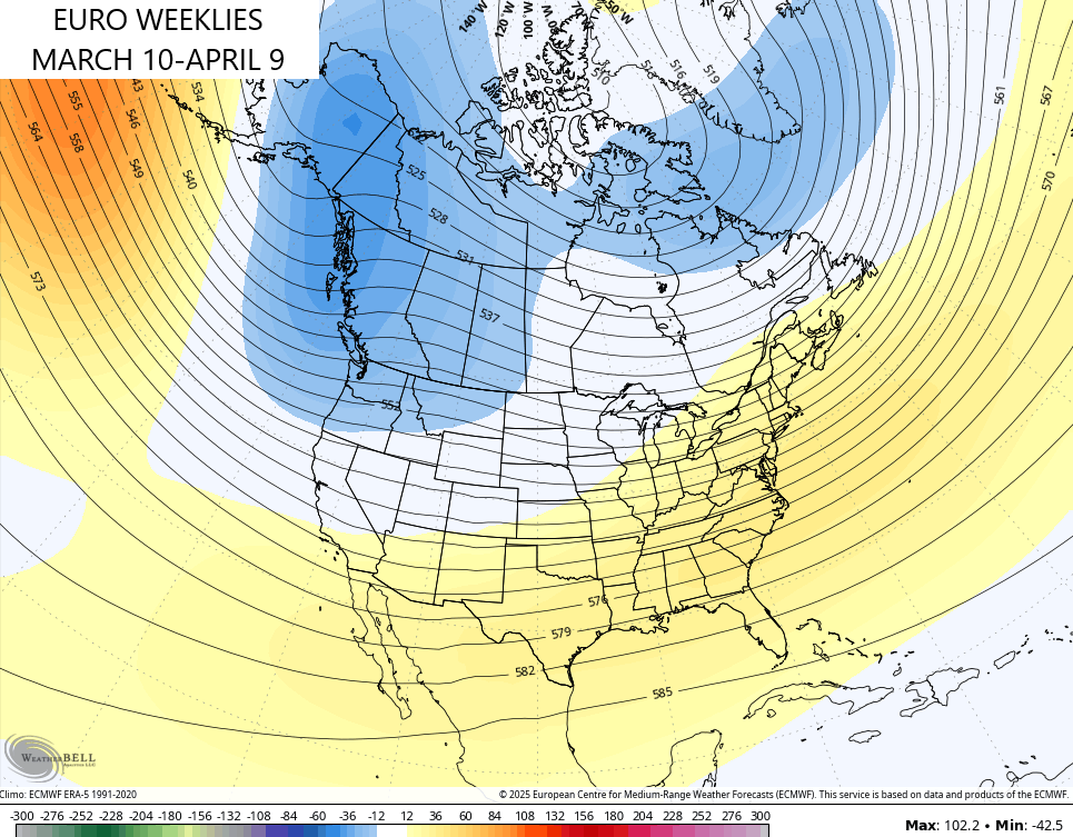
Temps with that reach the 70s at times.
It’s also a pattern that turns progressively stormy and wet from the middle of March into early April. Much of the rainfall showing up on the EURO Weeklies happens after the next 10 days or so…
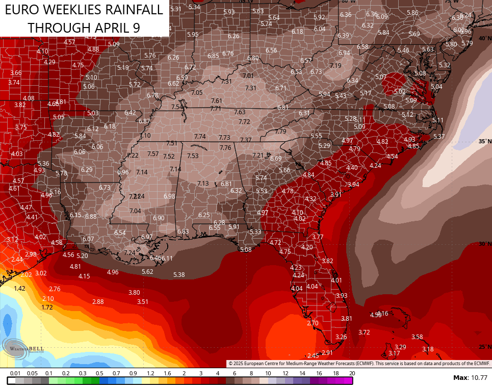
The orientation of the heaviest rains are also likely showing us where the severe threats show up… From our region through the Tennessee Valley and into the lower Mississippi Valley.
Buckle up for a very active severe weather spring.
Have a magnificent Monday and take care.

The potential for severe weather ramping up in mid-March is not surprising for several reasons, one of which has its roots in the transition from La Nina to ENSO-Neutral during that time frame. The lastest sea surface temperature anomaly chart shows that the below normal tropical sea surface values have shifted westward into the central Pacific, while warmer than normal water is beginning to take over in the tropical Pacific off of South America. Historic records show that in years when a transition from La Nina to ENSO-Neutral occurs during the spring, there is a noticeable increase in severe weather outbreaks.
https://www.ospo.noaa.gov/products/ocean/sst/anomaly/
Maybe we will shift to ENSO / El Nino for next Winter ?
Thanks Chris. Hoping the Spring weather will hold and not be a plant teaser. Back in the 1990’s, can’t remember the exact year, but on the 21st of March I was shoveling 8 inches of heavy wet Snow away from my many greenhouse doors, because it was getting too warm inside for the plants.
Enjoy the Day Everyone !