Good Tuesday, everyone. It’s a full-blown taste of early spring that’s doing its thing out there early this week. It’s part of a pattern that finds a lot of back and forth over the next few weeks and that makes our overall pattern much more active.
Temps out there today generally range from the upper 50s to mid 60s across the state on a gusty southwest wind. A mix of sun and clouds will be noted today and again Wednesday as temps jump deeper into the 60s. There’s even the chance for a 70 in the south and west.
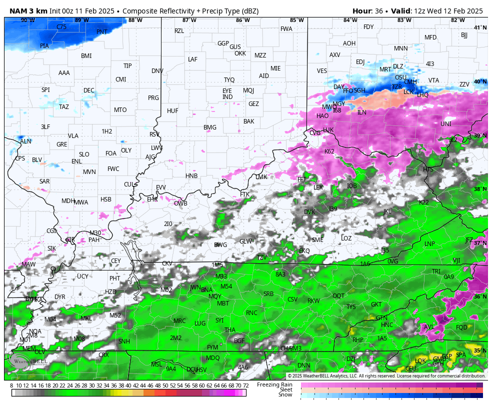
This milder air is ahead of a cold front dropping in with a band of gusty showers Wednesday night and Thursday morning. Here’s the Hi Res NAM future radar from 7pm Wednesday until 7am Thursday…
Temps come down behind that for Thursday with mid 40s north to mid 50s south and west. Winds are gusty and we may even see a few backlash showers later in the afternoon and evening.
Friday looks seasonable in terms of temps with very gusty winds and that takes us into the first day of March on Saturday. Near normal temps will be replaced by chilly air later in the day and into Sunday. Highs on Sunday may not get out of the upper 30s in some areas behind a mainly dry frontal passage.
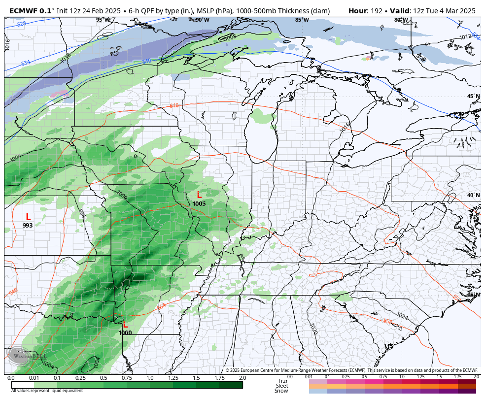
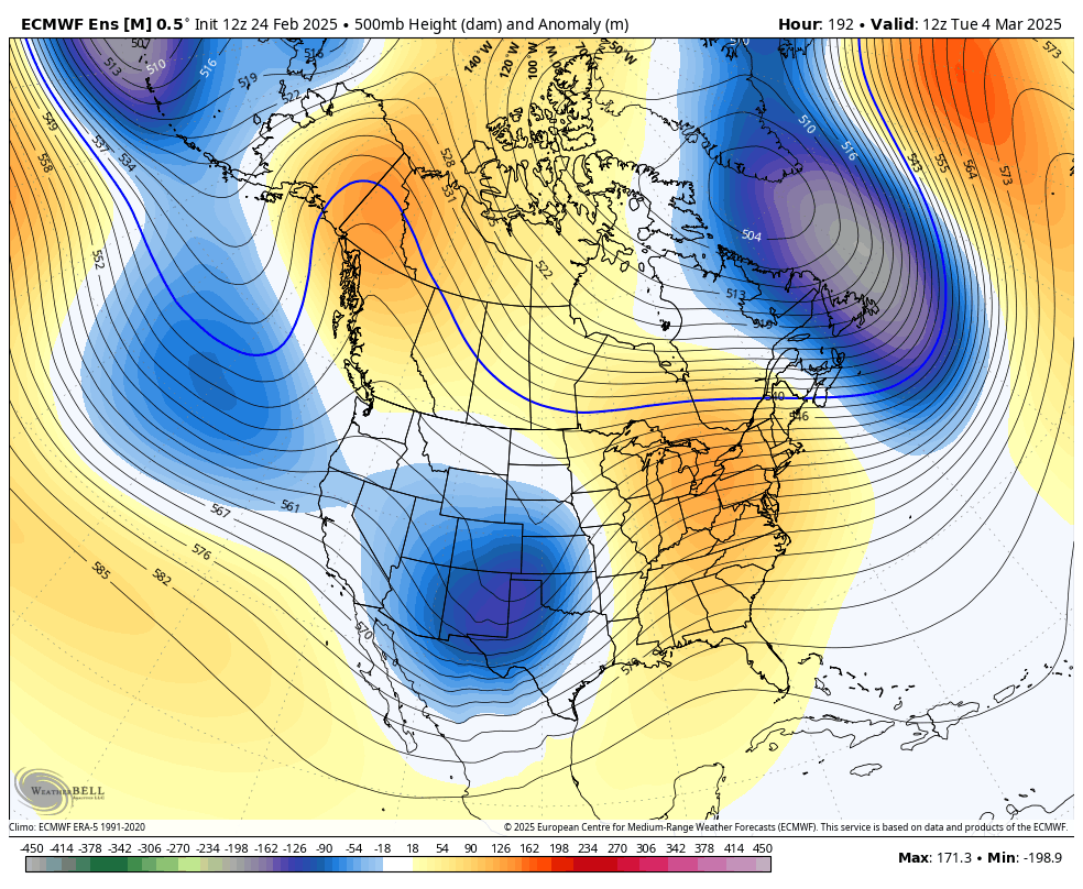
Temps rebound quickly early next week ahead of what may be a very potent storm system spinning into the region. This may fire up some pretty good thunderstorms ahead of it with colder air and the chance for winter behind it…
Check out the temperature departures ahead of this system and behind it…
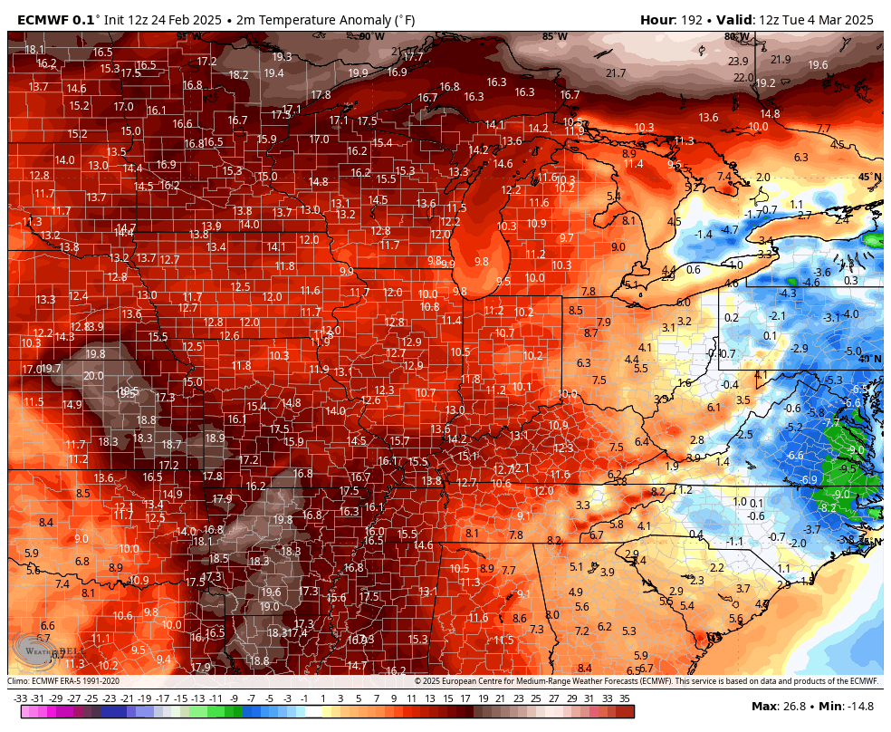
Getting such a warm surge ahead of it and a cold surge behind it is usually accompanied by some ugly weather. It’s still pretty early in the game for this storm system, but we will need to watch for severe weather and possible high winds.
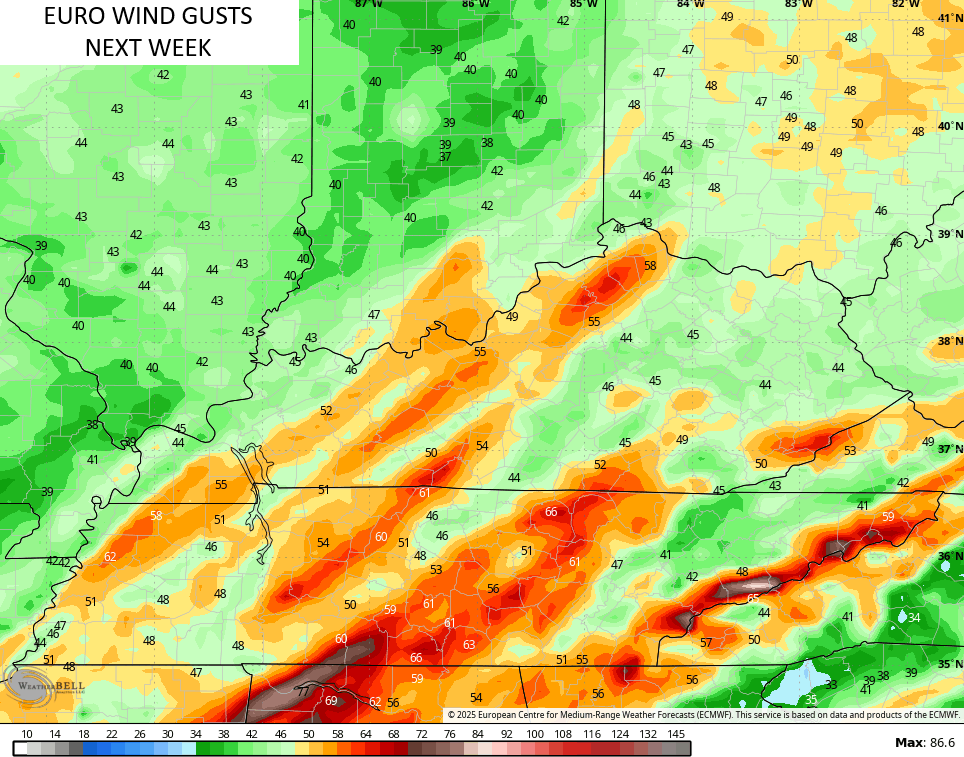
The EURO is seeing this potential with the wind gust forecast from way out…
This is the start of an active setup with deep troughs sweeping through from time to time into the second week of March…
That gives us the increasing threat of rain and some snow as temps swing wildly.
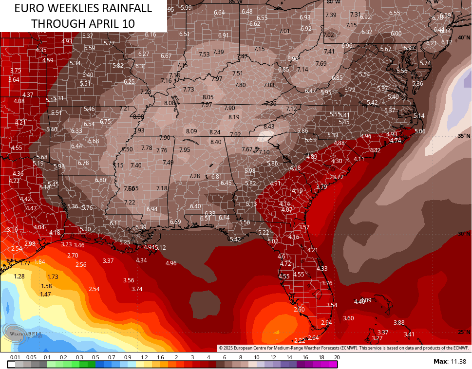
The pattern will really take off in terms of temps for the middle and end of March with above normal temps. Those will likely be accompanied by the threat for strong to severe storms and rounds of heavy rain.
The EURO Weeklies have most of this rain showing up during the second half of the month and into the start of April…
Have a terrific Tuesday and take care.

I am rooting for a hot but not too dry Spring and Summer.
I’m rooting for Spring weather to hold, and not stormy.
Omaha Nebraska has been in a dead area in terms of snow this winter… To think they’ve had less than 10 inches of snow all season… I mean, even here in Lexington I believe it’s right at 24 inches for the season (officially at KLEX).. I was watching a youtube video about weather manipulation and there were loads of people in the comments from that area saying they do not get snows like they used to… I think I read the same thing from a commenter from Muncie Indiana….. I do think climate change is a thing.. but I don’t think humans control it… Not that we should go around polluting the earth
Wow, Lexington really had a Snowy Winter. We only received 10 inches here in Maple. A lot of little Snows, which I think is normal for my area of the state. Mark, you bringing up ” weather control ” I think this is happening. I was convince after Hurricane Helene got stronger after making landfall.
Not trying to be argumentative here…..but there is no way on this earth that man has the ability to manipulate weather…..just nonsense to me.
Weather Manipulation could be happening, and I Fear sometime in the future it could be used as a War Weapon.
https://www.paradigmshift.com.pk/weather-warfare/#:~:text=Weather%20manipulation%20may%20be%20used,weather%20control%20endeavours%20are%20similar.
To each their own. Hurricane Helene did not strengthen after coming ashore….hurricane winds were felt much farther inland because of the speed of the hurricane..:,it took it longer to wind down. The flooding in the mountains was simply the lift in mountain terrain that is always talked about in addition to the 6-12 inches those locations received 24-36 hours before Helene arrived.
Thanks for the update Chris. In my local forecast, 65 degree high today and through the week, with very little chances of rain. Spring may be here to stay I hope.
Enjoy the early Spring weather folks !
awemke 99, thanks for the explanation of Hurricane Helene. I agree with you about weather manipulation. It is a bunch of nonsense. Sorry I posted such.