Good Wednesday, everyone. We have a super mild day taking shape across the region as we wait the arrival of a cold front later tonight. This brings more seasonable temps to the table to close February with another active pattern into week one of March.
Temps today reach the 65-70 degree range in many areas with a few low 70s in the south and west. Winds crank as a front sweeps in here later tonight and early Thursday and brings a few showers along for the ride. This isn’t a lot of rain, but it’s enough to wash some of the salt off the roads.
Gusty winds are noted behind this on Thursday as temps come down into the 50s. There’s another disturbance sweeping in here from the northwest late Thursday and Thursday evening. This brings a few showers and rumbles of thunder into the region and there’s the chance for some hail or graupel.
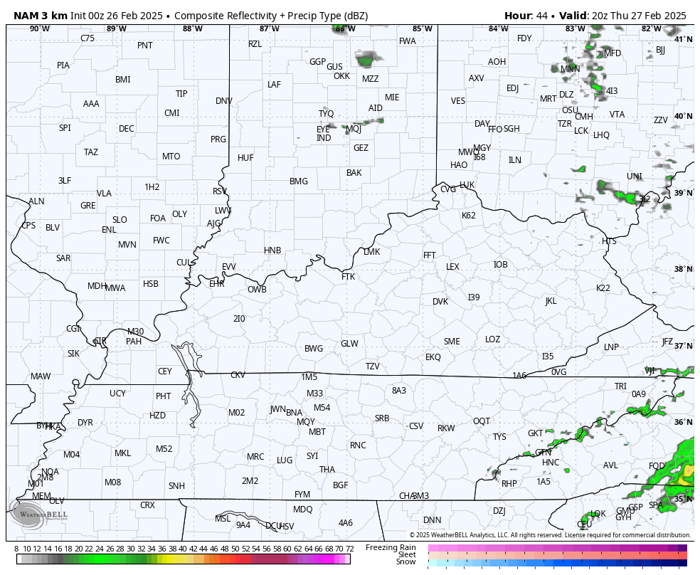
The future radar from the Hi Res NAM shows all this ending as a few flakes in the northeast Thursday night…
February ends with temps ranging from the upper 40s to middle 50s on Friday.
March comes in like a lamb with dry weather and temps in the 50-55 degree range on Saturday. Winds will be very gusty as another cold front dropping in. This is a dry front but does a number on temps with 30s for highs on Sunday.
Temps into early next week jump back up was we watch a storm system come together in the Plains. This system has the chance to bring some pretty good thunderstorms ahead of it and winter weather behind it.
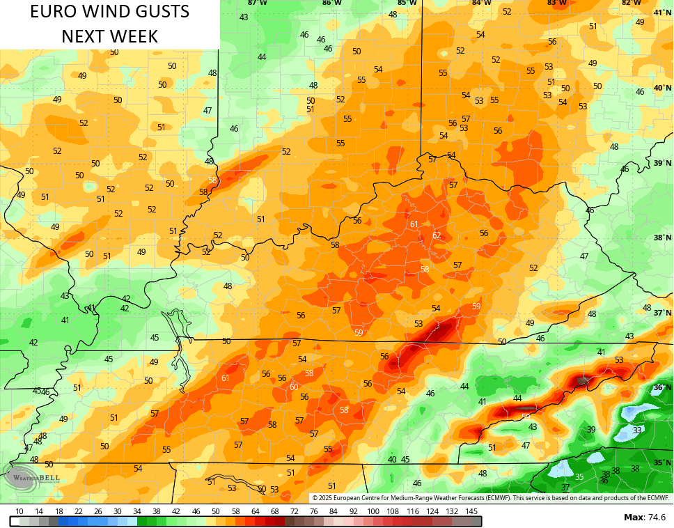
The EURO continues to have a threatening look for potential severe storms and wind ahead of the winter possibilities…
The EURO has the threat for severe storms that shows up on the wind gust forecast for next week…
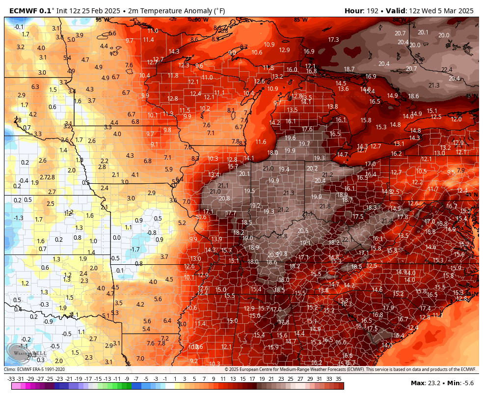
Temps in front of this system surge to well above normal temps before crashing to well below normal temps. Look how crazy this animation is…
With that cold comes the chance for some winter weather before the pattern tries to go into spring mode. You can see this transition starting at the end of the EURO Ensembles. Watch how that trough goes into the west with a ridge popping in the east…

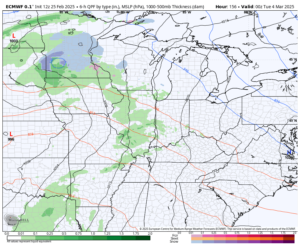
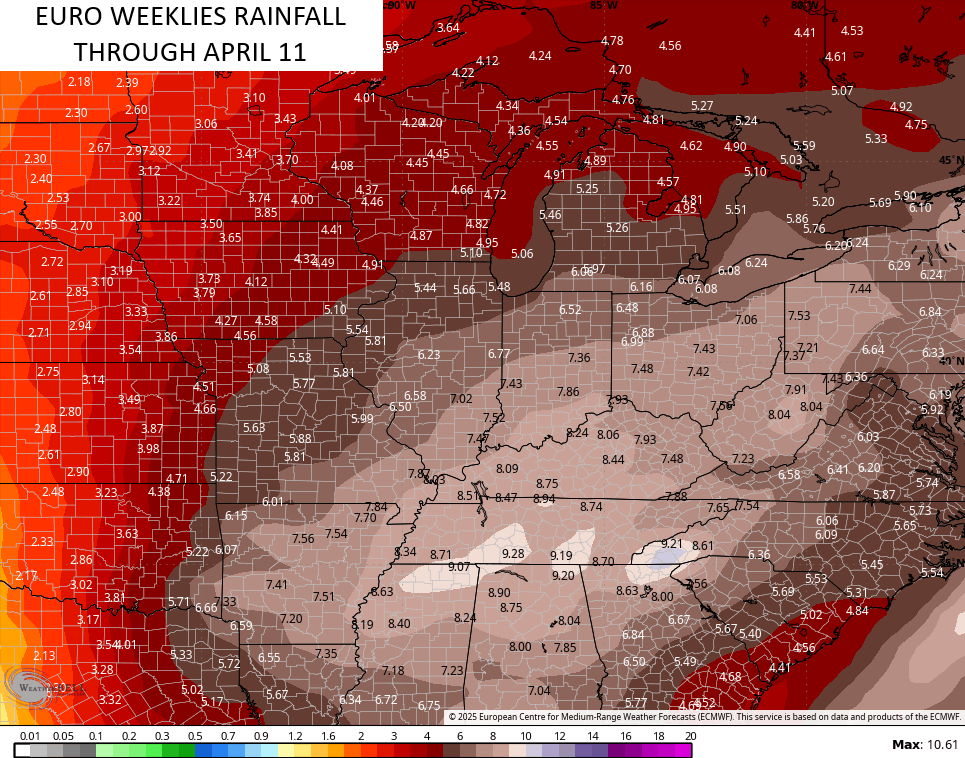
This is likely the beginning of a wet and stormy pattern into early April. The EURO Weeklies continue to grow wetter…
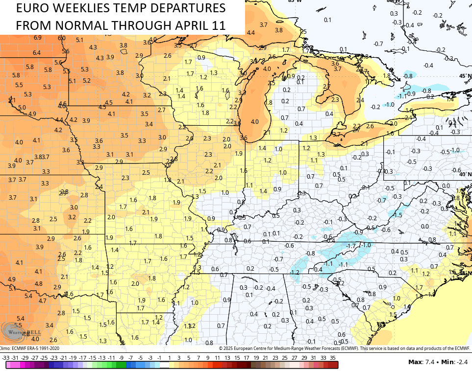
While we have some rounds of very mild air during this time, it’s interesting to note the EURO Weeklies have temps averaging close to normal into early April…
I may drop by for another update later today. I’ve been trying to get caught up on some rest of late, but I hope to get back into double posts here soon.
I leave you with your Kentucky Weather Radars to follow the showers in from the northwest…

Enjoy the day and take care.

Thanks Chris. Glad the temperatures are going back to normal. We don’t want a long period of above normal temperatures to cause the plant life out there to break their dormancy too early. It’s really hard to predict if there are anymore hard freezes to come ?
Enjoy the Day Everyone !