Good evening, everyone. It’s a very windy evening as a cold front drops in from the northwest. This brings a few rounds of showers and some thunderstorms into the region. That’s followed by some big temp swings and a very active setup heading into March.
Temps today gave us a serious case of spring fever with highs hitting 70 in many locations. Winds are cranking this evening with gusty showers and some thunder dropping in from the northwest into the overnight.
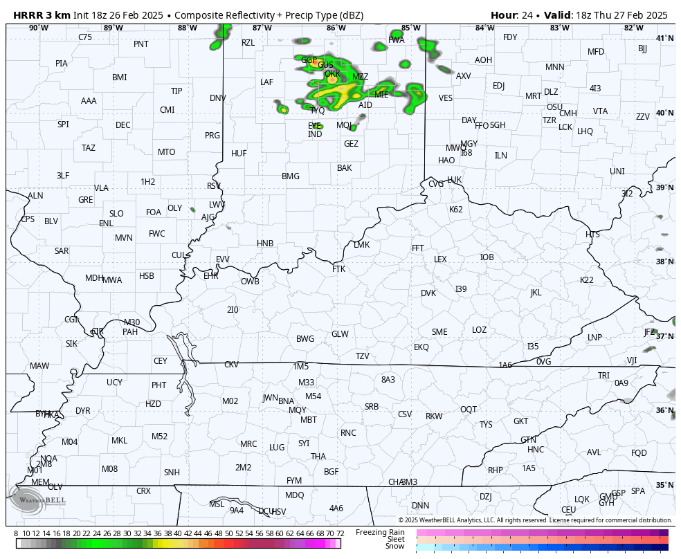
The setup behind this for Thursday continues to look interesting with a mix of sun and clouds and a few showers and storms cranking during the afternoon and evening. Some of those may contain some small hail or graupel. The future radar from the Hi Res NAM shows this well…
Temps for the final day of Meteorological Winter on Friday look to be in the 50s with a mix of sun and clouds.
Another cold front sweeps in here from the northwest on Saturday with falling temps and gusty winds. The temps behind this are pretty darn cold for Saturday night and Sunday. Check out those wind chills from Saturday evening into Sunday morning…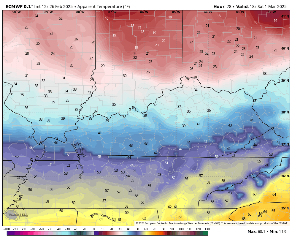
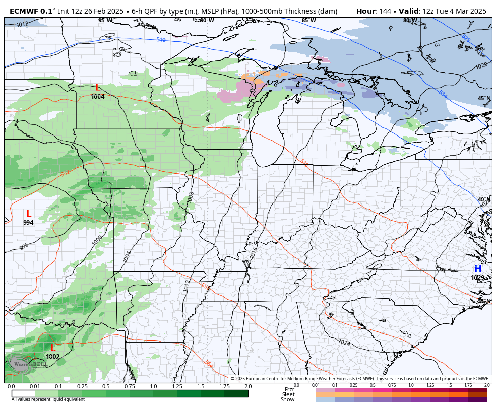
Temps rebound very quickly on Monday as a huge storm system develops in the Plains. That bring showers and storms in here Tuesday and Wednesday with the chance for winter weather behind it later in the week.
Some of the storms may be strong or severe ahead of this. Here’s how the EURO sees this storm and one coming behind it…
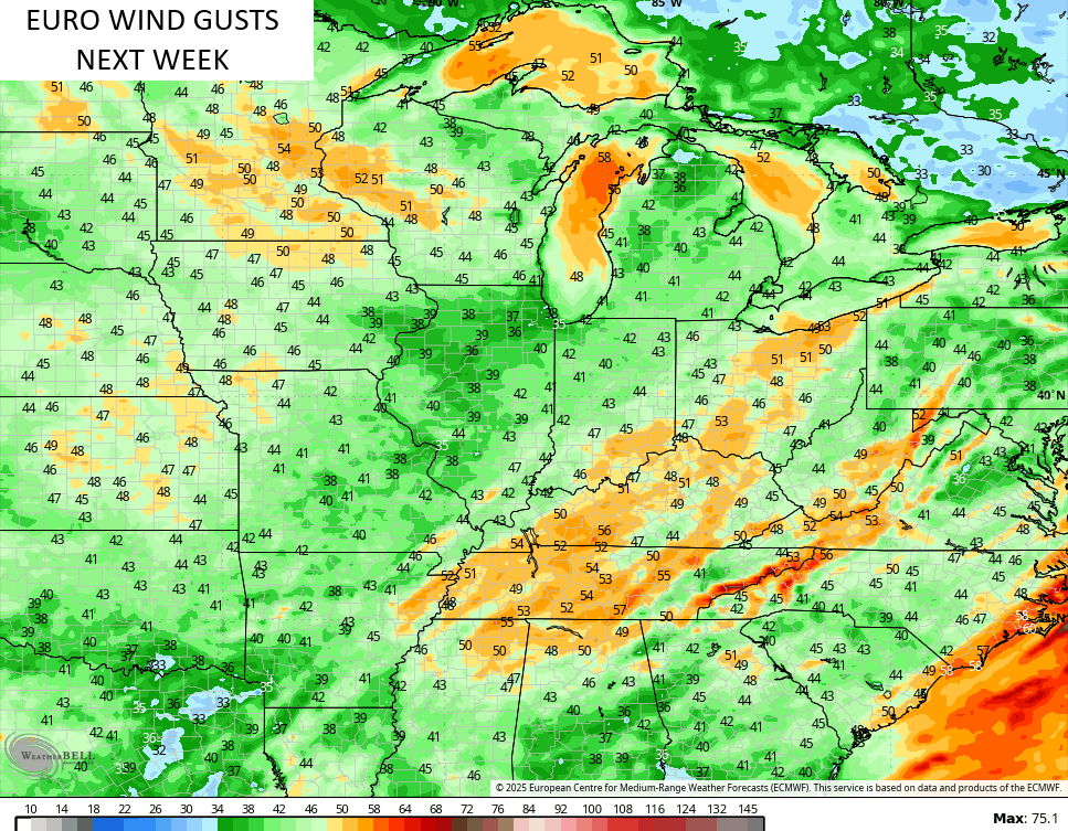
Wind gusts from this aren’t as stout as earlier runs, but are still up there…
I’ll see you guys with the main update later tonight. Until then, let’s track some showers and storms in from the northwest…

Enjoy the evening and take care.
