Good Thursday to one and all. Gusty winds are the name of the game for the next several days as our temps do a lot of bouncing around. This back and forth temperature pattern will lead to a very active month of March.
Temps out there today are mainly in the 50s with a mix of sun and clouds showing up. Winds are cranking behind a front pressing off to the southeast. There’s a weak disturbance dropping in from the northwest this afternoon and evening. That will fire up scattered showers and storms across central and eastern Kentucky and a few of these may drop some small hail or graupel.
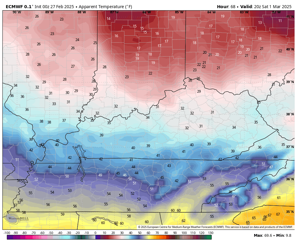
February wraps up on Friday with temps in the low and middle 50s with gusty winds cranking. Those winds are cranking and may hit 40mph at times ahead of the next front sweeping in by Saturday morning. This is a mainly dry frontal passage but packs a pretty good cold air punch behind it.
Temps drop through the day Saturday with wind chills really tanking Saturday night into Sunday morning…
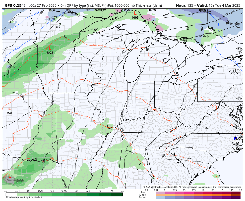
Temps rebound quickly early next week as we get ready for a potent storm system. This brings the threat for strong storms and high winds ahead of it and winter temps and the chance for some winter weather behind it.
Here’s the GFS…
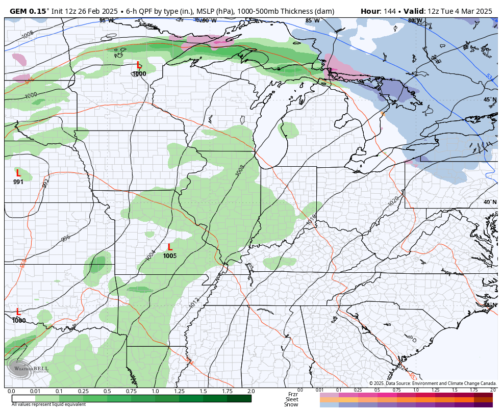
The Canadian…
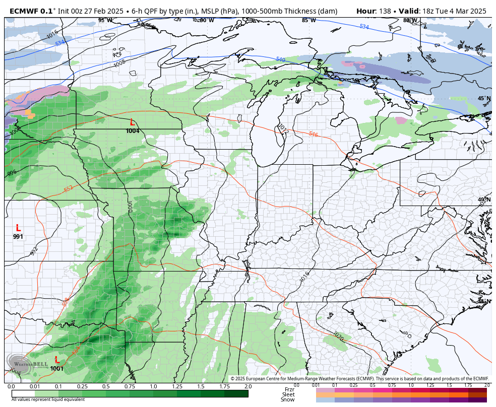
And the Euro…
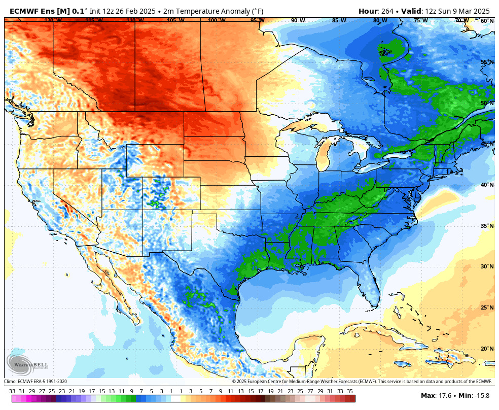
This back and forth pattern looks to trend much warmer as we head into the middle of the month. The EURO Ensembles show the initial cold to start week two of the month and then show the above normal temps quickly taking over…
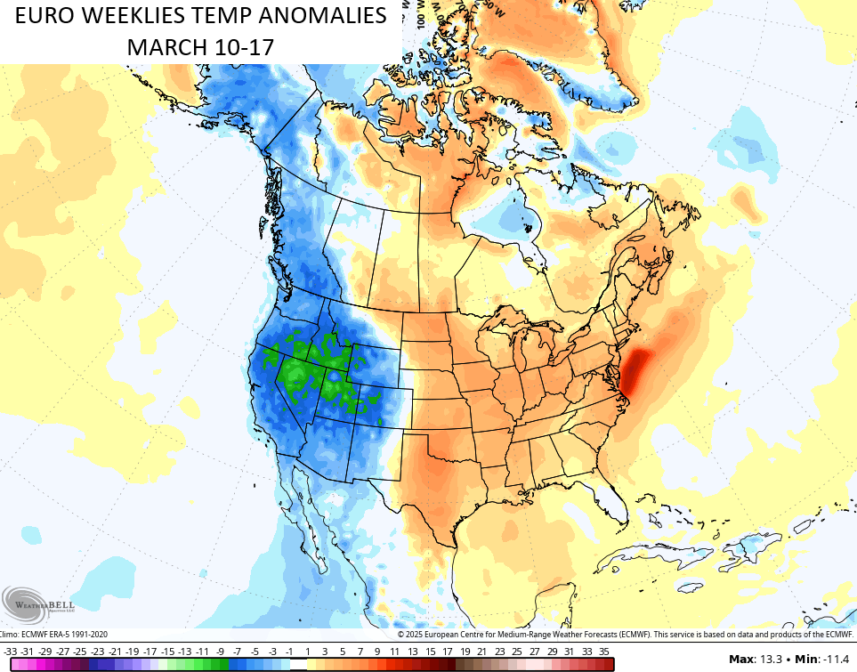
That turn to milder is backed up by the EURO Weeklies 7 day average temp anomalies from March 10-17…
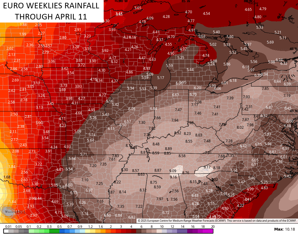
This milder pattern should also feature an increase in rain and thunderstorms in our part of the world through the second half of the month and into early April. The EURO Weeklies keep showing the bullseye of heaviest rainfall across the Ohio Valley and the Tennessee Valley…
Severe storms are a good bet during this time, folks.
I’ll give you and update later today. Until then, let’s track those scattered showers and storms that develop during the afternoon…


Have a great Thursday and take care.

It was a warm one today in central Warren County, with my PWS recording a high temperature of 77°F. I also noticed that buds were starting to swell on my maple trees!
Joe, our Red Maples are still dormant. Maybe due to the cooler nights here. I really had a tough time logging on this morning. I think my computer has been hacked, so this will probably be my last comment post. It’s too bad, as was enjoying and learning from everyone.
Small hail or graupel? I learned a new word today. I thought I was getting my weather forecast in Europe with the word ‘Graupel’ being thrown out there. I had to text Jim Cantore at the Weather Channel for clarification.
Dash, the first time I ever heard the precipitation type ” Graupel ” was on this Blog.
Computer problem solved !