Good afternoon, everyone. The scattered showers and storms blowing up across central and eastern Kentucky have the potential to get a little frisky in the northeast. This low-end severe risk may be a preview of what’s to come as we get into next week.
The Storm Prediction Center has the Marginal Risk for severe storms out for northeastern Kentucky through this evening….

With or without storms, winds are gusting 30mph to 40mph at times through the evening.
Here’s a look at the latest Watch/Warnings and Advisories map…

Cold winds kick in behind a second front arriving Friday night and early Saturday. That colder wind means business for the first few days of March with falling temps Saturday and highs only in the 30s Sunday. Wind chills Sunday morning and Monday morning may be as low as 10 to 15 degrees.
Milder winds quickly kick back in behind that later Monday and Tuesday ahead of a potent storm system rolling our way later Tuesday and Wednesday.
This is a system we’ve been highlighting for a while and now we are seeing the national folks getting in on the act as it may very well be a big time severe weather producer for parts of the country.
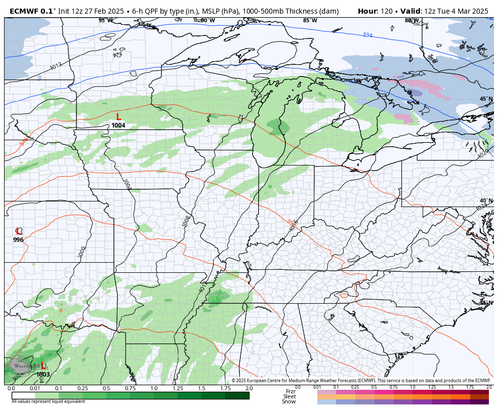
The EURO continues to have the look of strong to severe storms and high winds ahead of the system, with cold temps and some winter behind it…
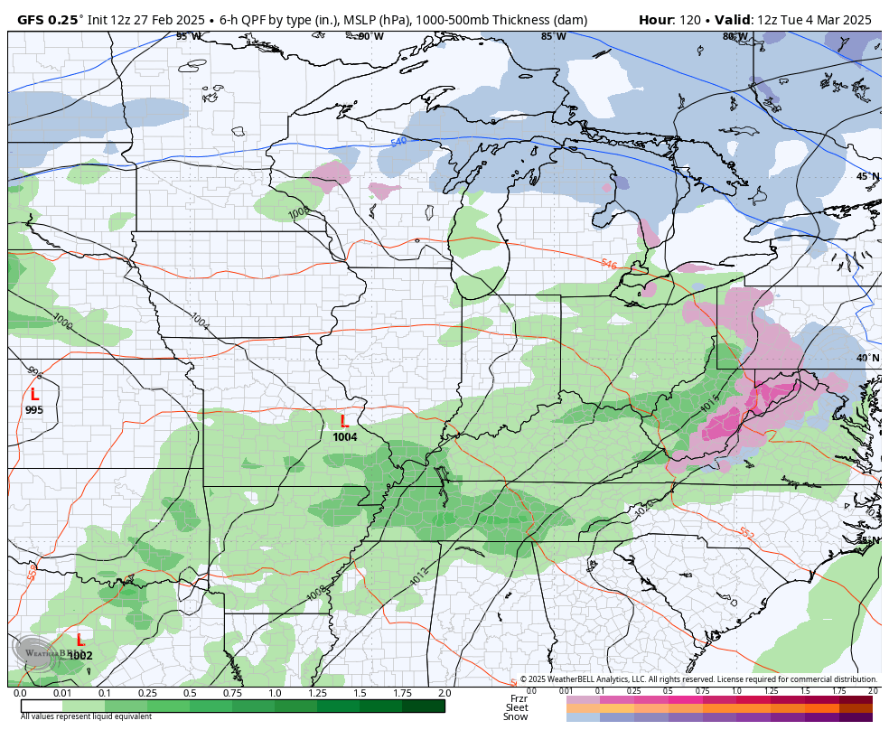
The GFS is coming in line with this…
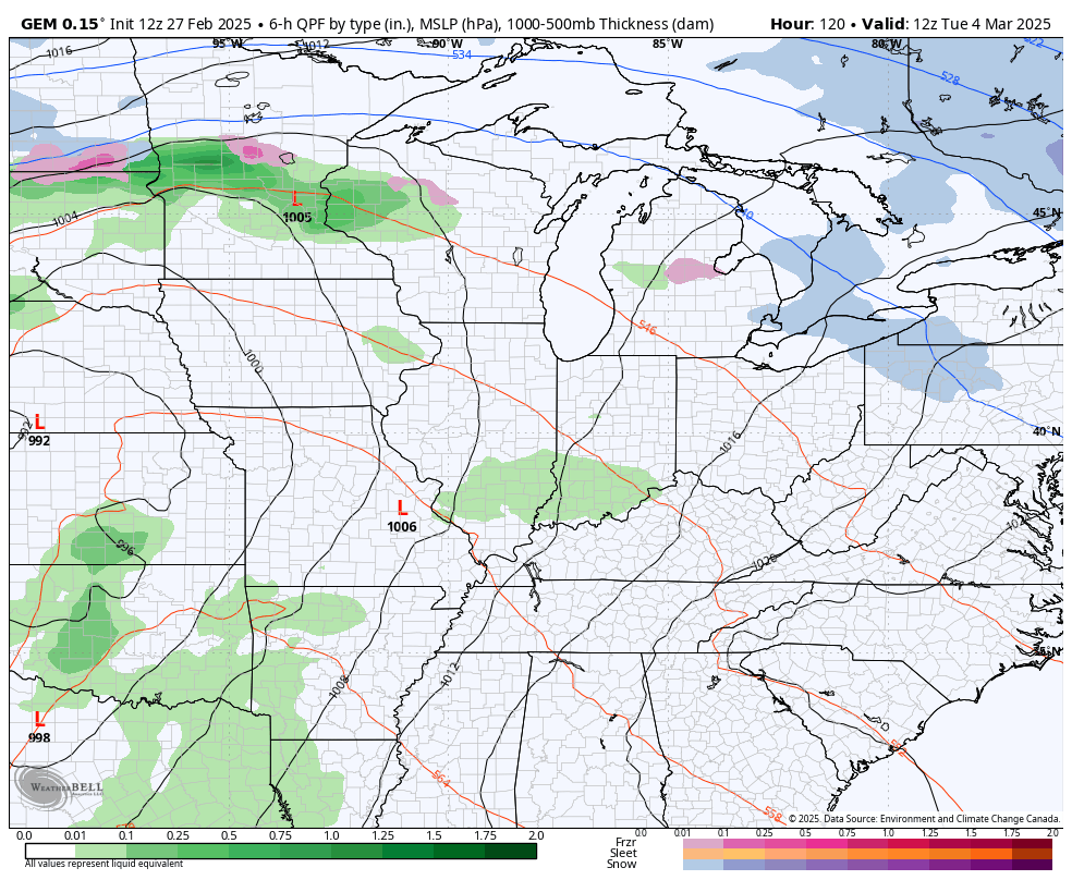
So is the Canadian…
That kicks off a back and forth temp pattern that can get us into some trouble.
I don’t like the looks of this spring, folks.
That’s all I have for you crazy kids right now; I leave you with your shower and storm tracking tools…

Current watches

Possible Watch Areas

Stay safe and have a great Thursday. Take care.
