Good Friday, everyone. Today marks the final day of February and that puts an end to Meteorological Winter. Of course, that means that Meteorological Spring begins with the first day of March on Saturday. March is a fickle month with severe weather and snow and there’s a chance we get all that out of the way in week one.
Before we get into the forecast part of the program, the NWS is losing a good one…
Well… the final Forecast Discussion from Meteorologist in Charge John Gordon (@mammatusman). Thank you for nearly 40 years of service, including 20 years at NWS Louisville! We will all miss your dedication and passion. https://t.co/HbMrq8kZ3M pic.twitter.com/EJHtsMJGZS
— NWS Louisville (@NWSLouisville) February 27, 2025
John has been in charge of the NWS Louisville for the past 20 years and is hanging it up. We have butted heads a few times over the years, but I’ve always thought very highly of John as a person and a forecaster. Happy retirement, John!
While we are at it… Fund the NWS and NOAA! That’s one agency that should be immune to cuts that directly impact public safety. They need more forecasters, not less. They need more resources, not less. That isn’t political, btw so don’t even start. 🙂
Winds are cranking out there today as another cold front drops in from the northwest. Those winds may hit 40mph or greater once again as temps spike into the upper 50s to middle 60s.
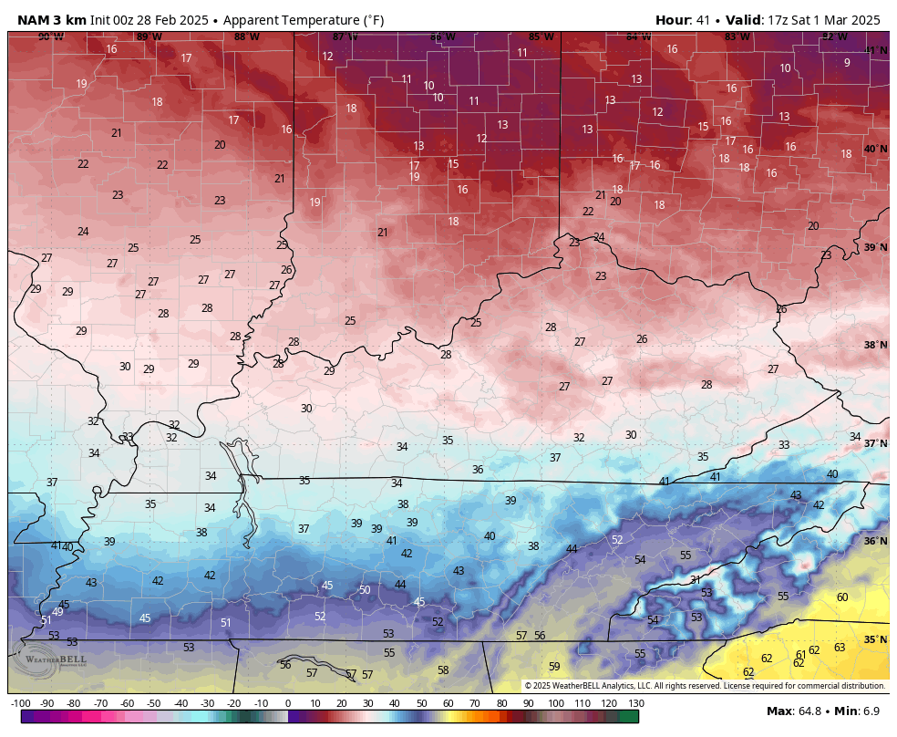
Once the front blows through later tonight, temps tank for the weekend. March comes in like a cold lamb on Saturday as temps drop like a rock. Wind chills hang in the 20s much of the day then drop through the teens during the evening into Sunday morning.
Here’s a look at that on the Hi Res NAM…
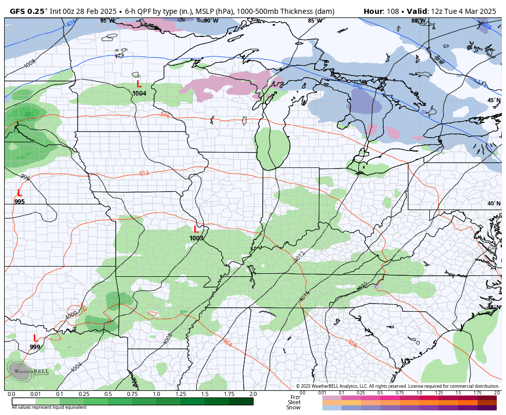
Sunday is cold and dry as we turn our attention toward a big storm system rumbling in here Tuesday through Thursday. Temps surge on a strong southwest wind ahead of this storm and that puts our region in the area of strong to severe storms and high winds. Once the storm blows through, cold air crashes in with the chance for some light snow and snow showers.
The GFS seems to have a decent handle on this system…
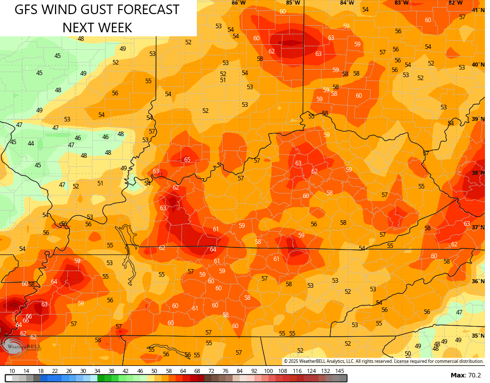
Check out the potential for high winds with this system…
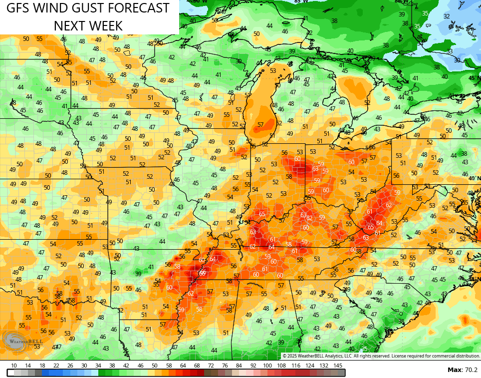
Notice how our region is the target area for the highest winds…
This kicks off another super active pattern as troughs swing through here starting next week and into the second week of March…
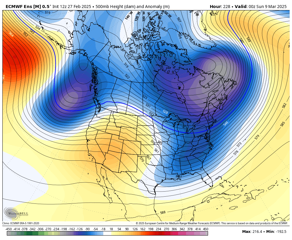
Notice that ridge popping in the east toward the end of that run of the EURO Ensembles. That’s something we’ve talked about for a while and it also shows up on the GFS Ensembles…
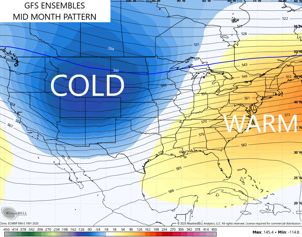
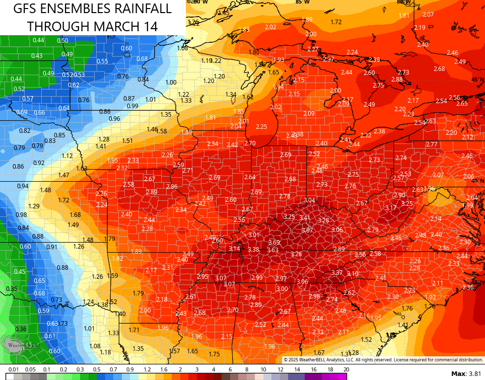
Warmer in the east and cold in the west usually means the battleground sets up in our region. That leads to increased amount of storminess and rainfall and that’s showing up on the same GFS Ensembles through the first 2 weeks of March…
This is the signal that’s been showing up on the EURO Weeklies for a long time and that continues to be the case through early April…
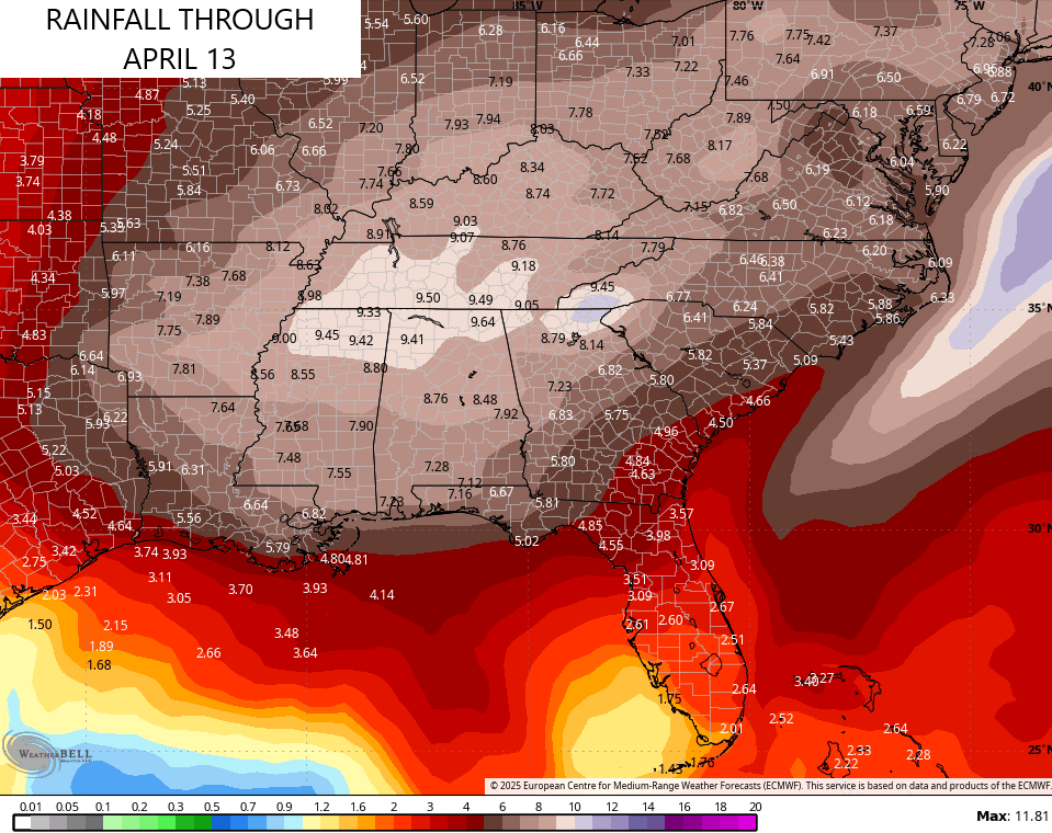
It’s going to be a very active spring around here, folks.
I’ll throw you another update later today. Make it a fantastic Friday and take care.

Thanks Chris. Hoping the ‘ Winds of March ‘ doesn’t take out our electrical power, because it takes a longtime to have the power restored here in the hills.
Enjoy the Day Everyone !
The SPC Day 5 Outlook is looking ominous, and I definitely agree on the seasonal severe prospects. One of the reasons is that in reviewing historical records for our region, we’ve experienced an uptick in severe storms during years where the transition from La Nina to ENSO Neutral occurs during spring…like this year.
Buckle up!
https://www.spc.noaa.gov/products/exper/day4-8/#
Thanks for sharing Joe. I have to agree. It doesn’t look good for states in Tornado Alley. I think now, I’ve should have started my Nursery 60 years ago in the state of Oregon or Washington, where Tornadoes are very rare, and it doesn’t get that cold, but lots of Snowy Winters, which I prefer. Lots of rainy days though and high winds. A down side.
It may go to ENSO / neutral, but I bet we won’t have a ENSO / El Nino for next Winter. Still strong evidence that the Pacific will remain in the negative phase for several years to come.