Good evening, everyone. It’s a cold ending to the first weekend of March as we turn our attention to the week ahead. It’s a week that finds the clash of the seasons taking center stage as they often do in the month of March.
In the overall scheme of things, I have no changes to the theme of the forecast. Here are some fresh headlines:
- Temps surge into the 60s on a strong southwest wind on Tuesday.
- Scattered showers and storms will show up as well.
- A potent storm system moves from the Plains States to the Great Lakes from Tuesday into Wednesday.
- This brings the threat for strong to severe storms across the state Tuesday evening into early Wednesday.
- The greatest severe threat continues to be in the west and south.
- There’s the chance for a second round of strong or locally severe storms Wednesday afternoon in the east.
- Winds are a MAJOR player with this storm system. Gusts of 50mph to 60mph will be possible Tuesday night and Wednesday morning.
- Cold air crashes in behind the departing low late Wednesday into Thursday.
- Light snow and snow showers show up during this time across central and eastern Kentucky.
- Some light accumulations show up as well.
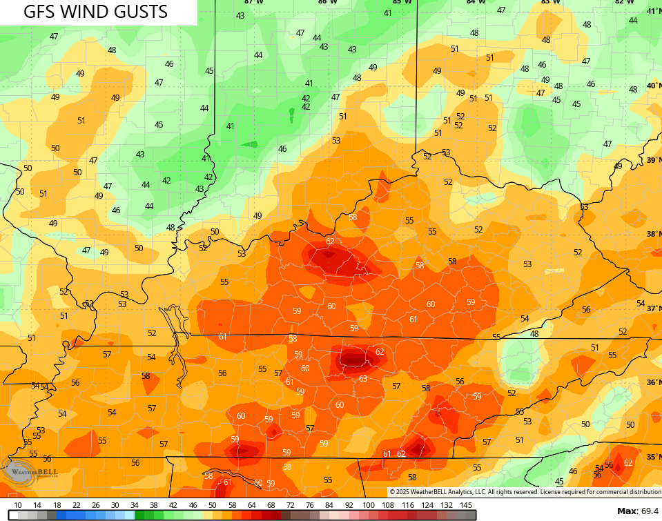
Here’s the GFS with the evolution of this system…
The peak wind gusts from the GFS are pretty stout…
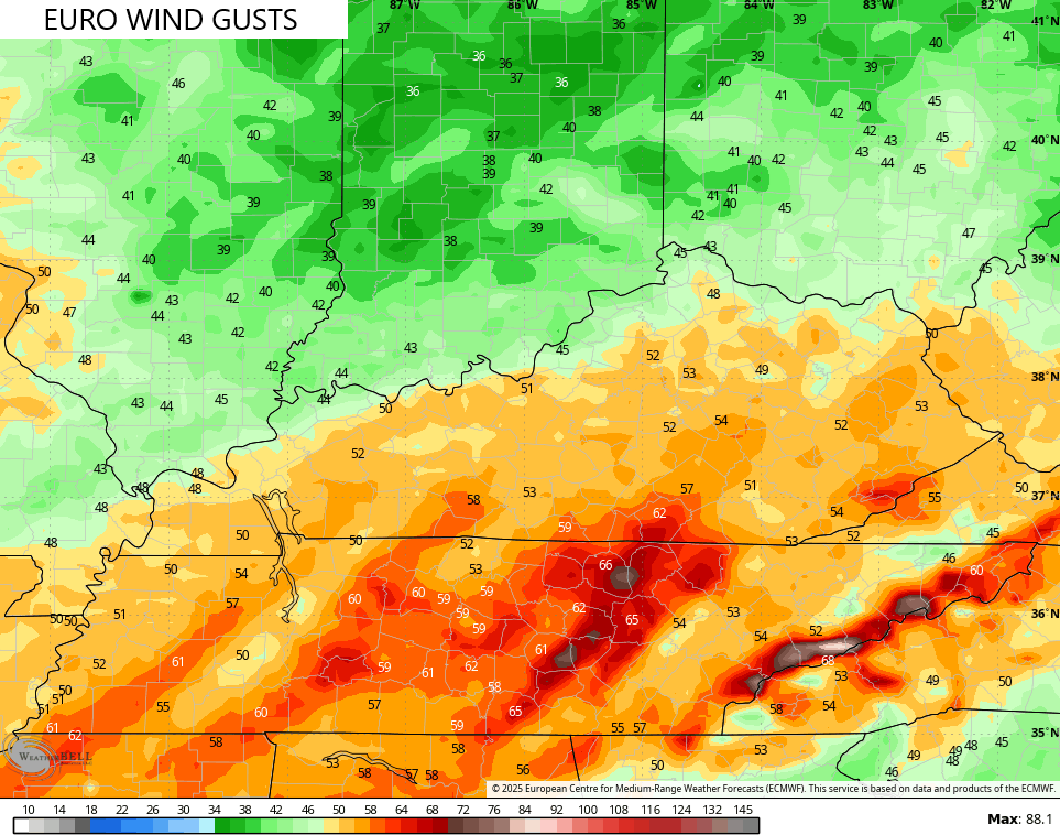
The EURO is a bit farther south with the worst of the winds…
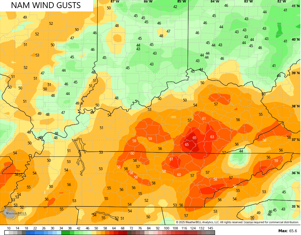
Here’s the NAM showing some big time wind gusts…
The clash of the seasons is very evident by looking at the Apparent Temps (Wind Chill) from Tuesday afternoon through Thursday morning. Check out this massive drop…
In terms of the severe threat. the Storm Prediction Center is only highlighting the far southwestern part of the state Tuesday afternoon and evening…

That threat would extend a bit farther east Tuesday night, but that tends to get lost in the shuffle on the SPC outlooks.
Another system targets us with rain and some snow later next weekend but should be followed by a big surge in temps early the following week.
Much more blocking is now showing up on the Ensembles for the middle of March and that means this back and forth temp pattern may not be ready to let go just yet. Watch how that trough comes crashing back into the east on the EURO Ensembles…
#TeamSpring wants no part of that setup.
I’ll have the full update later tonight. Enjoy the rest of the day and take care.
