Good Monday to one and all. It’s the first full week of March and we are kicking things off by tracking a storm system you would expect to see this time of year. It’s a system that threatens the region with severe storms, high winds, crashing temps and some snow.
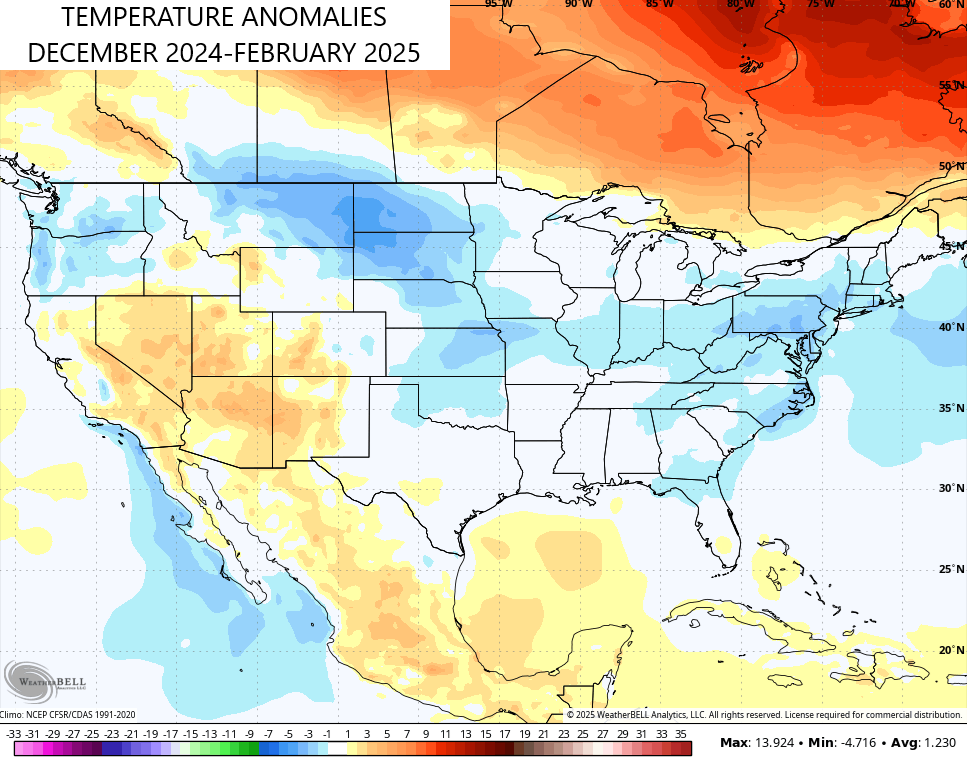
Before we get into that, how let’s talk briefly about the winter that’s in the process of wrapping up. Meteorological winter runs from December through February and we were generally -1 to -3 degrees colder than normal across Kentucky. As a matter of fact, much of the country turned out to have a colder than normal winter…
Snowfall for our region was also above normal, especially for central and eastern Kentucky with a general 20″-30 of snow, so far…
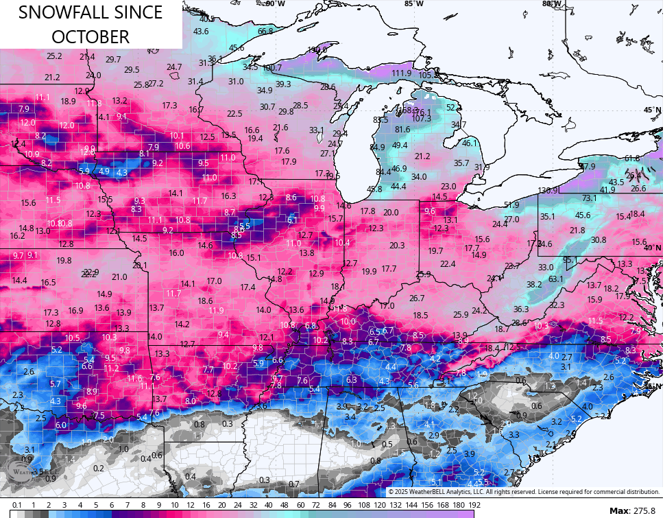
These areas had more snow than parts of the Dakotas and Minnesota. That’s pretty incredible.
No matter how you slice it, this was a harsh winter across Kentucky.
Ok, back to the weather of the weather that’s still to come.
Highs on this Monday reach the 50s in most areas as winds start to shift to the west and southwest ahead of the storm system coming our way for the next few days.
Here’s a rundown on how things may play out:
- Temps surge into the 60s on a strong southwest wind on Tuesday.
- Scattered showers and storms will show up as well.
- A potent storm system moves from the Plains States to the Great Lakes from Tuesday into Wednesday.
- This brings the threat for strong to severe storms across the state Tuesday evening into early Wednesday.
- The greatest severe threat continues to be in the west and south as a low-topped squall line moves through.
- Damaging wind is by far and away the main threat.
- There’s the chance for a second round of strong or locally severe storms Wednesday afternoon in the east.
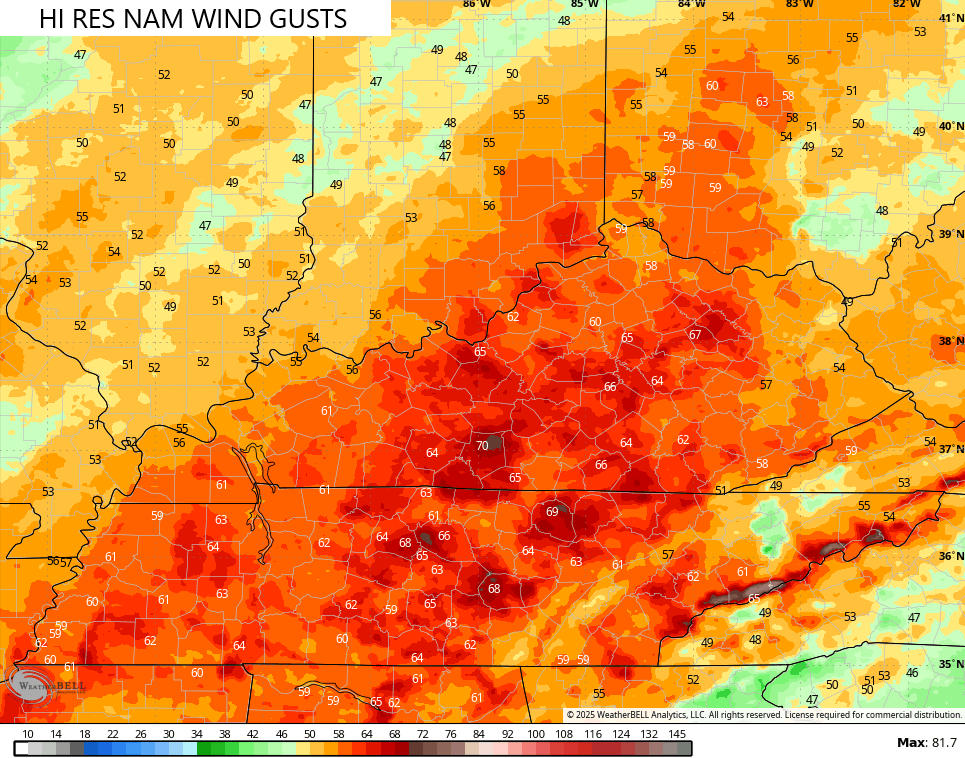
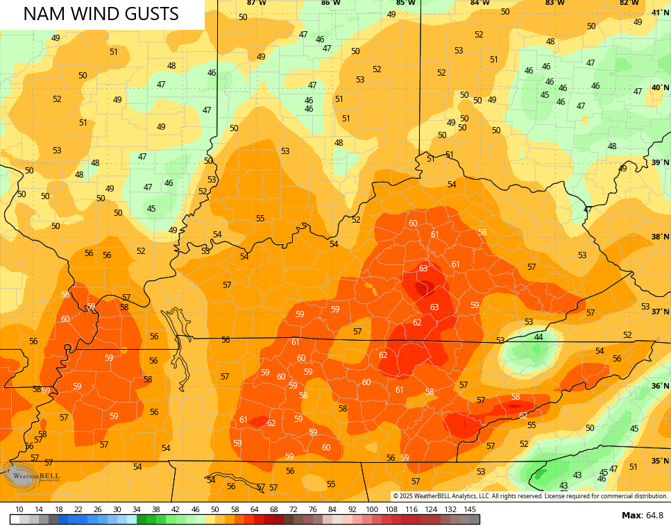
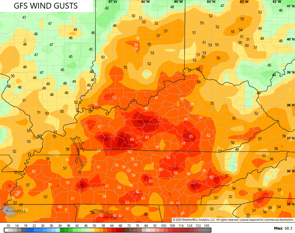
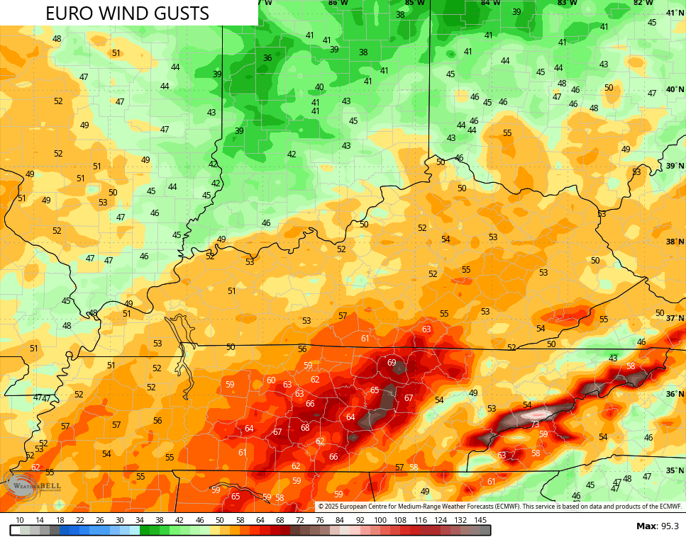
- Winds are a MAJOR player with this storm system. Gusts of 50mph to 60mph will be possible Tuesday night and Wednesday morning.
- Cold air crashes in behind the departing low late Wednesday into Thursday.
- Light snow and snow showers show up during this time across central and eastern Kentucky.
- Some light accumulations show up as well.
Here’s the latest Severe Weather Outlook from the Storm Prediction Center…

That likely misses on some of the overnight convection that can put cause some wind damage.
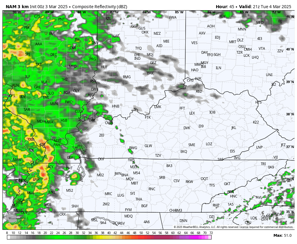
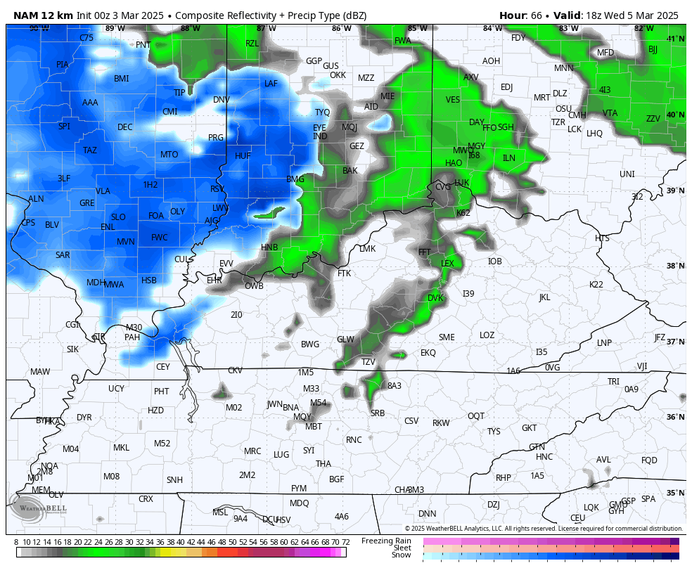
The Future Radar from the Hi Res NAM shows the Tuesday night squall line very well…
With or without thunderstorms, wind damage is a possibility as gusts reach 50mph to 60mph at times. Some of the models are picking up on the potential for higher gusts…
As cold air crashes in behind this low, backlash snows develop from northwest to southeast. This future radar from the NAM goes from 1pm Wednesday and ends at 7am Thursday…
Light snow accumulations are a good bet during this time and that may be enough to cause some cancellations and delays for Thursday.
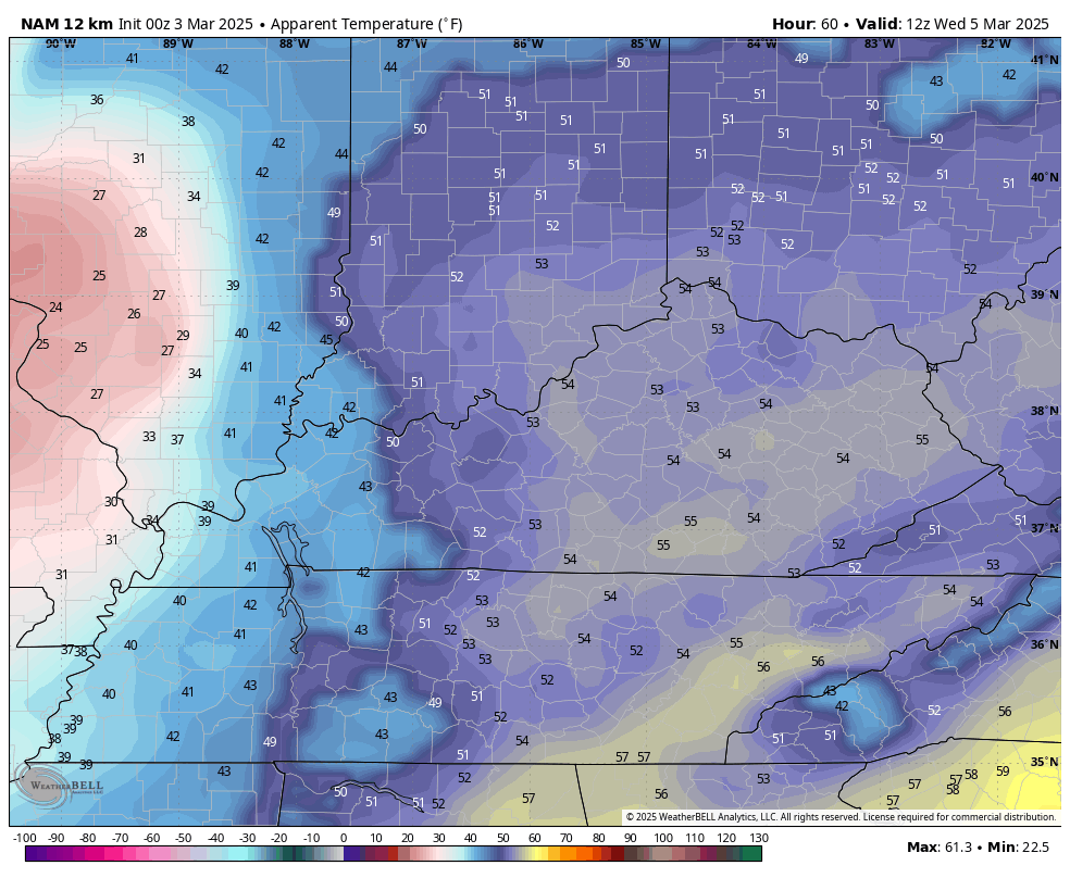
The temp plunge is pretty dramatic, especially if we look at the wind chills. This animation takes us from 7am Wednesday through 7am Thursday…
March is such the drama queen!
The dramatic swings continue after this with another system set to bring mainly rain with the chance for a touch of snow this weekend. Temps spike then crash behind this before a major temp surge takes place next week. 70 degree temps are a good bet next week before blocking tries to show up and flex a little bit.
I’ll have another update later today. Have a magnificent Monday and take care.

every year we seem to have several wind events like this..
I guess even in the Dakotas and Nebraska/Iowa you’re not guaranteed great snows every winter
Thanks for the update Chris. Hoping this Stormy Weather coming will weaken some. That has been the trend since 2019. This weak La Nina was not typical. La Nina’s of the past have produced mild and below normal Snowfall for the lower half of the CONUS, and above normal Snowfalls in the Northern States. Someone please explain why this happened. Has to be that something changed in the Pacific ? Our Winter here in Maple, Taylor County was well below normal in Temperature, but below normal in Snowfall. We received a lot of little Snows, about 10 inches total.
Enjoy the Day Everyone !
The seven Polar Vortex intrusions we have had since November are the main reason why this La Nina did not affect our weather in the usual way. The storm track was there, but the warmer air was not.
Thanks Joe. I just wish we could have an El Nino Winter. I’m tired of these multi – La Nina Winters.