Good afternoon, everyone. I wanted to drop by for a quick update on the storm coming our way over the next few days as it features a real battle of winter verses spring. It may be followed up by another battle this weekend.
The Storm Prediction Center continues to only have the southwestern corner of the state in a Marginal Risk for Tuesday…

In my earlier posts I mentioned how the overnight events sometimes get left out of these outlooks and I think that’s something we are seeing now. The Day 3 outlook has the Marginal Risk for severe storms across far eastern Kentucky for early Wednesday…

There’s a whole lot of the state there that never finds itself under anything but “thunderstorms”.
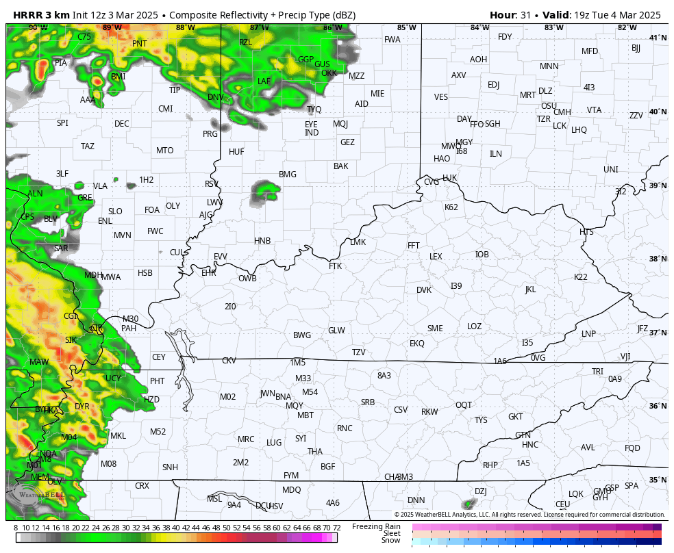
My take on this is we get a squall line of what are known as low-topped thunderstorms to sweep from west to east across the state Tuesday night. This line has a ton of wind energy aloft to tap and bring those winds down to the surface, potentially producing damaging winds.
The future radar from the HRRR shows this scenario very well…
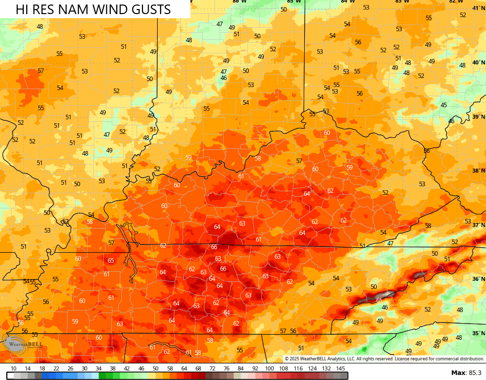
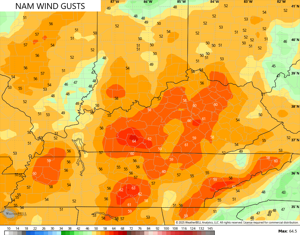
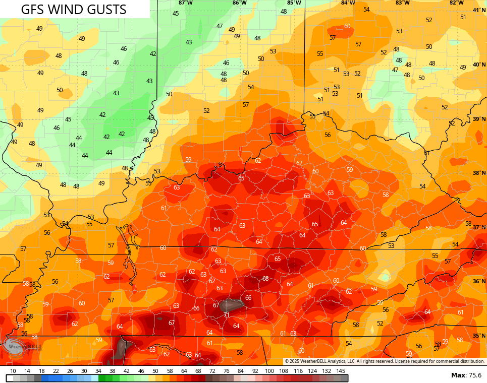
With or without severe thunderstorms, the potential for high winds is elevated. Gusts of 50mph to 60mph will be possible. Some of the models continue to go above and beyond those numbers…
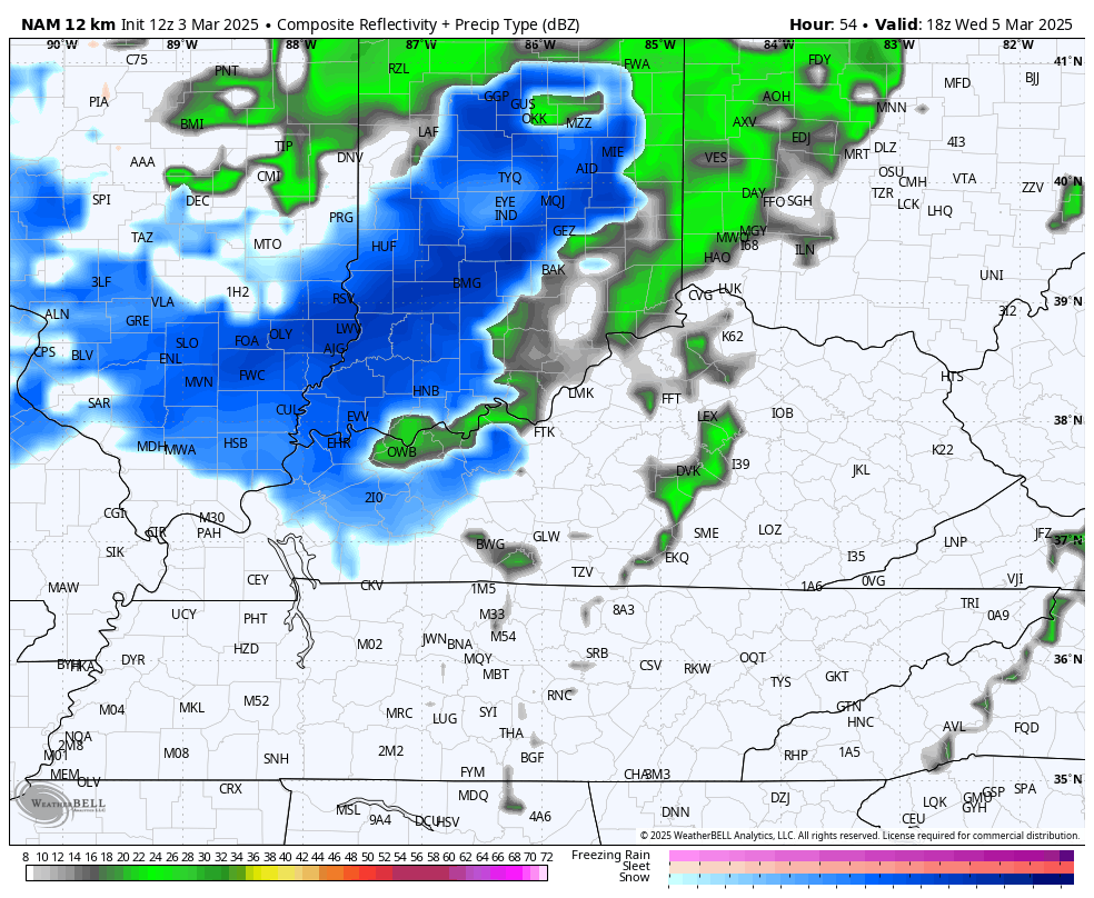
Cold winds kick in as temps crash behind the front from Wednesday afternoon through Thursday. This will likely bring in some light accumulating snows Wednesday night and Thursday morning…
The system coming in behind this for late next week into the weekend features rain with the chance for some snow. A few of the recent runs from the GFS have a mid-winter look…
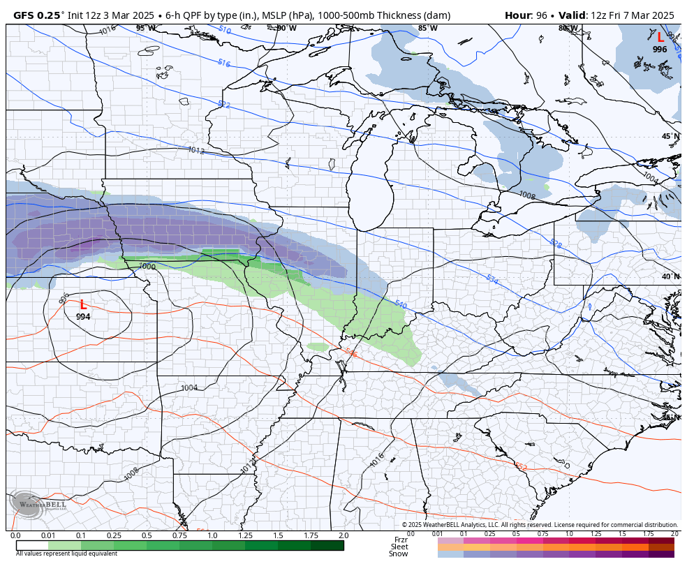
As of now, the odds of something like that are low… But they are not zero. Just something to monitor going forward.
Temps next week race toward 70 with another severe threat later in the week.
I’ll have the latest on WKYT-TV starting at 4pm then again here on KWC this evening. Enjoy the day and take care.

Thanks Chris. Hope all the models are wrong, and the Storm system weakens, and we have the biggest Snowstorm of the season this weekend to end Winter 2025 for good.