Good Wednesday to one and all. High winds are starting the day across central and eastern Kentucky as Old Man Winter gets ready to end it. Crashing temps will lead to a light snowfall for much of the state tonight and early Thursday.
Let’s start the day off talking about the winds. Gusts of 50mph to 60mph are possible very early this morning across the eastern half of the state with gusts settling down to around 40mph for the rest of the day.
Early day High Wind Warnings will give way to Wind Advisories for most of the state through the afternoon…

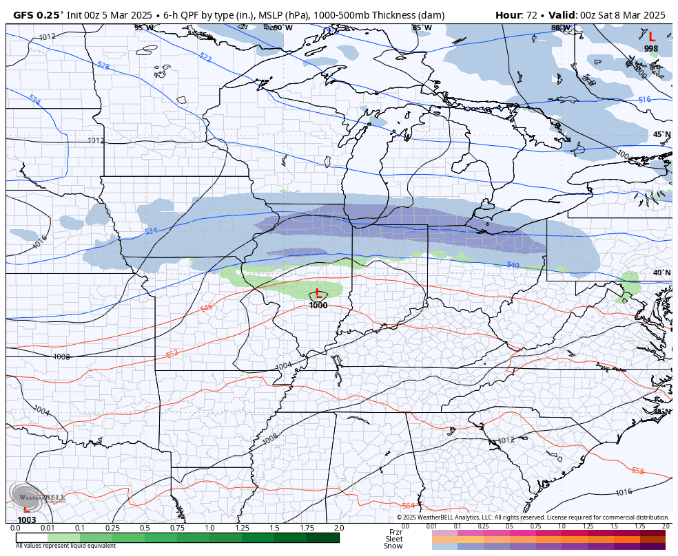
Old Man Winter then quickly takes control this afternoon as cold air crashes in with wraparound snows really ramping up. Folks, it’s going to snow pretty darn hard for a while as winds gust to 30mph-40mph at times. This means near whiteout conditions will be possible at times.
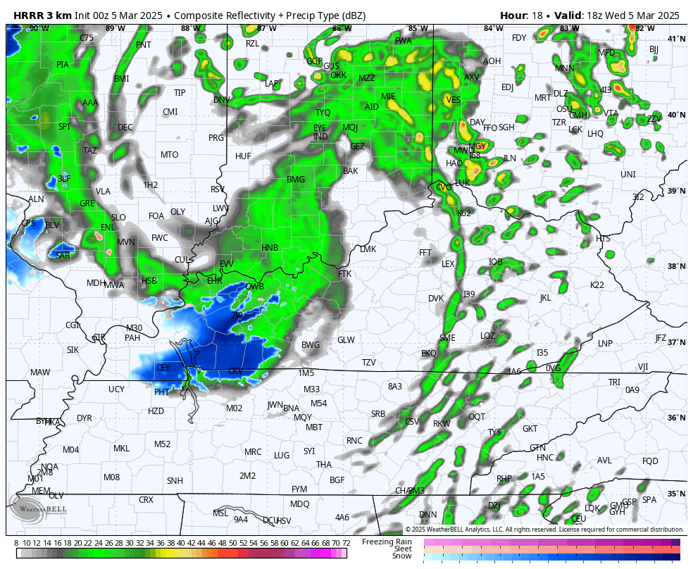
The future radar from the HRRR shows some intense snows sweeping eastward across the state today and tonight. This animation starts at 1pm this afternoon and goes through early Thursday morning…
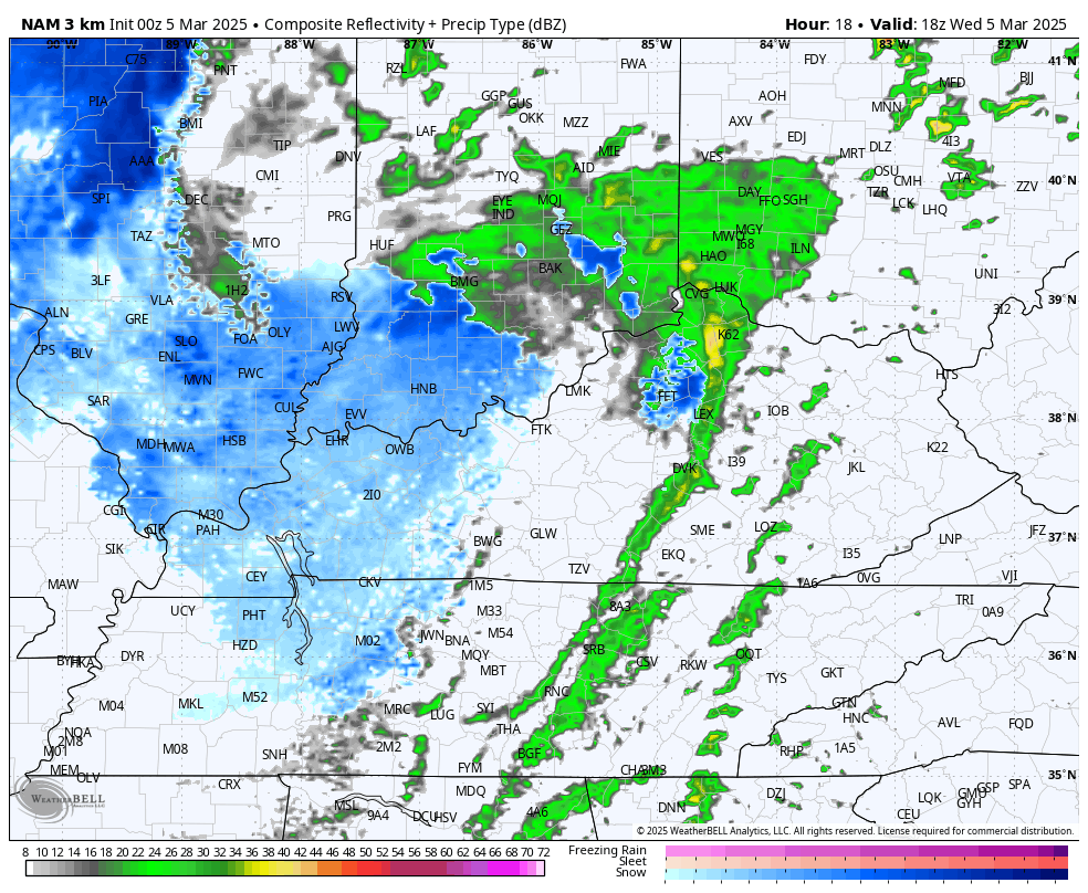
The Hi Res NAM future radar is similar for the same time period…
With a warm ground and temps above freezing, we will get a lot of melting, but it will snow faster than it can melt at times. This means widespread coatings to 1″ of snow will be possible with the chance for some higher totals, especially in the mountains across the southeast…
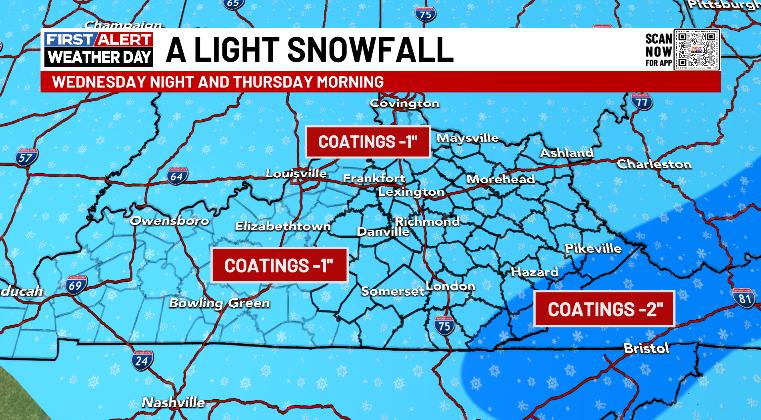
Much of what sticks will be on grassy surfaces and elevated surfaces. With the high winds, this is the kind of wet snow that can plaster the west and northwest facing sides of trees and buildings.
With temps dropping into the 20s tonight, slick spots will develop on area roads and this may very well cause some delays and cancellations Thursday morning.
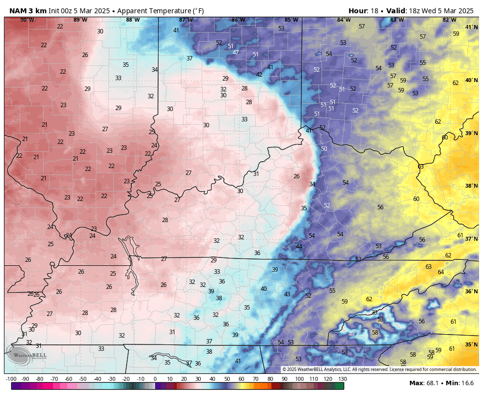
The wind chill temps are going to be an issue, too. The change today is VERY dramatic with wind chills dropping into the teens from this evening through Thursday morning. This animation starts at 1pm today and goes through Thursday morning…
Temps rebound quickly on Friday with readings into the 50s as winds stay gusty. That’s ahead of a system bringing a few showers in here through early Saturday. There’s even the chance for a few flakes with that.
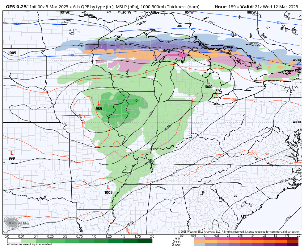
The next system looks to stay to our south over the weekend, but the GFS is still trying to bring some flakes into the far south and southeast Sunday…
Temps REALLY take off early next week with highs likely reaching the 70s on more than one occasion into the middle of next week. That’s likely ahead of another wind and potential severe storm threat later in the week…
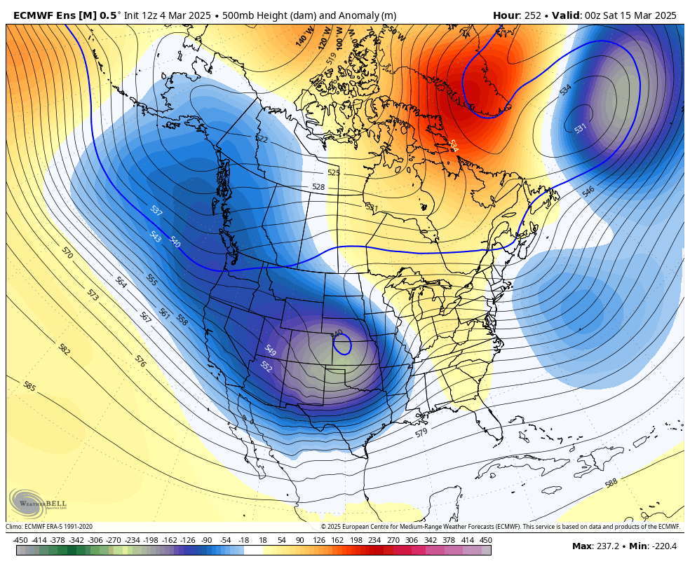
Much colder air comes in behind that as we continue to see a pattern showing more and more blocking, leading to a colder scenario for much of the country…
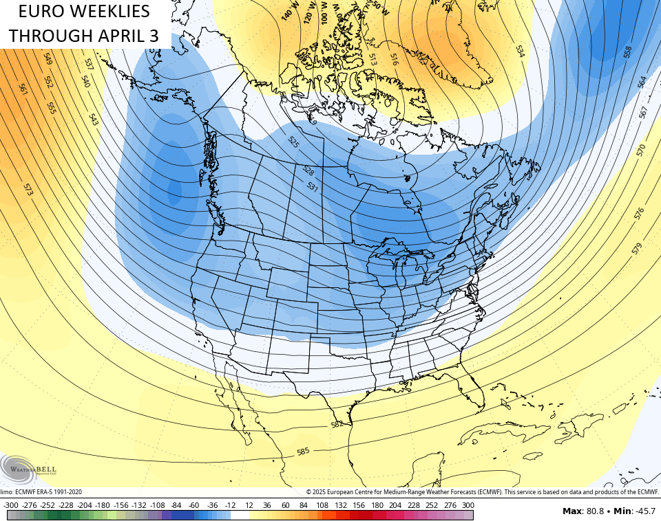
The EURO Weeklies have made a fairly significant switch over the next 30 days…
Welp.
I’ll have updates later today so check back. Until then, here are your Kentucky Weather radars to track today’s rain and snow…

Have a wonderful Wednesday and take care.

In central Warren County we ended up with 0.35 inches of rain yesterday, and had a peak wind gust of 42 mph. Approx 1,000 WarrenRECC customers lost power for several hours, as fallen trees brought down poles.
Just so I’m clear… this was NOT supposed to be a heavy rain event?? I ask because I’m seeing that we only got .17 inches of rain.
Thanks Chris. We had 0.34 inches of Rain in the past 48 hours. Winds were not that strong in my area, and no severe weather occured. I hope all the storms this Spring are like this one.
Enjoy the Day Everyone !
I knew those EURO weeklies were lying. They were saying that April was going to be warm.