Good afternoon, everyone. Gusty winds are taking on a much colder feel as Old Man Winter throws another punch at us. This punch includes wind chills in the teens with a light snowfall for much of the Commonwealth through Thursday morning.
A Wind Advisory continues for much of the state as gusts continue to top 40mph at times through early this evening. There’s also a Winter Weather Advisory for a few counties in the southeas…

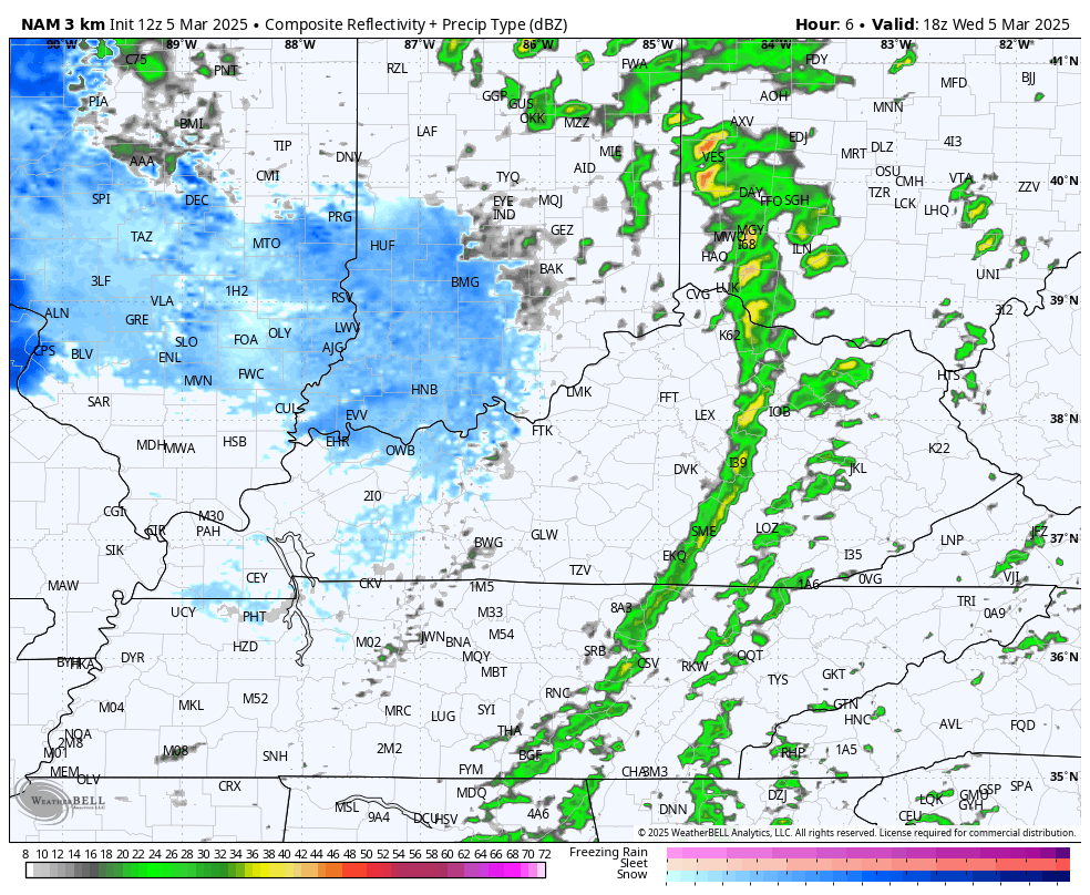
Snow breaks out this afternoon across the west and sweeps eastward this evening and tonight. Some of these bands will be heavy, reducing visibility and briefly coating roads. The future radar from the Hi Res NAM shows a mid-winters night…
The models continue to spit out light accumulations, but you can see the pockets of heavier snows…
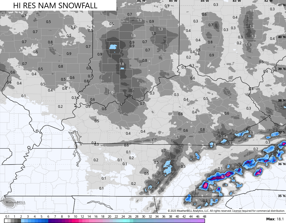
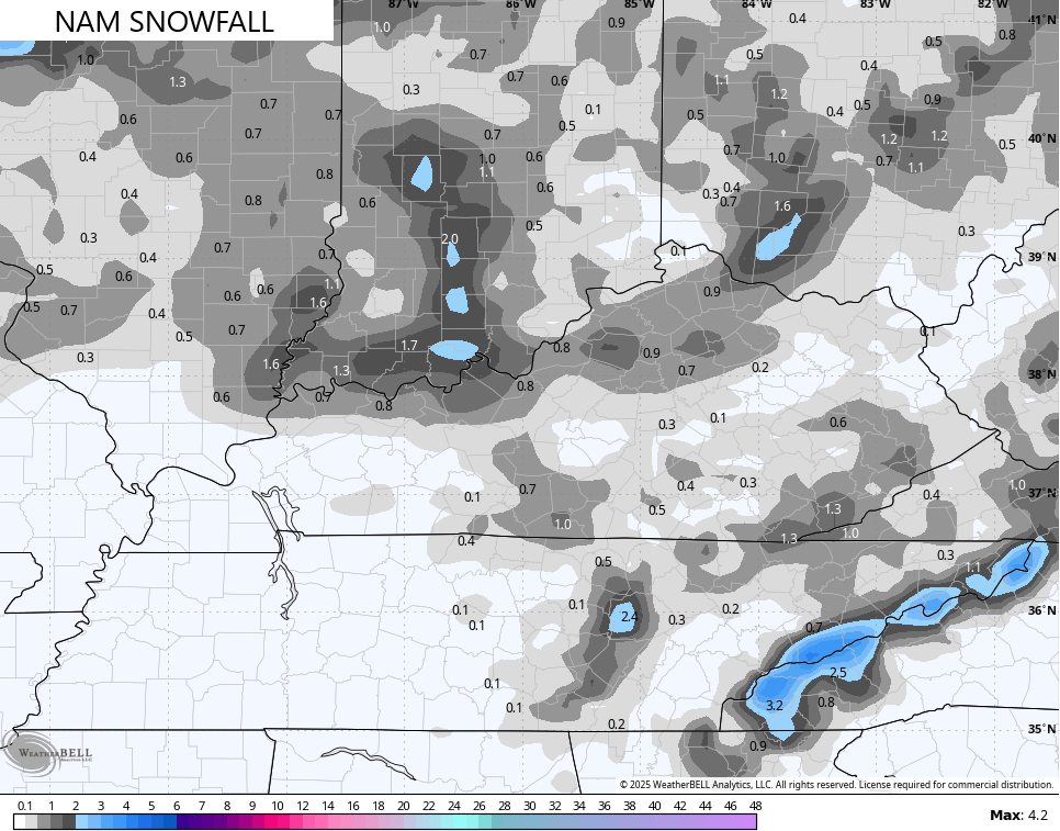
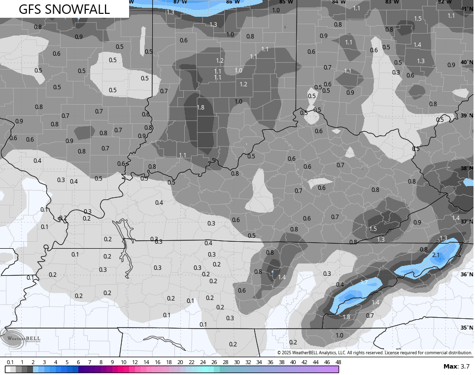
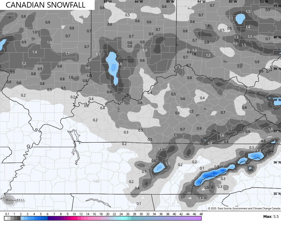
Again, coatings to an inch will be possible for many, especially on elevated surfaces and the grass…
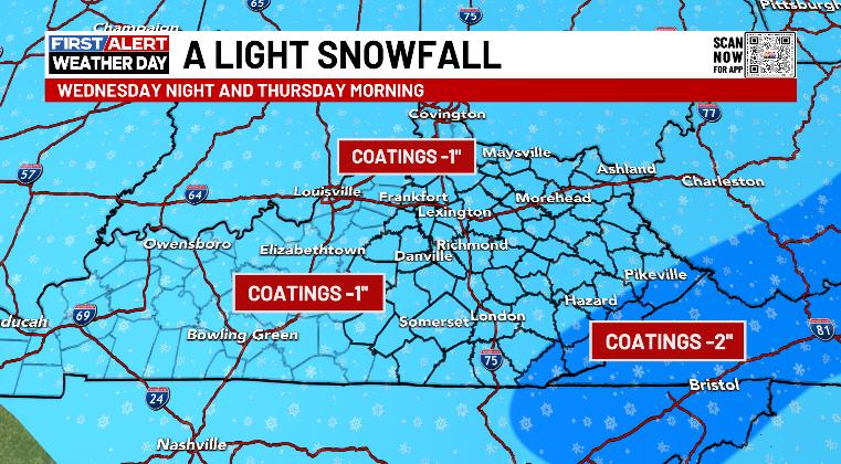
Some higher amounts will be noted along the Virginia border counties.
If you’re a fan of winter, tonight is a pretty good night.
I have no changes on the pattern after this with a weak system late Friday and Saturday with a full-blown Spring Fever Alert coming for next week. Does that hold? Probably not.
I’ll have the latest on WKYT-TV starting at 4pm and with another update here on KWC later this evening. Until then, here are your Kentucky radars to watch the switch to snow from west to east…

Enjoy this wintry Wednesday and take care.

Dang….I thought the pattern was going to flip warm later this month. Is it not going to now?….