Good evening, folks. Old Man Winter is back in the Bluegrass state and is bringing a light snowfall along for the ride. This blast of winter won’t hang out long as March is gonna March with some big temp swings ahead.
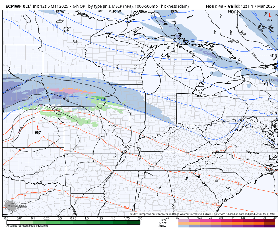
Light to moderate snow bands are rolling through the state through tonight and early Thursday morning. Light accumulations are showing up, especially on grassy surfaces and elevated surfaces.
With temps dropping into the 20s tonight, slick spots will develop on untreated roads, bridges and overpasses.
Winds are slowly coming down but gusts to 30-35mph overnight means wind chills in the teens later tonight and early Thursday.
The system coming in late Friday and early Saturday has a few showers with it that may end as a few flakes before skies become sunny Saturday afternoon. The system coming behind that will likely stay to our south…
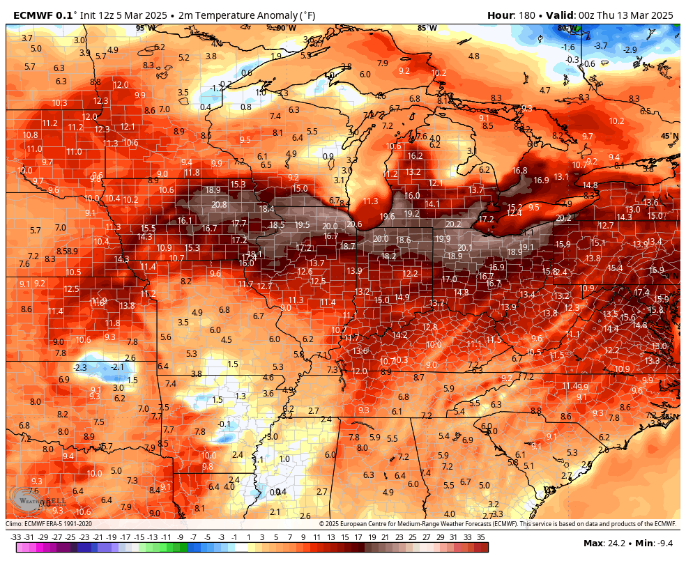
Temps by Sunday reach the 50s with 70s lurking into next week as we head back into another active pattern. That pattern really ramps up later next week with several systems rolling our way as cold air tries to fight back into the country.
This kind of setup can lead to similar storm systems as the one we just had. Here’s the EURO showing a series of potent systems…
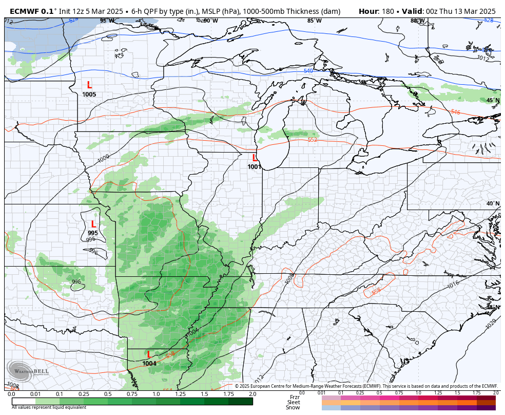
Temps are well above normal ahead of each low and then go well below normal behind each low…
I leave you with your tracking tools including our Kentucky Weather Cams to watch the wild weather across entire region…

Enjoy the evening and take care.
