Good Saturday, everyone. The clocks aren’t the only thing springing forward this weekend as our temps get ready to take on more of an April look and feel over the next week and change. This pattern will also bring the increasing potential for more winds and big storms.
Our Saturday starts with a quick-hitting band of showers zipping through the area. You may even see a snowflake mixing in before the sun takes control by the afternoon. Temps will be seasonably chilly today with mid 40s to low 50s for highs.
We all make a run into the 50s on Sunday with partly to mostly sunny skies.
Monday finds temps in the 60s with readings reaching 70 or a little better Tuesday and Wednesday. That’s ahead of a scattered shower or thunderstorm on Thursday.
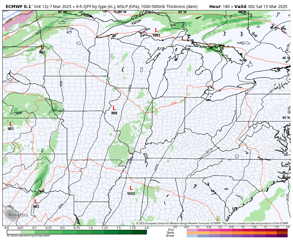
As that passes through, temps surge Friday and Saturday and we have a chance at 80 degrees if we can get enough sunshine. Those warm temps are on a strong southwest wind ahead of a big time storm system that may bring severe weather and high winds back into the region.
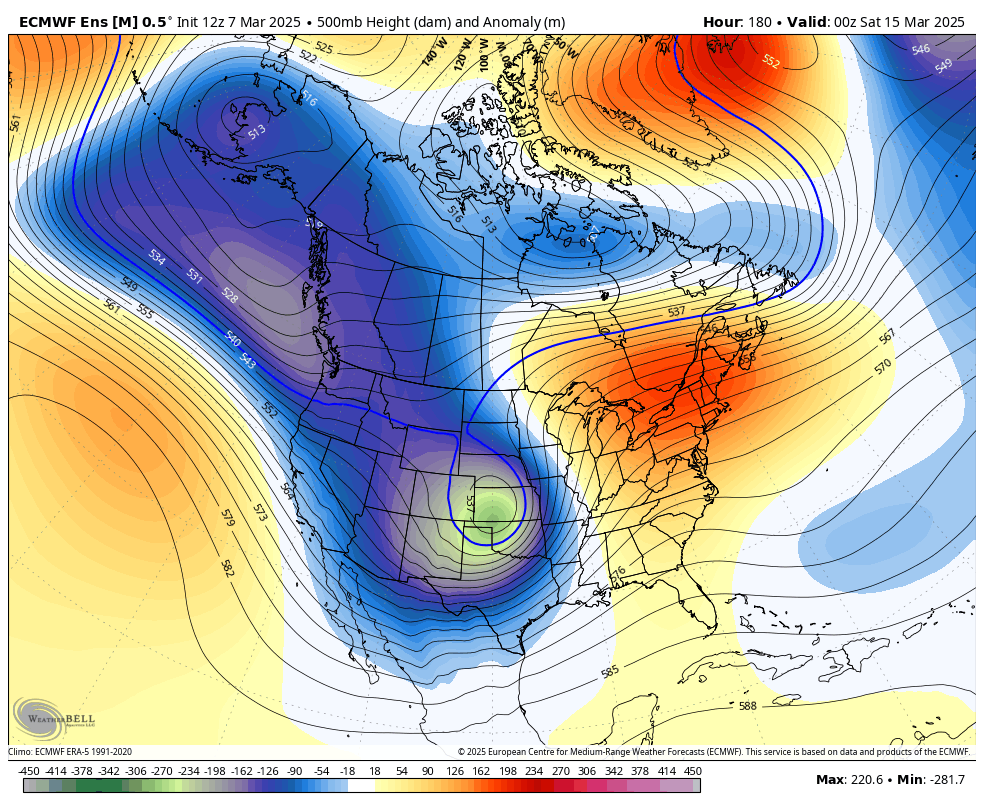
That’s likely the first in a series of big systems that have temp spikes and of them and temp drops behind them…
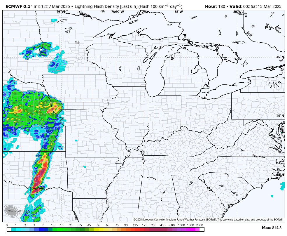
The EURO lightning forecast for next weekend is pretty impressive from a week away…
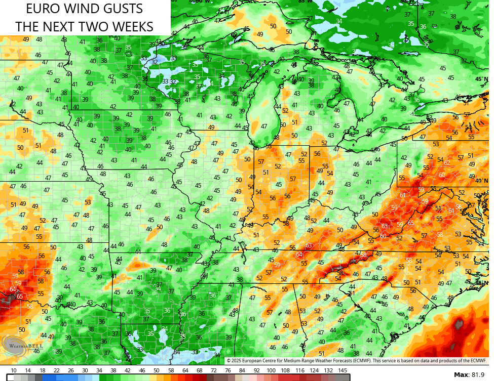
The model is already seeing the potential for another round of high winds…
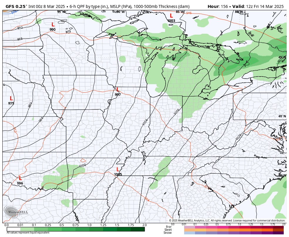
The GFS also has a similar overall look as the EURO for next weekend…
The EURO Ensembles continue to bring those troughs east through the end of the run on March 22nd…
I leave you with your Kentucky Weather Radars to track the early day showers…

Make it a great Saturday and take care.
