Good Sunday, everyone. Our clocks are now in spring forward mode and our temperatures are about to play a game of follow the leader. Temps in the coming week will be more typical of April than the middle of March and ain’t nobody complaining!
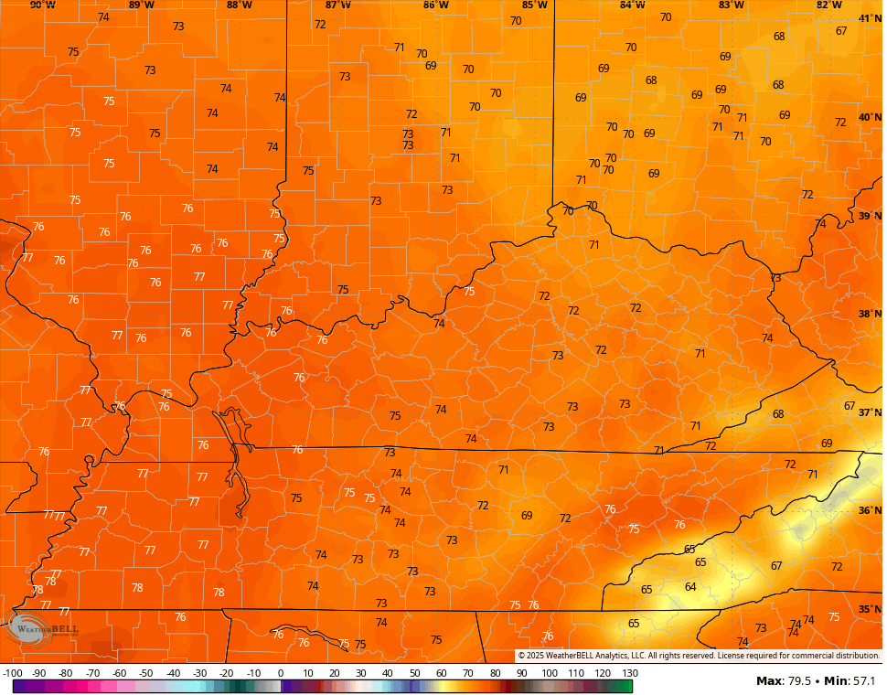
Temps today reach the 50s under a partly sunny sky. From there, let’s spring this pattern up! Highs reach the 60s by Monday then near 70 for Tuesday with a good shot at the 70s each day from Wednesday through Saturday.
Can we get an 80 out of this? It’s on the table as the models are likely undercooked…
Another powerhouse of a storm system develops in the Rockies and rolls into the Plains states by Friday. That system will likely have another blizzard behind it with severe weather ahead of it.
Exactly what this system means for us remains to be seen, but we may actually deal with a scenario where a front sweeps in here Friday night and Saturday with another low pressure rolling along it.
All of the above would bring the potential for severe storms, high winds and heavy rains to Kentucky and surrounding areas.
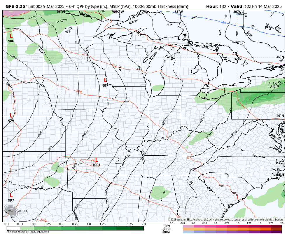
Here’s the GFS with the evolution of all this…
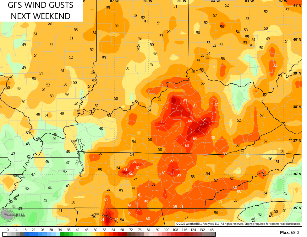
Look at those wind gusts…
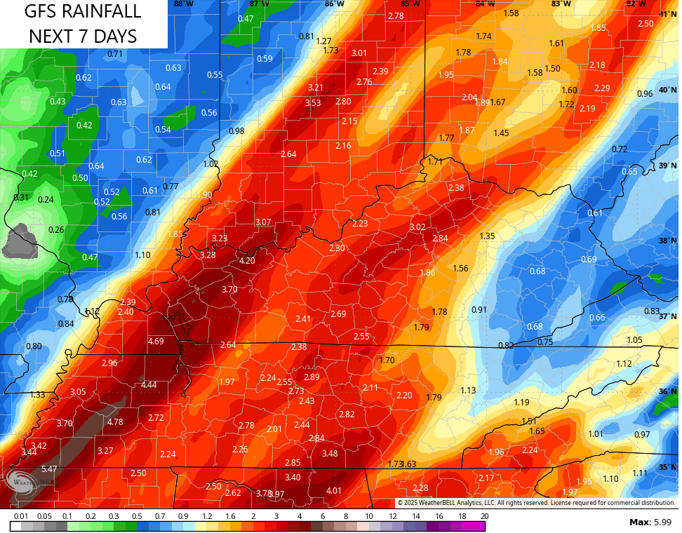
The GFS would bring the potential for flooding rains into Kentucky with the latest run focusing on western and central Kentucky…
The EURO Ensembles continue to show these deep troughs sweeping into the eastern half of the country right on through the end of the run on March 23rd…
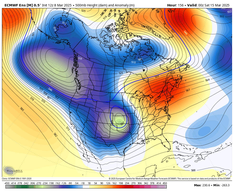
You can see how the trough starts to hang around the east in the final frames and that would bring us the chance at below normal temps and maybe some winter.
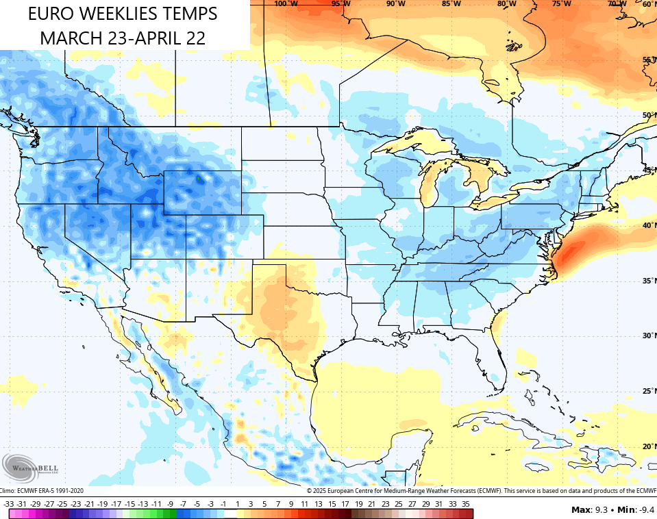
The EURO Weeklies are also latching onto the idea of temps averaging below normal from that point through the same point in April…
There’s nothing worse than blocking showing up in the springtime. Well, maybe a strong southeast ridge in the winter, but let’s not quibble.
Have a sensational Sunday and take care.

The EURO weeklies are rubbish. Not long ago, they showed a warm April.
It won’t be that warm.