Good Tuesday, everyone. Our mid-April weather continues to throw some awesome temps our way and that won’t be ending anytime soon. With the warmer setup, we are also tracking the potential for some spring storms and wind by the weekend.
Temps today hit the upper 60s and low 70s with a mostly sunny sky. Low and middle 70s are likely on Wednesday and Thursday. Isolated storms may show up Wednesday night and Thursday, but this action isn’t terribly widespread.
Highs by Friday and Saturday surge deep into the 70s with an outside shot at an 80.
That’s ahead of a potent storm system developing in the Plains and rolling toward the upper midwest. That drags a cold front in here with another low pressure developing along it Saturday.
All of this puts our region in the area to watch for severe storms from Friday night into Saturday. It also brings us the possibility of high winds and heavy rains.
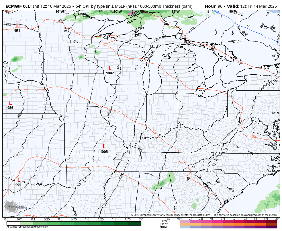
The EURO is now seeing this wave of low pressure much better than before…
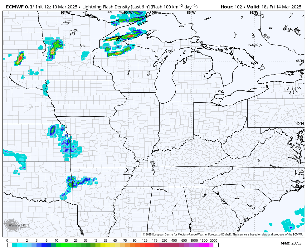
The lightning forecast from the EURO continues to show some good action around here…
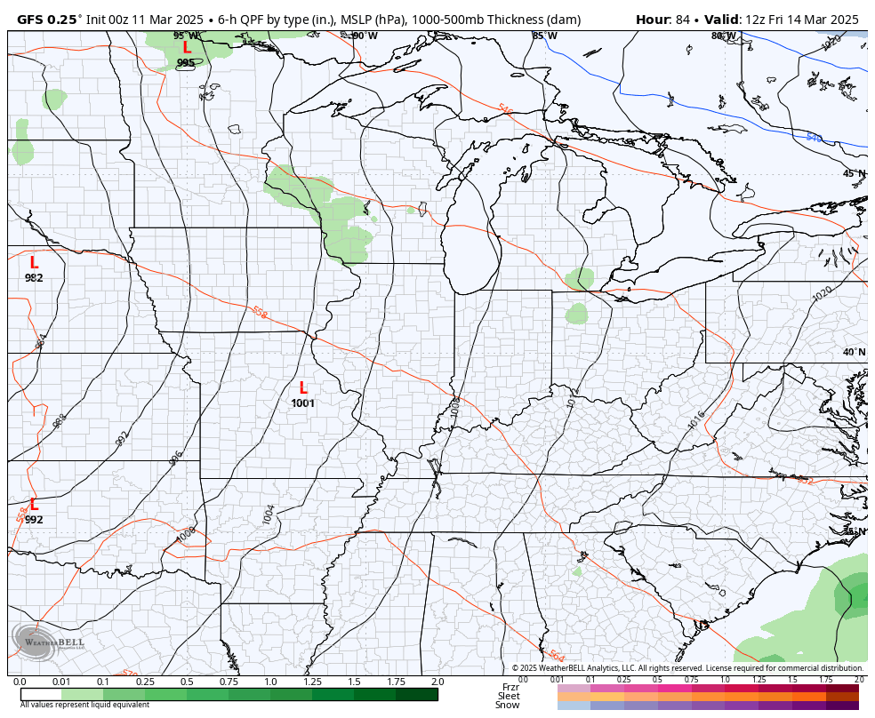
The GFS has a similar look…
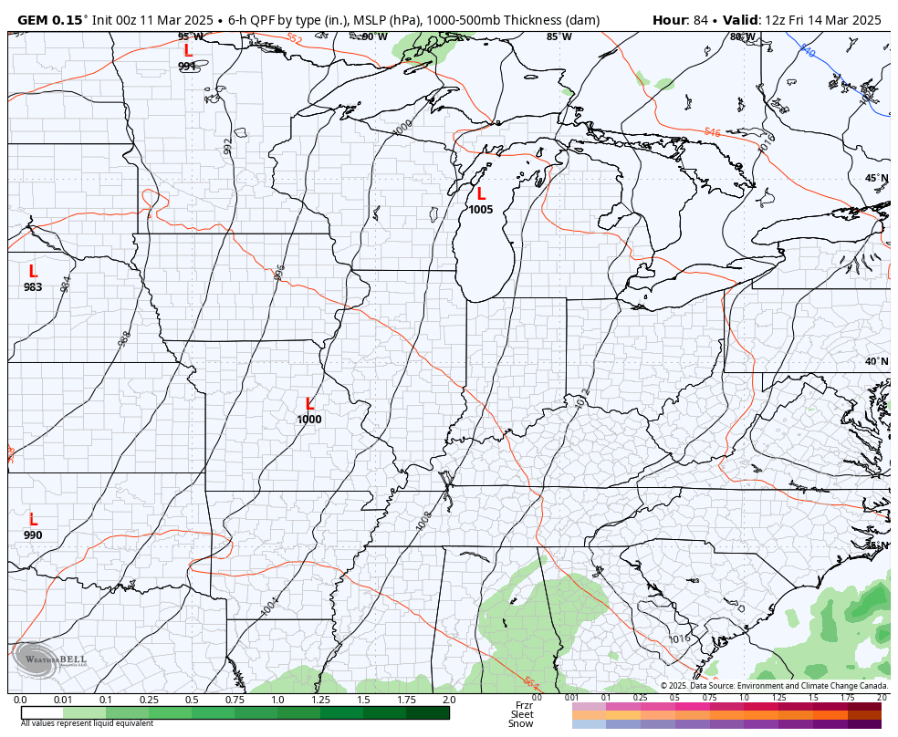
The Canadian Model even tries to bring a touch of flakes in behind it all…
The Storm Prediction Center continues to highlight parts of our region in the severe weather threat on Friday…

And again on Saturday…

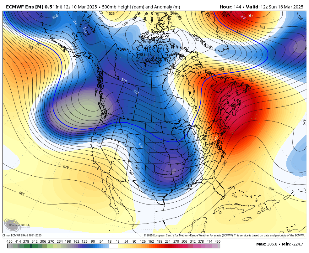
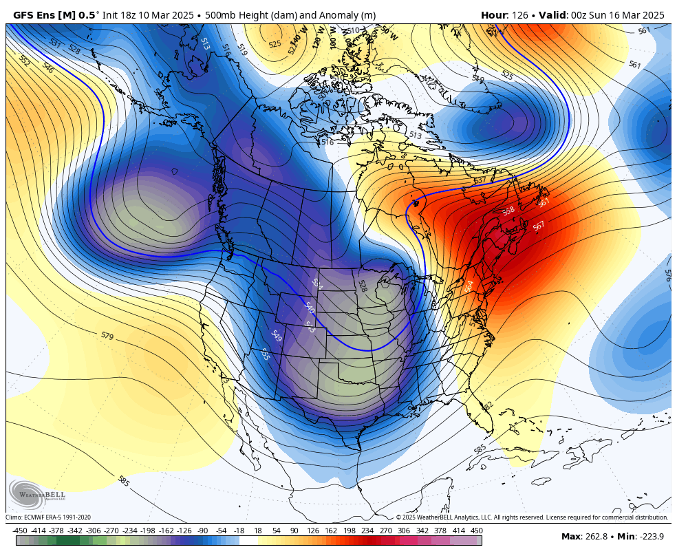
Temps chill down behind this system as it pulls away later Sunday and Monday, but those temps should jump right back up by Tuesday and Wednesday of next week. That should be ahead of another powerful storm being pushed by another deep trough sweeping in. This signal for deep troughs sweeping through continues to show up well on the various ensembles.
Euro Ensembles…
GFS Ensembles…
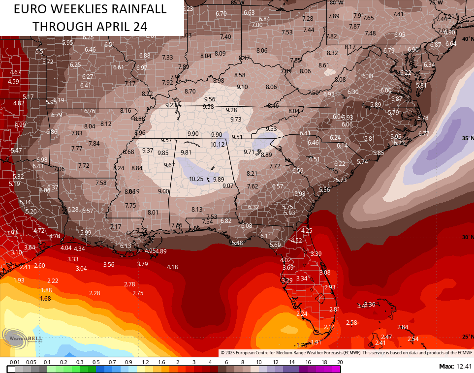
This makes for an active pattern that likely takes us through much of the spring. The EURO Weeklies go through April 24th and indicate the potential for a lot of storms and rain…
Have a terrific Tuesday and take care.
