Good Monday to one and all. It’s a much better weather day taking shape across Kentucky as high pressure takes control of our weather, albeit for a day. This kicks off a pattern that is chillier than normal for this final full week of March.
Temps today hit 55-60 for most with low 60s in the west and south. Clouds this morning give way to afternoon sun and fairly gusty winds.
This is ahead of a clipper-type system dropping in from the northwest. Winds will be very gusty with a few showers and Tuesday into Wednesday as colder winds kick in…
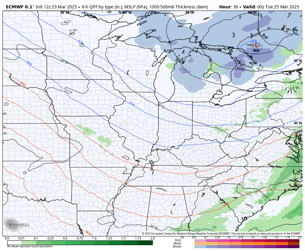
Temps Tuesday may be near 70 in the far west, with 50s into much of central and eastern Kentucky. Highs on Wednesday may not get to 50 across parts of northern and eastern Kentucky. Ugh.
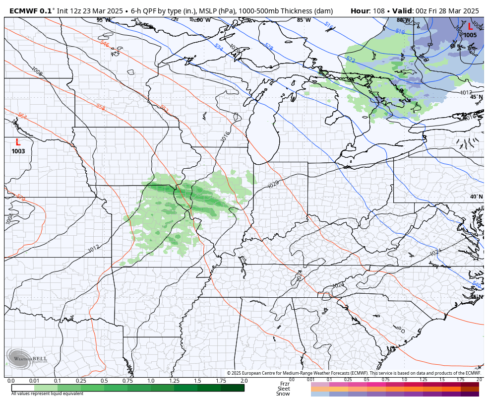
Southwest winds kick in by Thursday night and Friday as a storm system cranks to our west. That system brings in scattered showers and storms on Friday as temps surge. The main threat for thunderstorms will roll through this weekend with the chance for a few strong storms…
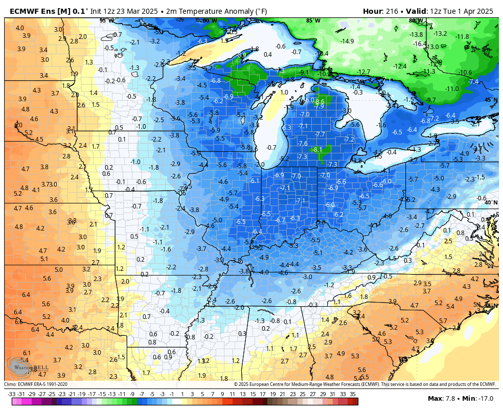
Temps will come way down right behind that by Monday, but a warm pattern is trying to flex on us during the first week or two of April. The EURO has some serious warmth with temps well above normal for the first week of the new month…
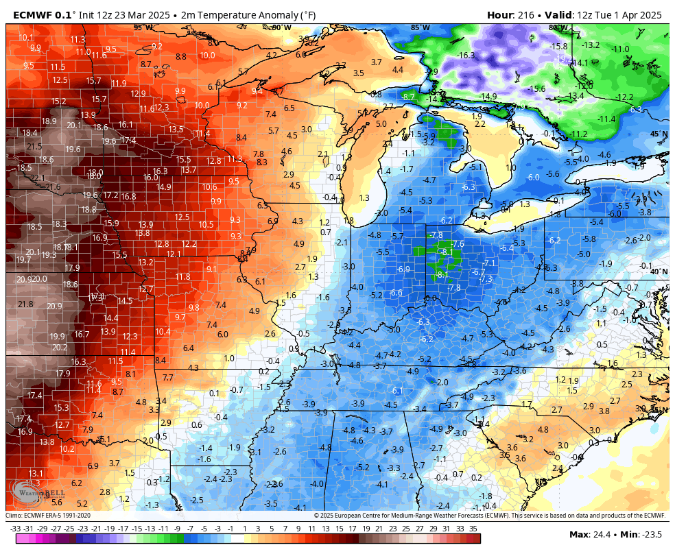
That’s been the view from the EURO Ensembles for a while and they continue to show some big-time spring warmth…
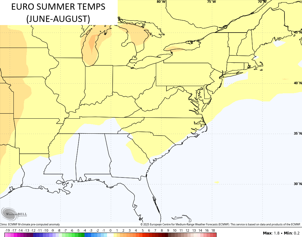
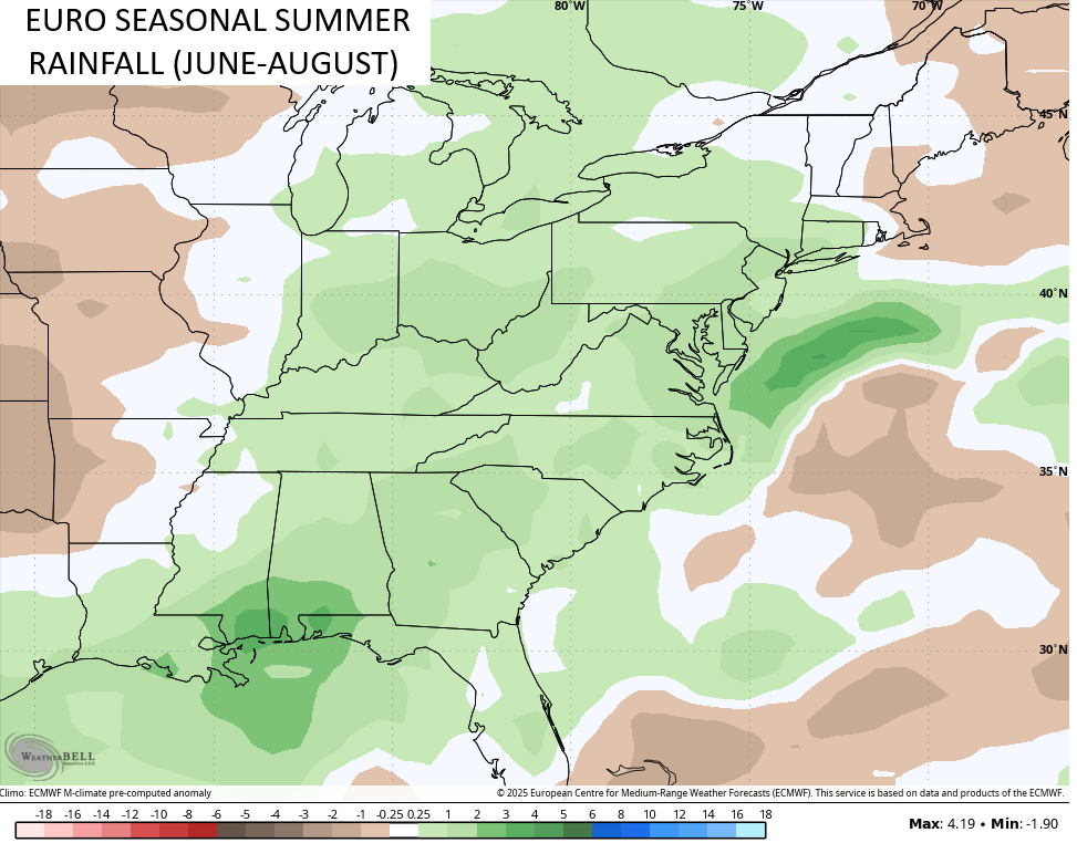
If we look ahead to the summer, the EURO Seasonal is showing a fairly tame temperature summer with above normal precipitation.
Temps are forecast to be just a touch above…
Here’s the above normal rains…
I leave you with some old school tunes to start the week…
You know you’re going to be singing that all day!
Have a Manic Monday and take care.

Enough rain with just above normal temps would be great.