Good Tuesday, everyone. We have a clipper-looking system rolling through the region today and Wednesday before spring surges back in later this week. This is ahead of a spring storm system arriving this weekend, bringing the potential for strong to severe storms.
The system today has a shield of showers along and to the north of the track of the small low. This brings chilly showers with the chance for a few snowflakes getting in on the fun. Western and southern Kentucky will get in on more sun with temps that can spike into the 60s for a time.
Your Kentucky Weather Radars are on duty to track the batch of chilly showers…

Another round of chilly showers and, perhaps a few flakes, arrives tonight and early Wednesday. This looks to impact some of the same areas getting in on today’s action. Temps on Wednesday are seasonably chilly across the entire region as gusty winds from the northwest do their thing.
Temps rebound on Thursday with upper 50s to middle 60s for the entire area. This is ahead of a BIG surge in temps showing up Friday into the weekend. The warm up is along and ahead of a big storm system that threatens us with severe weather this weekend. Here’s a rough outline of how this may look…
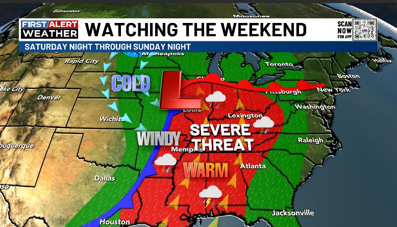
A few storms rumble in along the warm front on Friday. From there, a strong southwest flow kicks in with a few strong storms on Saturday with the best chance for severe weather Saturday night through Sunday night.
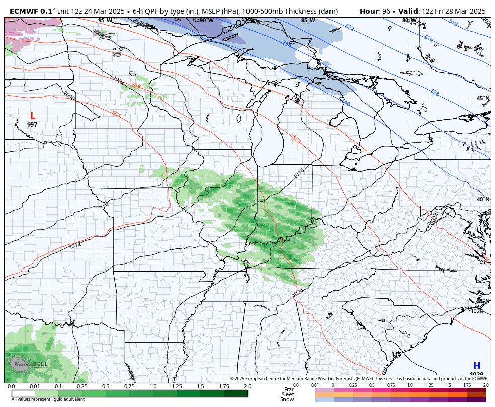
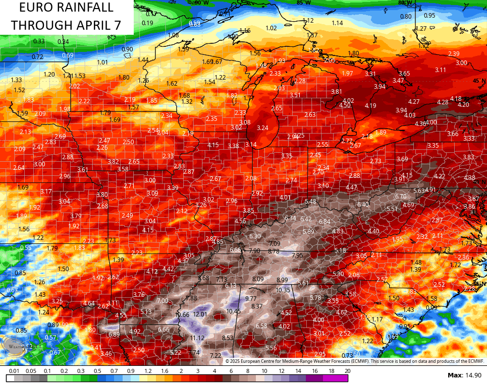
You can see all this very well on the EURO…
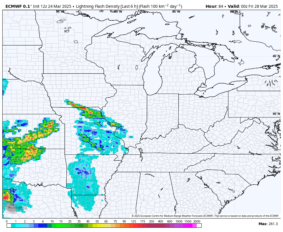
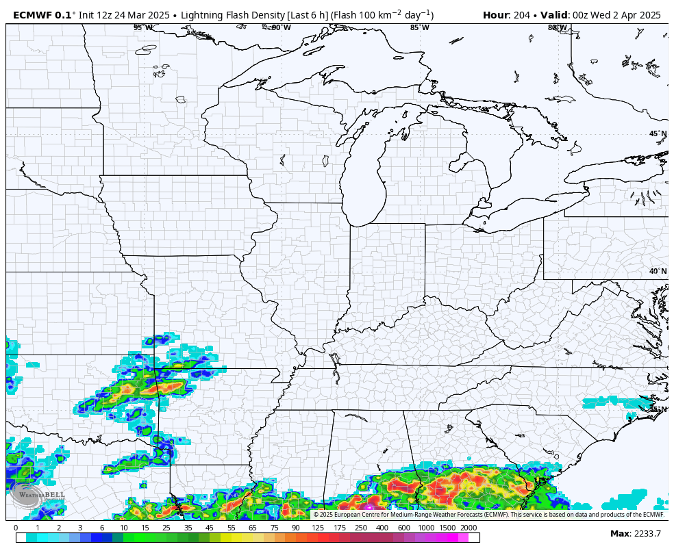
The lightning forecast from that same run is pretty extensive…
The Storm Prediction Center is already putting our region in the Severe Weather Outlook for Sunday…

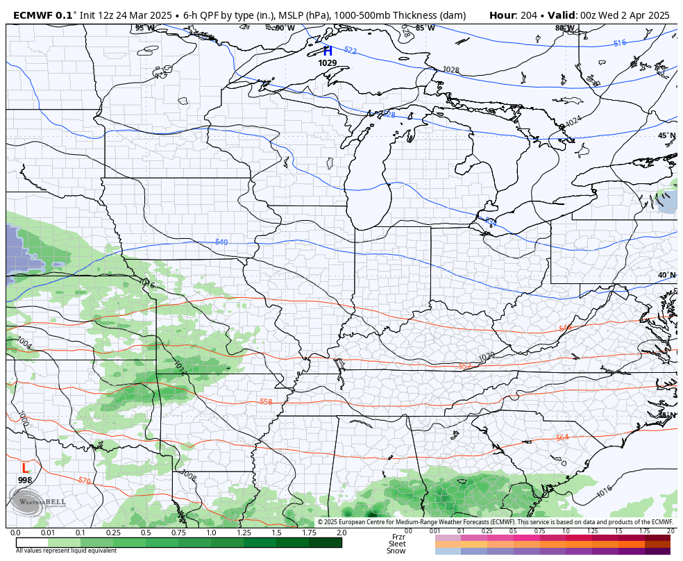
After a quick drop in temps, expect a few more strong storm systems to develop and impact us later in the first week or so of April…
The long range look at the lightning potential…
This continues to look like a very active severe weather season in our region and things should really take off as we get into April. The EURO is seeing that with the above storm systems. The model is also seeing the chance for some hefty rain totals over the next two weeks…
Have a terrific Tuesday and take care.

Looks like March will go out like a lion as another dose of severe storms will hit the SOKY region on Sunday. All signals continue to indicate above normal severe storm activity in April & May for South Central Kentucky.
Buckle up!
Will be glad when the ‘ Hot Days of Summer ‘ arrive with normal rainfall for the crops.
I just looked at the 10 day GFS and I noticed it sure doesn’t look like there’s going to be much SUN the next 10 days… Maybe some hopefully
Looking at the Radar, a real pronounced clipper system is moving through the central part of Indiana southeast to West Virgina. This I believe is rare for being this late in March ? This La Nina is still making an impact across the CONUS. I thought we were suppose to phase into ENSO / neutral late this month ? One can’t receive an accurate weather forecast anymore. Weather forecast were more accurate back in the 1950’s and 60’s. End of rant.