Good Wednesday, everyone. It’s another chilly day across Kentucky as we focus on a big storm rolling in here for the weekend. That system brings an increased threat for severe thunderstorms to the entire region.
We still have a small shower chance out there today with a mix of sun and clouds. Winds are gusty with temps ranging from the low 50s to near 60.
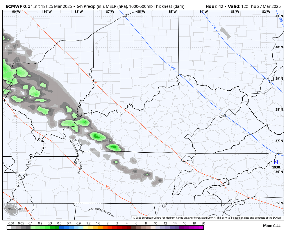
A warm front works from southwest to northeast Thursday and will produce some showers and thunderstorms. While the whole front is moving to the northeast, individual showers and storms are rolling from northwest to southeast. This animation from the EURO goes from 8am Thursday to 2pm Friday…
Scattered storms lift out early on Friday with high temps hitting 75-80 degrees to start the final weekend of March. Those warm temps continue into the weekend with the chance for some strong storms on Saturday.
Sunday and Sunday night looks to bring about a significant severe weather threat for our region. The Storm Prediction Center continues to highlight this potential from 5 days out…

Much of this is in the same area I’ve been highlighting for the past few days…
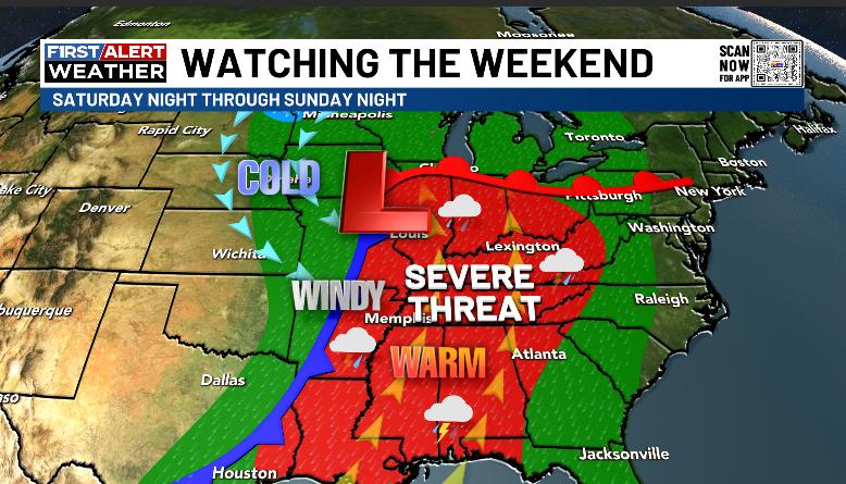
The EURO has a pretty threatening look for all modes of severe weather…
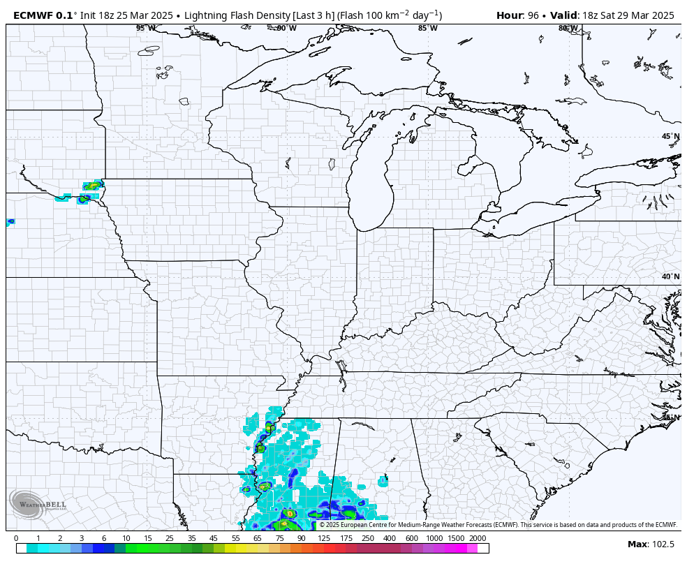
The greatest severe threat comes Sunday afternoon and evening and you can see the timing on this with the lightning forecast animation from the EURO…
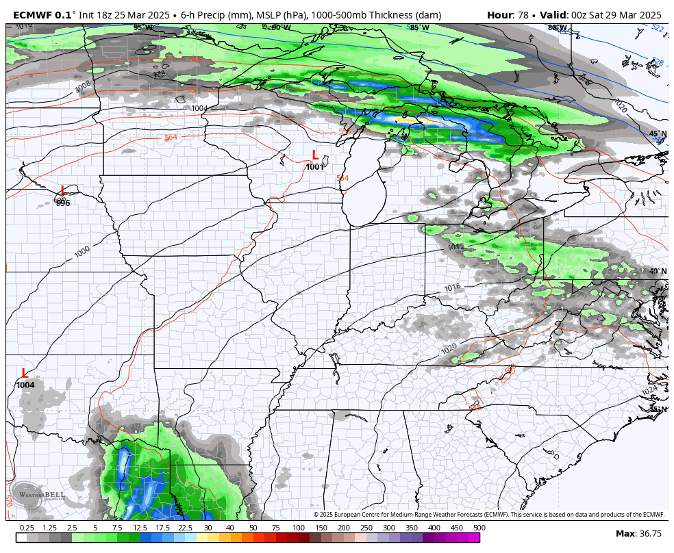
The pattern behind this remains very active with several more big storms crossing our region. You can see this showing up on the EURO…
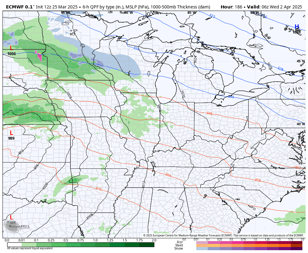
It’s interesting to note how the EURO and many other medium range models go toward enough blocking to bring the potential for one last gasp of winter weather. No thanks.
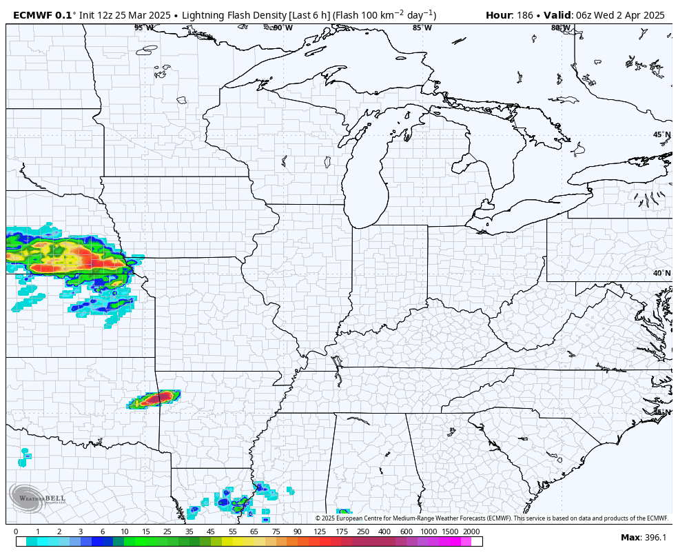
That same setup would likely bring more in the way of severe weather into the region. Check out all the lightning…
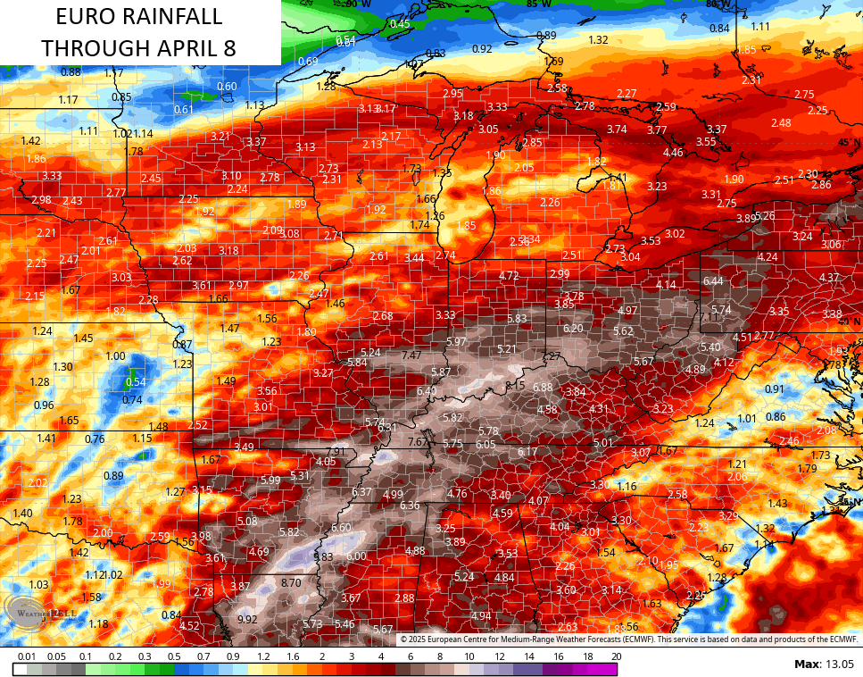
The EURO continues to throw down a lot of rain over the next two weeks…
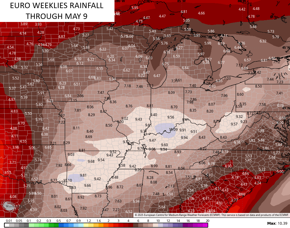
The EURO Weeklies suggest this kicks off a VERY wet setup through the first week or so of May. The bullseye of heaviest rains are right on top of us during this time…
Make it a wonderful Wednesday and take care.

It won’t be very wet nor snowy. Tough luck.
Touch’e Jeff.
There’s always that potential when it comes to weather. Potential being the key word.