Good Thursday to one and all. We have a warm front pressing across the Commonwealth today and it’s bringing the chance for a few showers and storms. This opens up some big time warmth that will help fuel some late weekend severe storms as a powerhouse storm system moves our way.
Let’s begin with today and roll forward.
Not everyone will see showers and storms today as this stuff is pretty scattered. Temps range from the upper 50s to low 70s. Those 70s then surge in for Friday and will be introduced by a few strong to severe storms overnight and early Friday. Highs by Friday afternoon will hit 75-80 for most areas.
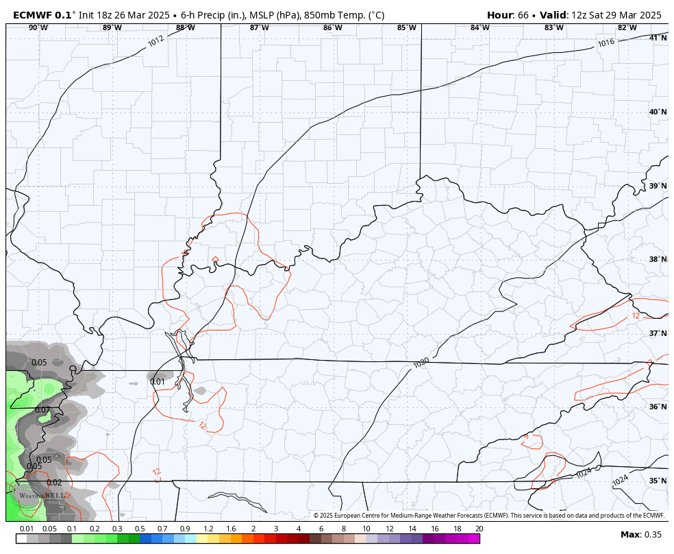
Saturday is another day with temps in the 70s as some late day showers and storms rumble in from the southwest. This action looks a little more prominent Saturday night. This animation goes from 8am Saturday to 8am Sunday and shows the increase…
This brings us to Sunday and Sunday night and that’s when the best threat for severe weather shows up across our region…
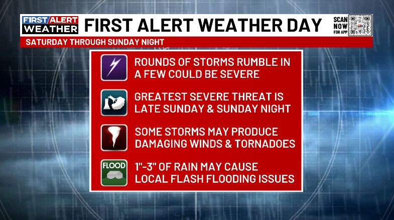
The Storm Prediction Center continues to highlight this potential from several days out…

I’ve seen a lot of folks talking about how the SPC has never done this or that before and it’s somehow an indication of the severity of what’s to come. Slow down, folks. The SPC is just getting a little bolder when it comes to issuing severe weather outlooks in the 4–8-day window. This is something they have been really slow to embrace in recent years, so, just because they’re issuing these now does not mean this is an unprecedented setup.
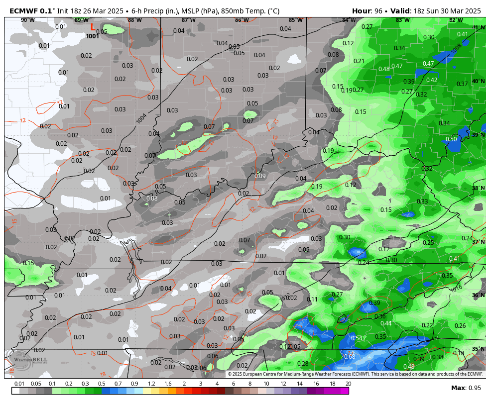
As far as this Sunday and Sunday night goes, the trend is for a slower arriving system. The EURO doesn’t bring the worst of the storms into Kentucky until after dark Sunday and then shows this action exiting the east early Monday…
All modes of severe weather are possible, but that’s about the extent of this until we get closer. Details on such events don’t fully show themselves until a day or two before.
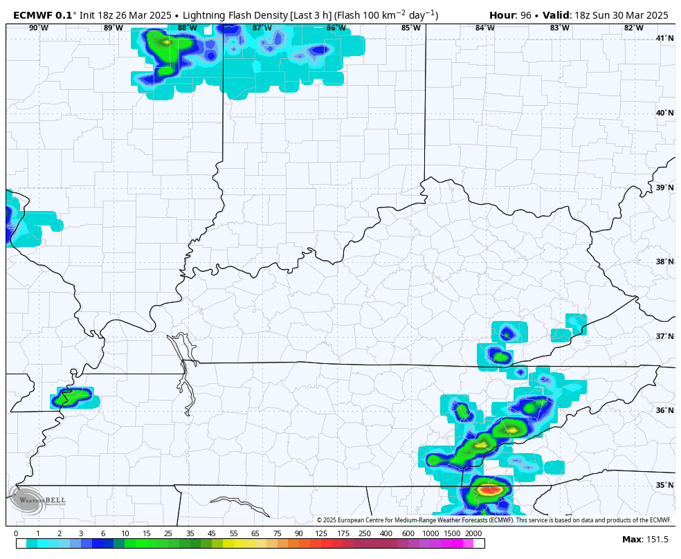
The lightning forecast from the EURO continues to indicate a ton of lightning Sunday evening and Sunday night…
Temps drop behind this front by Monday and Tuesday before another big jump surges in ahead of what may be another severe storms threat around the middle of next week.
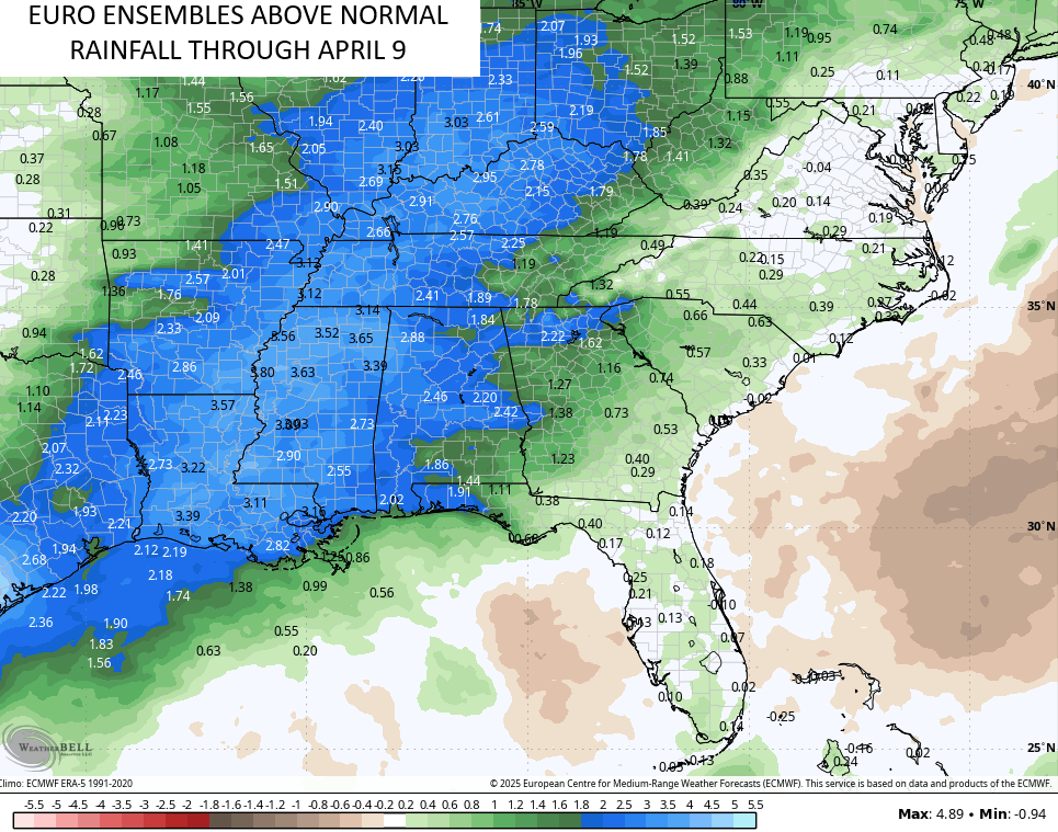
The stormy setup looks to continue through the spring and I’ve made no secret that I think this is a VERY active severe weather spring. If we look at the EURO Ensembles over the next two weeks, we can clearly see the wetter than normal pattern from the storms. This map shows how far above normal the rainfall numbers are through April 9th…
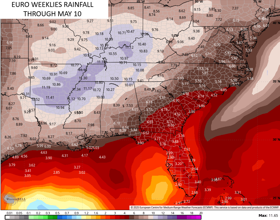
The EURO Weeklies go through May 10th and show where the severe weather bullseye sets up… From Our region into the lower Mississippi Valley. Here are the forecast rainfall numbers…
I’ll drop by for another update later today. Until then, let’s track the scattered showers and storms lifting through the region today…

Enjoy your Thursday and take care.
