Good evening, everyone. A warm front is pressing through the region and it’s touching off scattered showers and some storms. The focus continues to be on the weekend and the severe storms threat coming later Sunday and Sunday night.
The overall setup simply hasn’t changed much at all. We will see a broken line of showers and storms rumble through tonight with temps pushing 80 for Friday. After a few showers and storms around late Saturday into early Sunday, the severe storms threat then takes center stage.
The Storm Prediction Center continues to highlight the entire area in the severe weather risk for Sunday…

The latest guidance from the Colorado State Machine Learning Probabilities Prediction is currently showing the greatest risk across western Kentucky on Sunday…

The CIPS Analog-Based Severe Probability Guidance is also highlighting western and areas of central Kentucky with the greatest severe weather risk…

That’s based on the latest set of models and will change based on what the last model runs suggest.
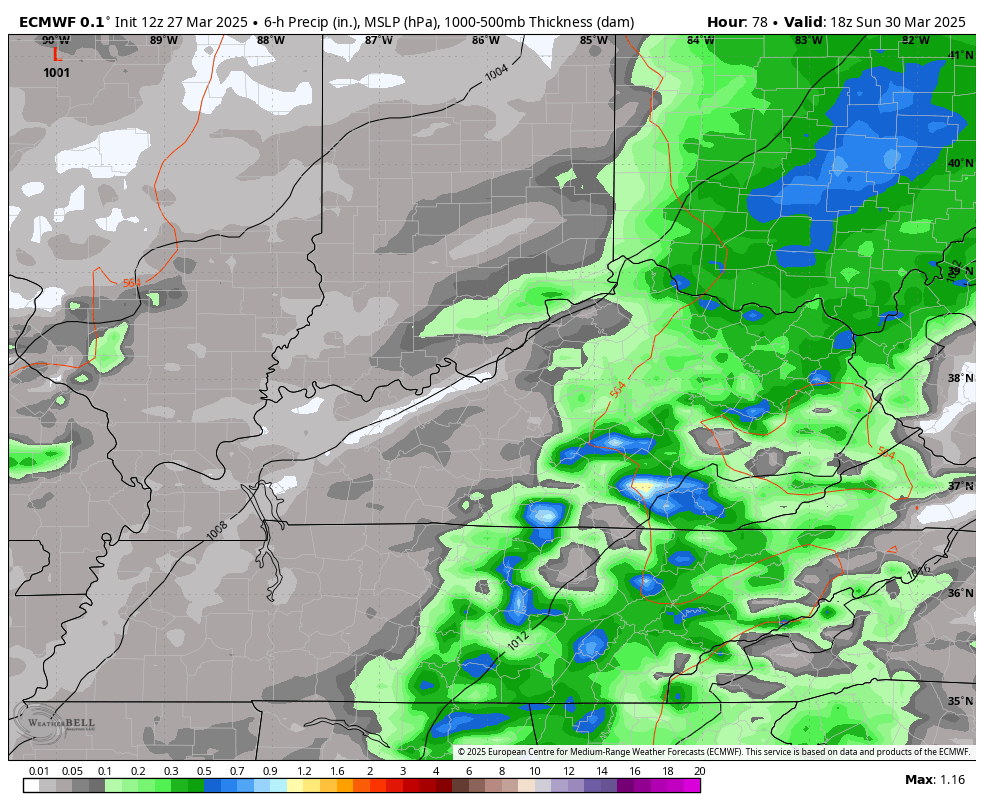
I continue to think the best chance for severe weather won’t arrive until later Sunday evening into the wee hours of Monday morning. This has been the trend on the EURO for several days now and that still looks to be the case.
This animation goes from 2pm Sunday through 2pm Monday…
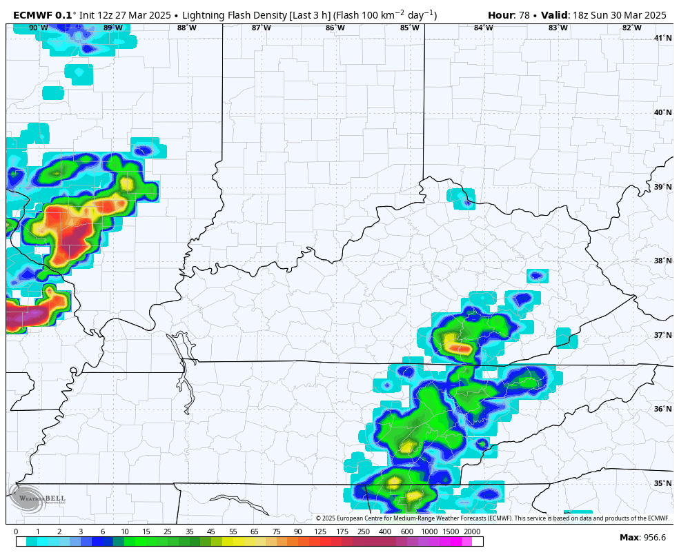
The lightning density forecast from that same time period shows how the storms decrease some as they reach eastern Kentucky late Sunday night…
I’ll go into full detail on all this with my next update tonight. I’ll also look ahead to additional severe threats coming next week.
Until then, let’s track the showers and storms developing along our warm front…
…

Enjoy your evening and take care.
