Good Friday, everyone. A surge of May air is taking over today and through the upcoming weekend. This blast of warm air is also bringing scattered showers and storms on the front end, with a severe threat on the back end. Additional severe threats are lurking behind this for next week.
Temps today hit the 75–80-degree range on a strong southwest wind kicking in. These warm temps will be introduced by a few showers and storms early today. Once those move away, we get into a mix of sun and clouds.
Saturday is another very warm day with a few showers and storms rolling in from the southwest late in the day. That sets us up for showers and storms Saturday night through the first half of Saturday…
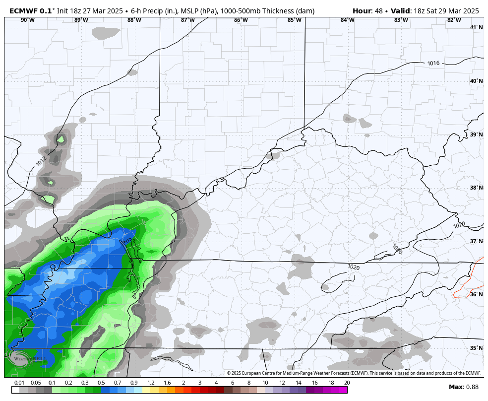
Some of those storms may be severe with a very low-end severe threat as of right now.
The main severe storms threat comes in behind that late Sunday into Sunday night. Here’s the Sunday Severe Weather Outlook from the Storm Prediction Center…

The current SPC Probability of Severe Weather…

As I’ve been mentioning, the main severe threat looks to arrive late in the evening into the wee hours of Monday morning. The EURO was the first to highlight this and it continues to do so…
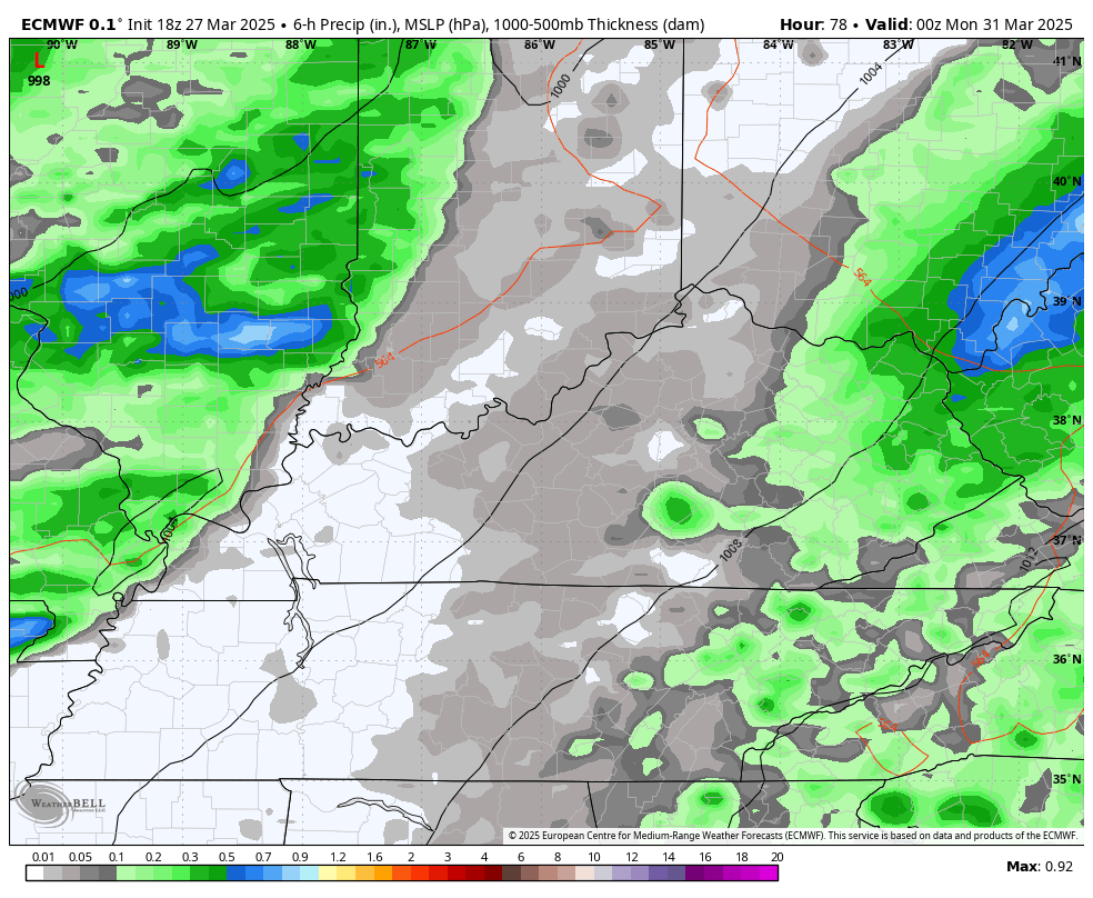
That animation goes from 8pm Sunday through Monday at 2pm.
The lightning density forecast from the EURO gives us a good indication of the intensity of these storms…
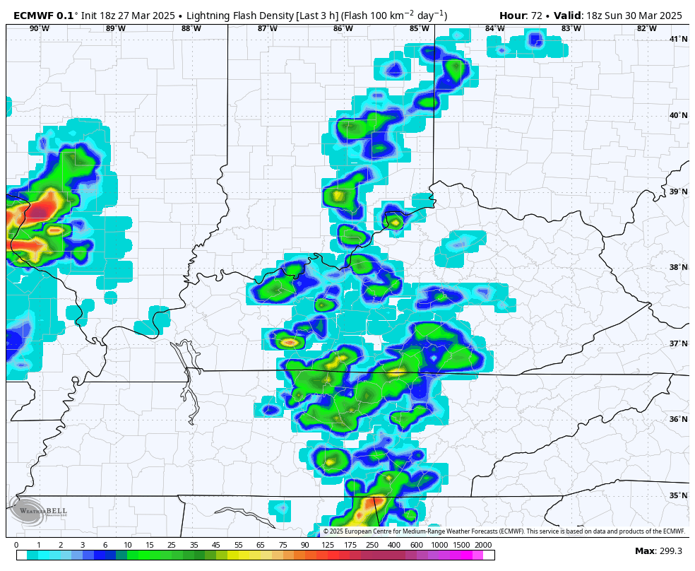
Notice how the lightning slows down some as the storms move into eastern Kentucky. That’s likely a sign of weakening storms.
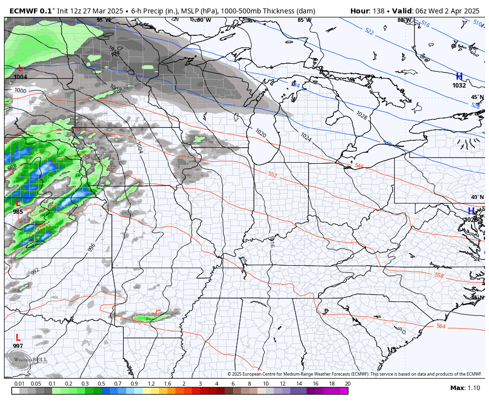
Chillier winds blow in for the final day of March and into day one of April. Winds quickly flip around and become very warm by Wednesday as we watch another potent storm system or two rumble in from the west…
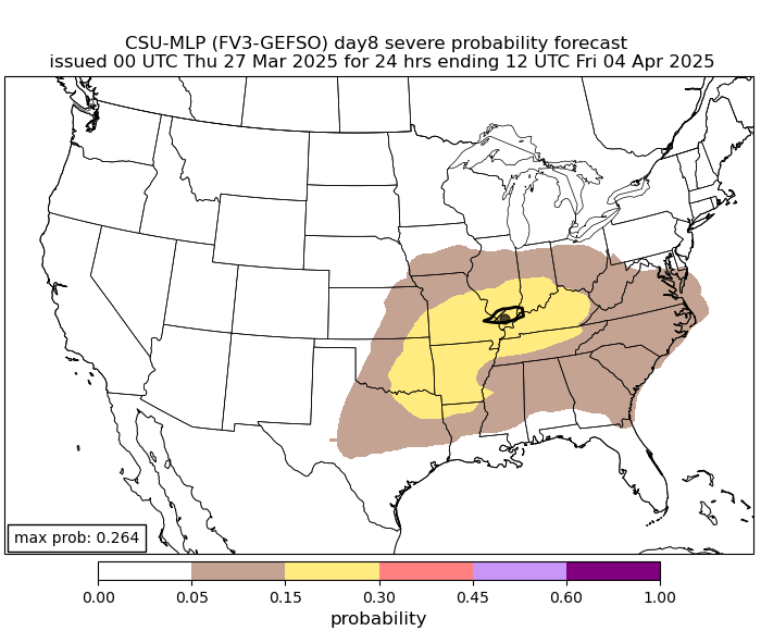
Temps in the 80s are possible ahead of this, giving us plenty of fuel for more in the way of strong to severe storms. The latest guidance from the Colorado State Machine Learning Probabilities Prediction is showing the severe storms potential for two infamous weather dates, April 3rd and 4th…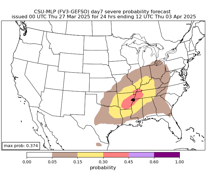
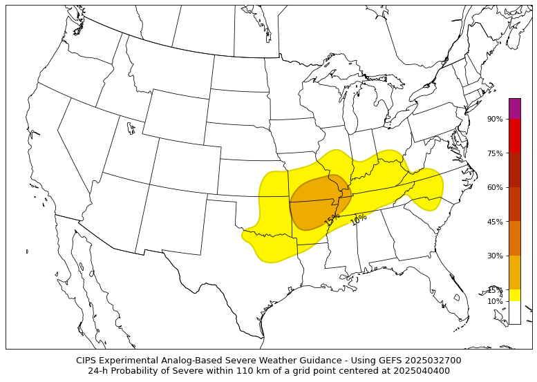
The CIPS Analog-Based Severe Probability Guidance is also highlighting the severe weather potential during this time…
Since early February, I’ve been trying to get you guys ready for what I expect to be a very busy spring severe weather season in our part of the world. You’re seeing that starting up with the above maps and we are seeing the potential on the various ensembles.
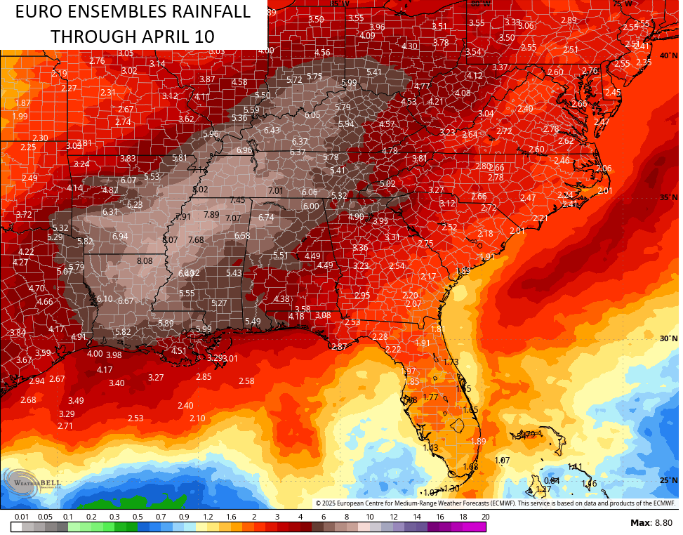
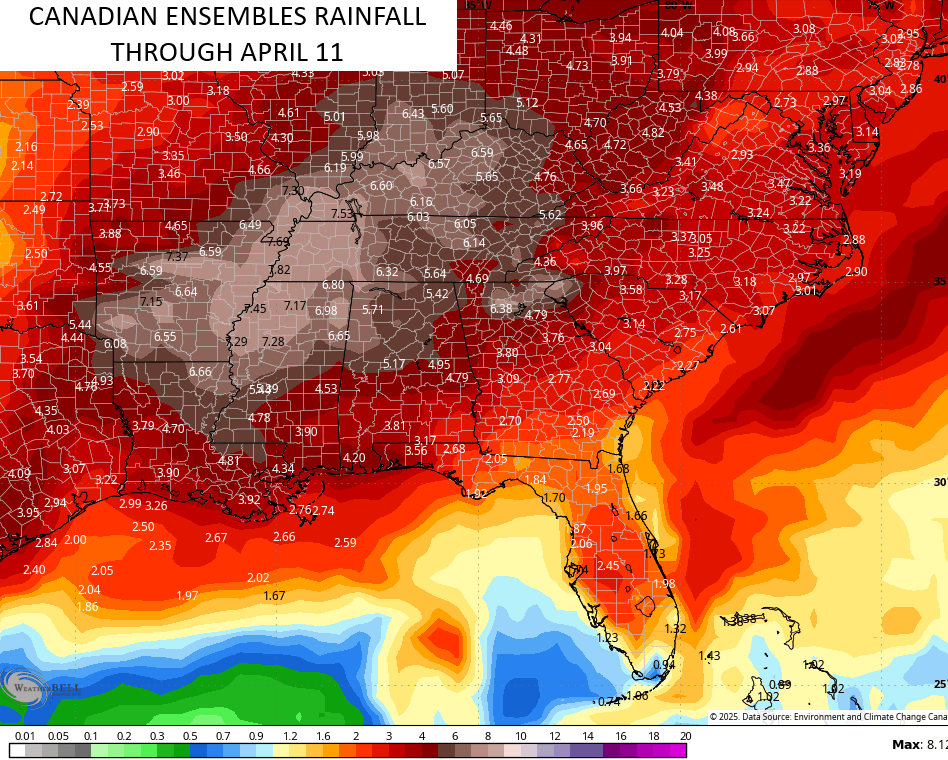
Look at the heavy rains over the next few weeks from our region into the lower Mississippi Valley…
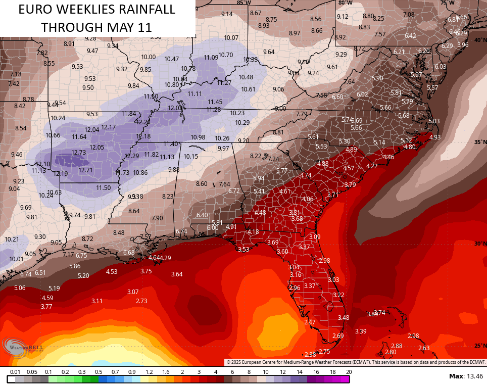
Looking through all of April and into the first 11 days of May, we find a MAJOR signal for severe weather and heavy rains showing up on the EURO Weeklies…
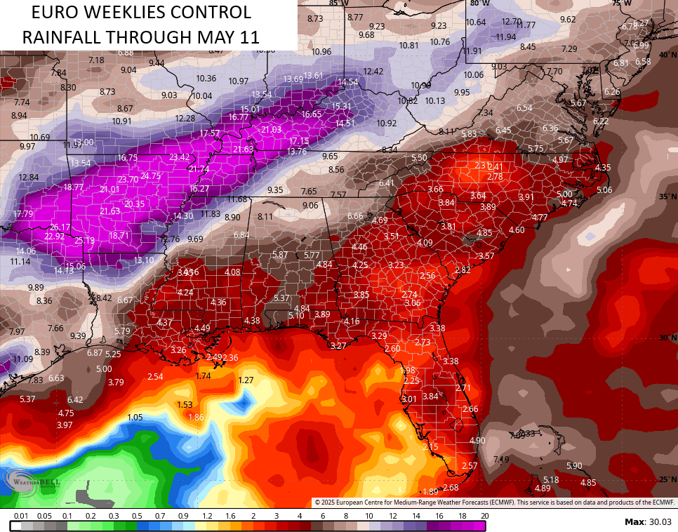
The single run of the EURO Weeklies is even uglier with rainfall amounts through the same time…
We went through a number of years with a relatively quiet spring severe weather season around here. That changed last spring and that active look is back for the spring of 2025.
I’ll through you another update later today. Until then, let’s track the showers and storms rolling along our Friday warm front…
…

Enjoy your Friday and take care.

Big outdoor plans next weekend, starting Friday. Maybe those predicted storms and downpours will go elsewhere and we get gentle, intermittent April showers.
The uptick in severe weather this spring comes as no surprise. The fact is, we’re in a weak La Nina which is forecasted to phase into ENSO Neutral in April, and historical records have shown that when a La Nina – ENSONeutral shift occurs in the spring, chances for severe weather outbreaks increase significantly.
The Sunday system will have a great deal of cold air aloft, so the chances for large hail are greater, so it would not surprise me to see the SPC up the severe potential to moderate risk for areas to the west of I 65.
The last time ENSO was Neutral was in December 2019. From then on it’s been in the negative. Last month the PDO was a – 1.45. That tells me there has not been any significant change in the precipitation pattern across the CONUS.
That would be nice, if it happens ?
The above reply is for Lex yard Guy. Sometimes the reply’s don’t line up.
Yuck. The unfortunate tradeoff for early warmth.
Sure is a beautiful day. Clear blue skies, and warm comfortable temperatures. The warm front through, puts us in the dry slot. All we have to worry about is the cold front late Sunday. I hope it weakens like all previous storms, as it moves across the states ?
Jeff, it’s just been a late start to Spring, and I read the Agriculture weather forecast for April, calling for below normal temperatures. That may mean a long hot Summer ahead.