Good evening, everyone. Our last weekend of March is off and running and it feels more like the last weekend of May. Very warm air has invaded the region and this provide some of the fuel for severe weather later Sunday and Sunday night.
While we will see some showers and storms around late Saturday into the first half of Sunday, these should be fairly well behaved. That changes from west to east Sunday evening into Sunday night as a potent storm system rumbles into the region.
This is likely to bring all modes of severe weather into Kentucky. Damaging winds, large hail and a few tornadoes will threaten the region.
Because of this, the Storm Prediction Center has the Enhanced Risk for severe weather for all of central and western Kentucky with the Slight Risk in the east…

I wouldn’t be surprised to see areas of western Kentucky upgraded to a Moderate Risk before all is said and done.
The severe weather probabilities remain very high for western and central Kentucky…

Again, much of that is for late Sunday evening into Sunday night.
The Storm Prediction Center is picking up on the slower arrival time of the severe threat and has now extended this threat into early Monday across eastern Kentucky…

After a break late Monday and Tuesday, the setup becomes one to really keep an eye on from Wednesday through next weekend. I’ve talked about this in recent updates and I have no changes to the overall potential.
This is a setup where we may be in a multi-day severe weather event with flooding rains also an increasing threat.
The Storm Prediction Center is already highlighting the severe threat starting next Wednesday…

Our region is very likely to be in the Battlezone for much of spring and I’ve been trying to hit this point really hard over the past month or two. Repeat showers and storms can really do a number on our region and this is something the seasonal models have been suggesting for a while.
Now we find the medium range models all locking in on a VERY active and VERY wet pattern in the coming few weeks. The theme of all the models is exactly the same, they just differ on placement and rain totals through varying times.
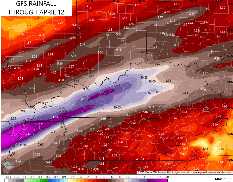
Look at the GFS rain numbers over the next 2 weeks…
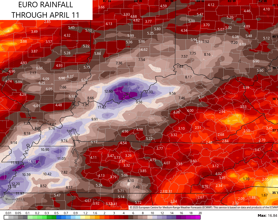
The EURO for roughly the same time…
The ICON doesn’t go out as far but it is absolutely going bonkers with rain and storms over the next week…
![]()
![]()
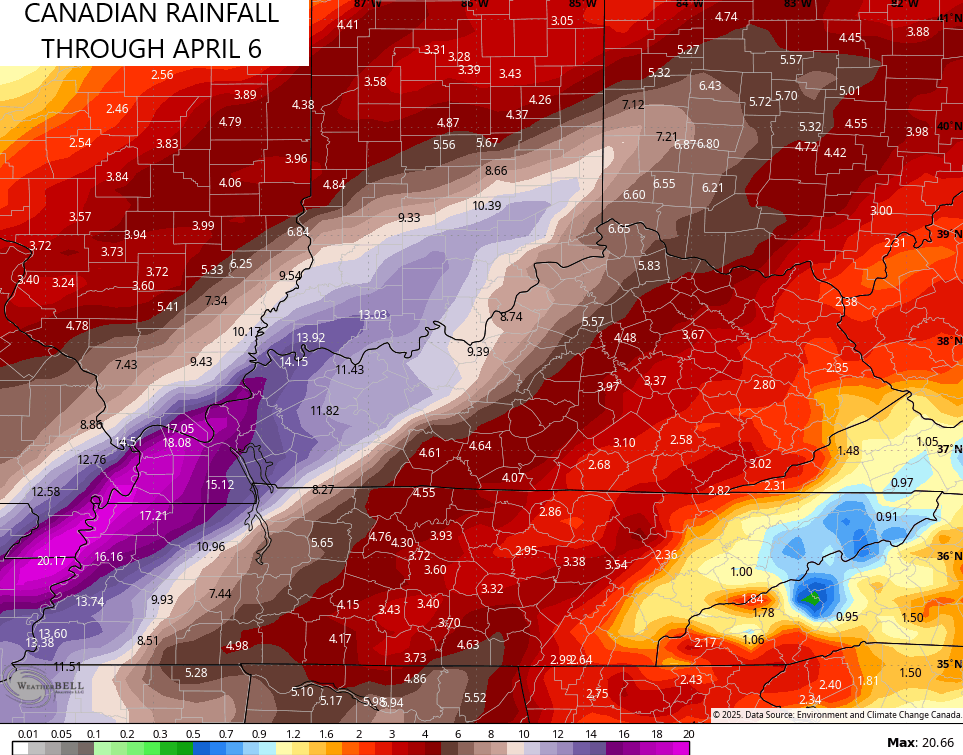
The Canadian has a different placement, but it’s seeing a similar potential…
The Ohio River Forecast Center is already highlighting the flooding potential in our region for the week ahead…
Multiple rounds of rain are expected over the next 7 days. This rainfall could be heavy at times, with total accumulations of 1.5 to 4″ for much of the area. The 10-day potential for river flooding is high, with minor flooding likely and moderate and major flooding possible. pic.twitter.com/D0lA9tyOi1
— NWS OHRFC (@NWSOHRFC) March 28, 2025
Have a great evening and take care.
