Good Saturday to one and all. A significant severe weather event is on the way to parts of the region late Sunday into Sunday night. This kicks off a very active pattern as we head into April and it’s one that will cause more issues next week.
Let’s start with today and roll forward. Highs are deep into the 70s again with another 80 possible for areas getting in on enough sunshine. Some showers and storms pop across the west later today and slowly lift to the north and northeast overnight into early Sunday.
From there, we await the arrival of a potent storm system from the west. Strong to severe storms will develop late this afternoon and early evening just to our west. This action then sweeps across Kentucky late Sunday evening through Monday morning. The timing on this isn’t good as it hits when many folks will be sleeping and not paying attention to what’s going on.
Damaging winds, large hail and a few tornadoes will all be possible across Kentucky and surrounding areas.
The Storm Prediction Center continues to highlight the increased severe weather threat for Sunday and Sunday night…

Here’s the breakdown of the SPC probabilities of tornadoes with this…

The Hi Res NAM shows the increased potential for rotating thunderstorms for much of western and central Kentucky…
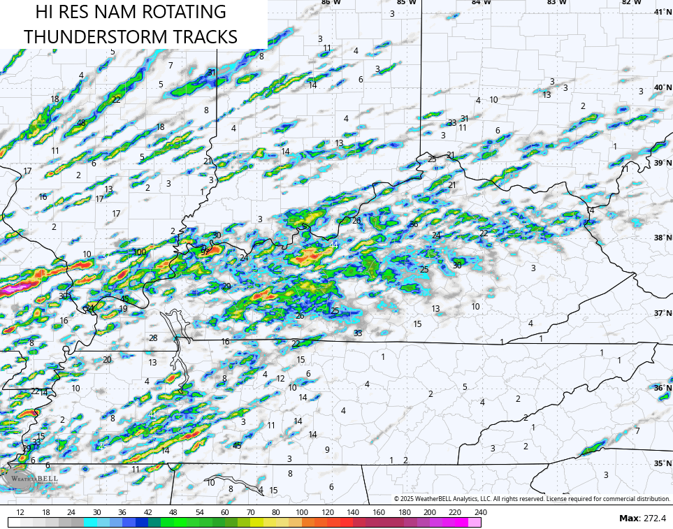
You can see how the rotating storms slow down some as they hit eastern Kentucky.
The damaging wind threat continues to be the highest and most widespread…

These storms may also contain some VERY large hail. Here’s a look at the Severe Hail Outlook…

Areas of eastern Kentucky may still be dealing with severe weather to start Monday, and the Storm Prediction Center is showing this threat…

Local high water issues may also be noted Sunday into early Monday as these storms can drop a quick 1″-3″ of rain.
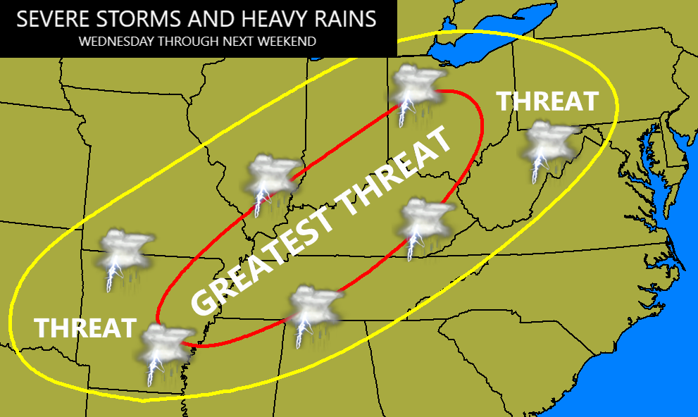
After a chilly break late Monday into Tuesday, we are likely to enter into a multi-day severe weather and heavy rain setup. Here’s a preliminary look at where all this may set up starting Wednesday…
The potential for flooding and flash flooding will be noted during this time with the potential for several inches of rain.
Severe storms will also be possible with the Storm Prediction Center highlighting the potential for Wednesday…

I’ll have another update later today. Until then, here are your scattered showers and storms tracking tools…

Enjoy your Saturday and take care.
