Good afternoon, everyone. A significant outbreak of severe weather is on tap for the region Sunday into Sunday night, kicking off a very busy severe weather week ahead. A bigger severe weather outbreak is looming for Wednesday with additional severe storms and flooding rains through next weekend.
The Storm Prediction Center keeps the Enhanced Risk for severe weather across all of western and central Kentucky Sunday and Sunday night…

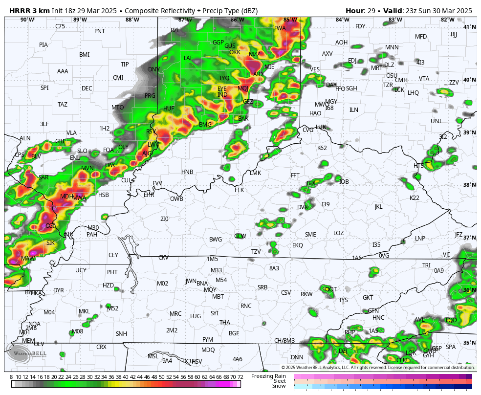
Sunday looks to start with scattered showers and storms moving away as we watch our potent storm system push in from the west. Skies become partly sunny with southwest winds screaming ahead of our cold front surging in. Severe thunderstorms develop along and ahead of this front to our west Sunday afternoon. Those storms then rumble across Kentucky Sunday evening into very early Monday morning.
This future radar from the HRRR starts at 7pm Sunday and goes through Noon Monday…
The potential for tornadoes is increased across western and central Kentucky. The potential is there for a few long-tracked, significant tornadoes. Here’s the Tornado Outlook from the Storm Prediction Center…

The last two runs of the HRRR show a significant amount of rotation thunderstorms moving across Kentucky from southwest to northeast. Here are those runs showing the tracks of these rotating thunderstorms…


You can see how the rotating storms slow down some as they hit eastern Kentucky.
The damaging wind threat continues to be the highest and most widespread…

These storms may also contain some VERY large hail. Here’s a look at the Severe Hail Outlook…

Areas of eastern Kentucky may still be dealing with severe weather to start Monday morning, and the Storm Prediction Center is showing this threat…

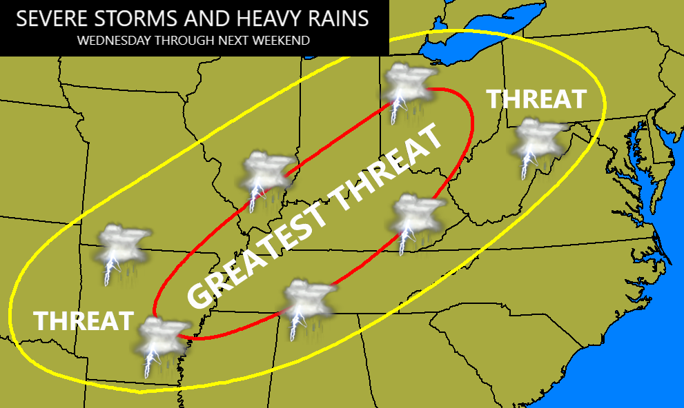
Chilly winds blow in later Monday and continue into Tuesday. Those winds quickly turn back from the southwest on Wednesday as another powerhouse storm system winds up and presses into the region from the west. This will likely produce widespread significant severe weather on Wednesday with the boundary slowing down on top of us, leading to more severe weather and flooding rains through next weekend.
I made this map yesterday and it still looks good…
The Storm Prediction Center is very bold with the Wednesday Severe Weather Outlook…

The latest guidance from the Colorado State Machine Learning Probabilities Prediction is very ominous for our region…

Waves of severe storms and flooding rains may cause a lot of issues from Wednesday through next weekend.
I may throw you guys another update later this evening. Until then, let’s track the showers and storms rumbling in from the southwest…
…

Enjoy the rest of your day and take care.
