Good Sunday, everyone. It’s a very active weather day across the region with severe thunderstorms and a few tornadoes showing up. This event is the opening act to what may be a bigger and more prolonged event coming for the middle and end of the week.
Here’s an outline of the current severe weather event:
- Scattered showers and thunderstorms are out there this morning and one or two may be strong.
- Partly sunny skies then take control during the middle of the day into the afternoon as temps and dewpoints surge.
- Southwest winds gust up as our cold front inches closer from the west.
- Strong to severe thunderstorms develop later this afternoon and early evening just west of the Ohio River.
- Initially, supercell thunderstorms are likely to move into western and parts of central Kentucky this evening.
- These supercells are developing in an environment conducive for tornadoes to develop. A few strong tornadoes will be possible in the west.
- From there, we watch all this likely come together into a huge line of severe storms that push from west to east across the state this evening into early Monday morning.
- Damaging winds are the primary player with this line but a few tornados can still spin up.
- The large hail threat will be especially prominent across the western half of Kentucky.
- The overall severe storms threat will diminish as these storms move into eastern Kentucky but that doesn’t mean we won’t see some issues there.
The latest Severe Weather Outlook from the Storm Prediction Center shows how today’s risk continues to be the greatest across western and Central Kentucky…

The Future Radar from the HRRR shows the evolution of this whole severe weather event. This animation starts today at 2pm and goes through 8am Monday…
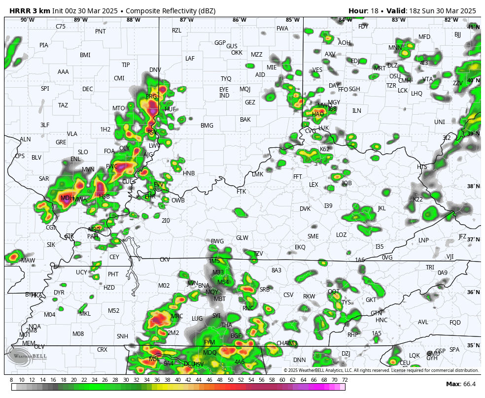
Here’s a look at the rotating thunderstorm tracks from that run of the HRRR…

This is why the Tornado Outlook continues to be highest across the western half of the state…

The Damaging wind potential is much more widespread…

Like the tornado risk, the risk for Severe Hail is also the greatest in the west…

The overall severe risk moves out of eastern Kentucky early Monday and the Severe Weather Outlook for Monday shows this well…

Chilly winds kick in behind the departing storm system later Monday into Tuesday.
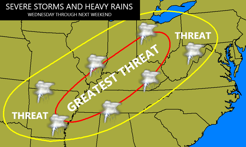
That’s ahead of another powerful storm system set to impact our region starting Wednesday. This is a potent low pressure rolling toward the Great Lakes as it drags a cold front into our region. This front then becomes stationary on top of us by Thursday and may very well stick around through the weekend. Rounds of strong to severe thunderstorms rumble through the region with the potential for a major severe weather outbreak Wednesday and Wednesday night.
The Storm Prediction Center is already putting the severe weather bullseye on top of us for Wednesday…

With the boundary stalling on top of us, the severe weather and flooding rains bullseye continues to be on top of us through next weekend…
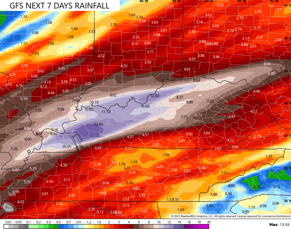
The various forecast models are falling in line with my way of thinking as they are spitting out major rainfall numbers through this time next weekend…

I’ll have updates later today and will likely be on WKYT-TV as the severe weather is blowing in. Until then, here are your Sunday severe storms tracking tools…

Current watches

Possible Watch Areas

Make it a great Sunday and take care.
