Good evening, everyone. Our line of severe thunderstorms is racing into the state and will push through tonight with damaging winds and a few tornadoes possible. This kicks off a very active pattern that will feature a multi-day severe weather event and potential significant flooding.
In the short-term, the overall setup really hasn’t changed much as the Storm Prediction Center keeps most of the state in the Enhanced Risk for severe storms tonight…

The tornado risk continues to be the greatest across western Kentucky with some of that getting into central parts of the state before fading in the east…

Damaging winds are the main player…

The large hail potential is mainly confined to the west…

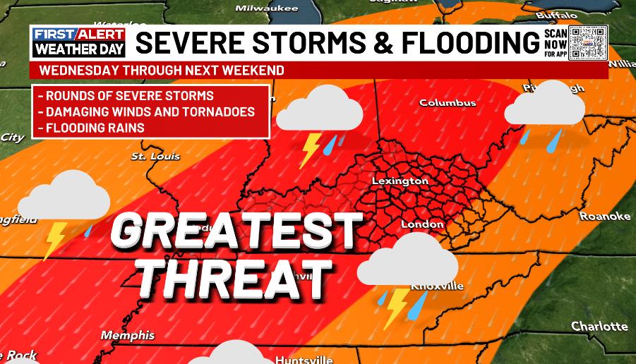
Chilly winds blow behind this departing system Monday afternoon into Tuesday before we get into a VERY ugly setup from Wednesday through next weekend.
This is the pattern we’ve been talking about for a while now and other agencies are now jumping on board with the potential. The Storm Prediction Center continues to have a very high signal for severe weather on Wednesday…

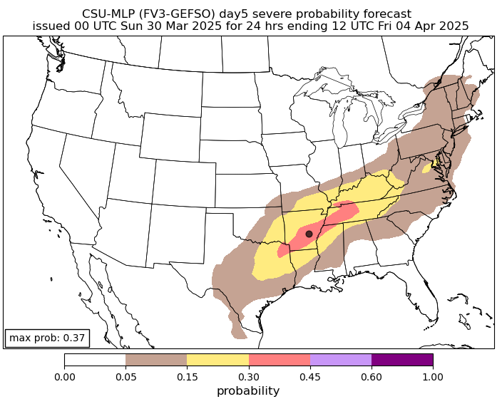
The latest guidance from the Colorado State Machine Learning Probabilities Prediction is really ominous for severe weather Wednesday into Wednesday night…

That shows up Thursday as well…
The Storm Prediction Center is also highlighting this with a Thursday severe storms risk…

That severe risk may very well go through next weekend.
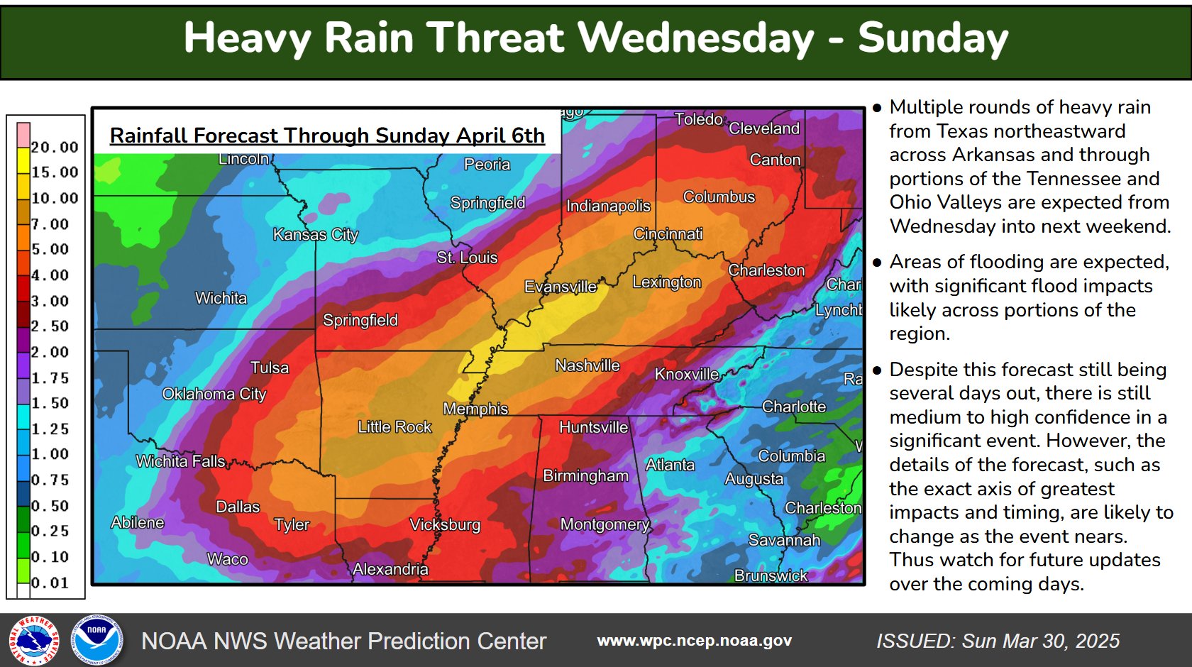
This setup is concerning for more than just severe weather. Significant flooding issues will be possible with much of our region in the bullseye…
The rainfall forecast from the Weather Prediction Center has double digit rainfall numbers across western Kentucky…
I’ll be on WKYT-TV as the severe weather is blowing in tonight. I also have you guys ready to track the severe storms…

Current watches

Possible Watch Areas

Make it a great evening and take care.
